
MyTopo
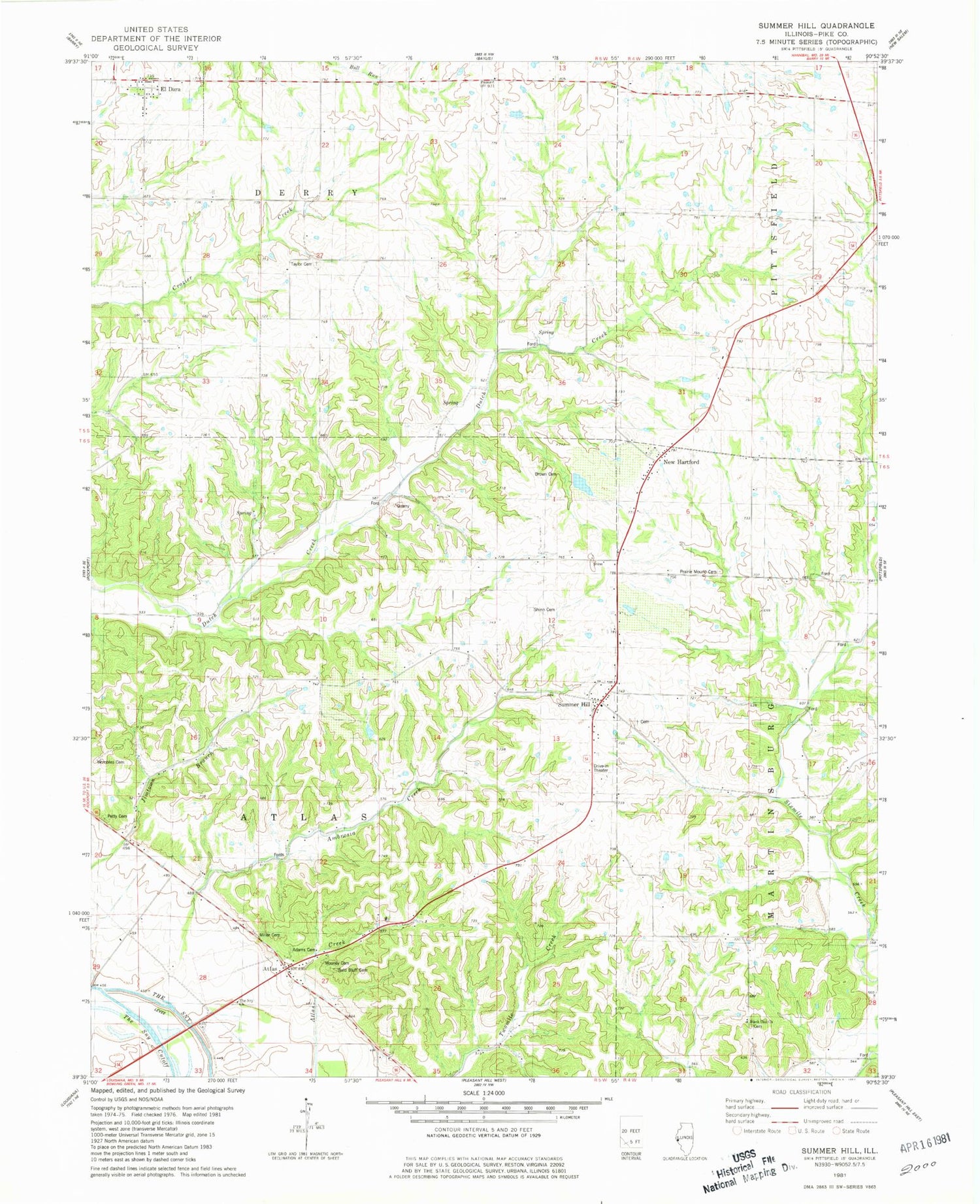
Classic USGS Summer Hill Illinois 7.5'x7.5' Topo Map
Couldn't load pickup availability
Historical USGS topographic quad map of Summer Hill in the state of Illinois. Map scale may vary for some years, but is generally around 1:24,000. Print size is approximately 24" x 27"
This quadrangle is in the following counties: Pike.
The map contains contour lines, roads, rivers, towns, and lakes. Printed on high-quality waterproof paper with UV fade-resistant inks, and shipped rolled.
Contains the following named places: Adams Cemetery, Ambrosia Creek, Atlas, Ball's Bluff Cemetery, Black Oak Cemetery, Black Oak Church, Black Oak School, Brown Cemetery, Central School, Clark 54 Drive-In, Coldwater School, Dutch Creek School, El Dara, Miller Cemetery, Mooney - Marion Cemetery, New Hartford, Petty Cemetery, Pike County, Pleasant View School, Prairie Mound Cemetery, Prairie Mound School, Shinn Cemetery, Spatterdock Lake, Stony Point School, Summer Hill, Summer Hill Cemetery, Taylor, Taylor - Martin Cemetery, The Sny Cutoff, Township of Derry, Union School, Village of El Dara, West Point School, Wombles Cemetery


