MyTopo
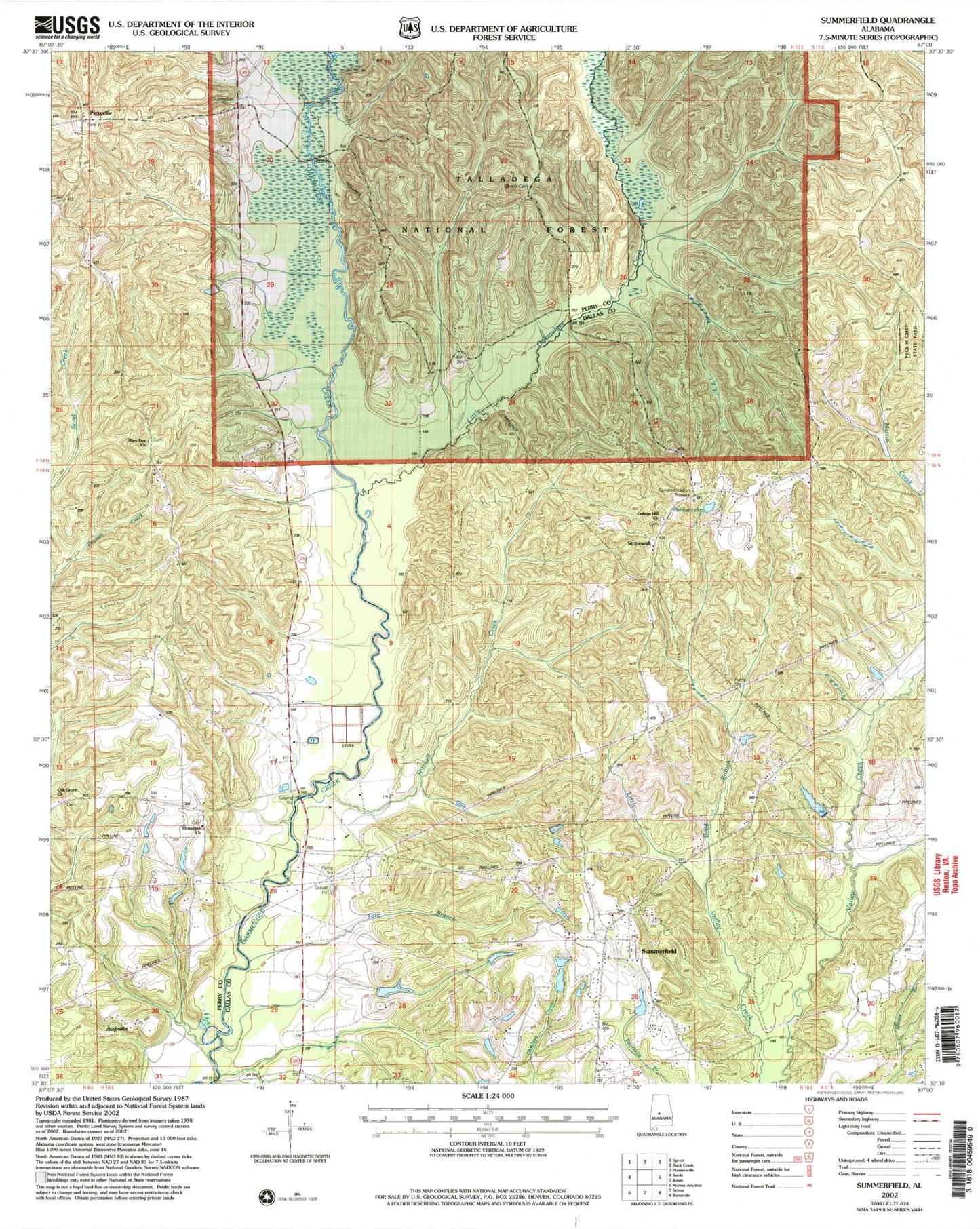
Classic USGS Summerfield Alabama 7.5'x7.5' Topo Map
Couldn't load pickup availability
Historical USGS topographic quad map of Summerfield in the state of Alabama. Map scale may vary for some years, but is generally around 1:24,000. Print size is approximately 24" x 27"
This quadrangle is in the following counties: Dallas, Perry.
The map contains contour lines, roads, rivers, towns, and lakes. Printed on high-quality waterproof paper with UV fade-resistant inks, and shipped rolled.
Contains the following named places: Augustin, Bogg Branch, Chestnut Hill, College Hill Church, D C Beville Lake, Evergreen School, Holliman Lake, Holliman Lake Dam, Independence Bridge, J M Gentry Dam, Little Oakmulgee Creek, Long Bridge, Macedonia Church, Martin Cemetery, Mary Etta Church, Melton Bridge, Melton School, Mitchell Creek, New Macedonia Church, Oak Grove, Oak Grove Church, Oak Grove School, Ocmulgee Baptist Church, Pardue Lake, Pardue Lake Dam, Perryville, Perryville Baptist Church, Perryville School, Section Valley School, Shiloh Baptist Church, Shiloh Cemetery, Stonewall, Summerfield, Summerfield Church, Summerfield Volunteer Fire Department, Tadlocks Store, Tate Branch