MyTopo
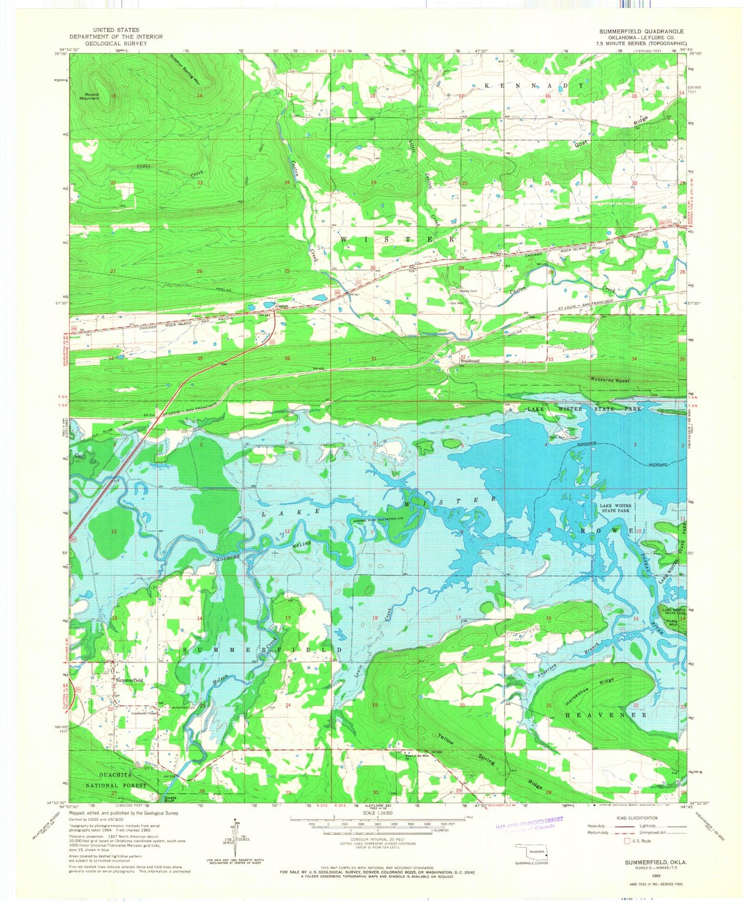
Classic USGS Summerfield Oklahoma 7.5'x7.5' Topo Map
Couldn't load pickup availability
Historical USGS topographic quad map of Summerfield in the state of Oklahoma. Map scale may vary for some years, but is generally around 1:24,000. Print size is approximately 24" x 27"
This quadrangle is in the following counties: Le Flore.
The map contains contour lines, roads, rivers, towns, and lakes. Printed on high-quality waterproof paper with UV fade-resistant inks, and shipped rolled.
Contains the following named places: Anderson Branch, Braidwood, Buzzards Roost, Caston, Caston Mountain Creek Site 1 Dam, Caston Mountain Creek Site 1 Reservoir, Caston Mountain Creek Site 3 Dam, Caston Mountain Creek Site 3 Reservoir, Cedar Creek, Coal Creek, Community Chapel, Fourche Maline, Goat Ridge, Goats Bluff, Heart o' the Hills Church, Holson Creek, Horseshoe Ridge, Lewis Creek, Little Caston Creek, Maxey Cemetery, Round Mountain, Summerfield, Summerfield Cemetery, Summerfield Fire Department, Township of Wister, Victor, Waterfowl Refuge, Wister Division, Wister Lake, Wister Lake State Park, Wister Public Hunting Area, Yellow Spring Ridge, ZIP Code: 74966