MyTopo
Classic USGS Summerville NW South Carolina 7.5'x7.5' Topo Map
Couldn't load pickup availability
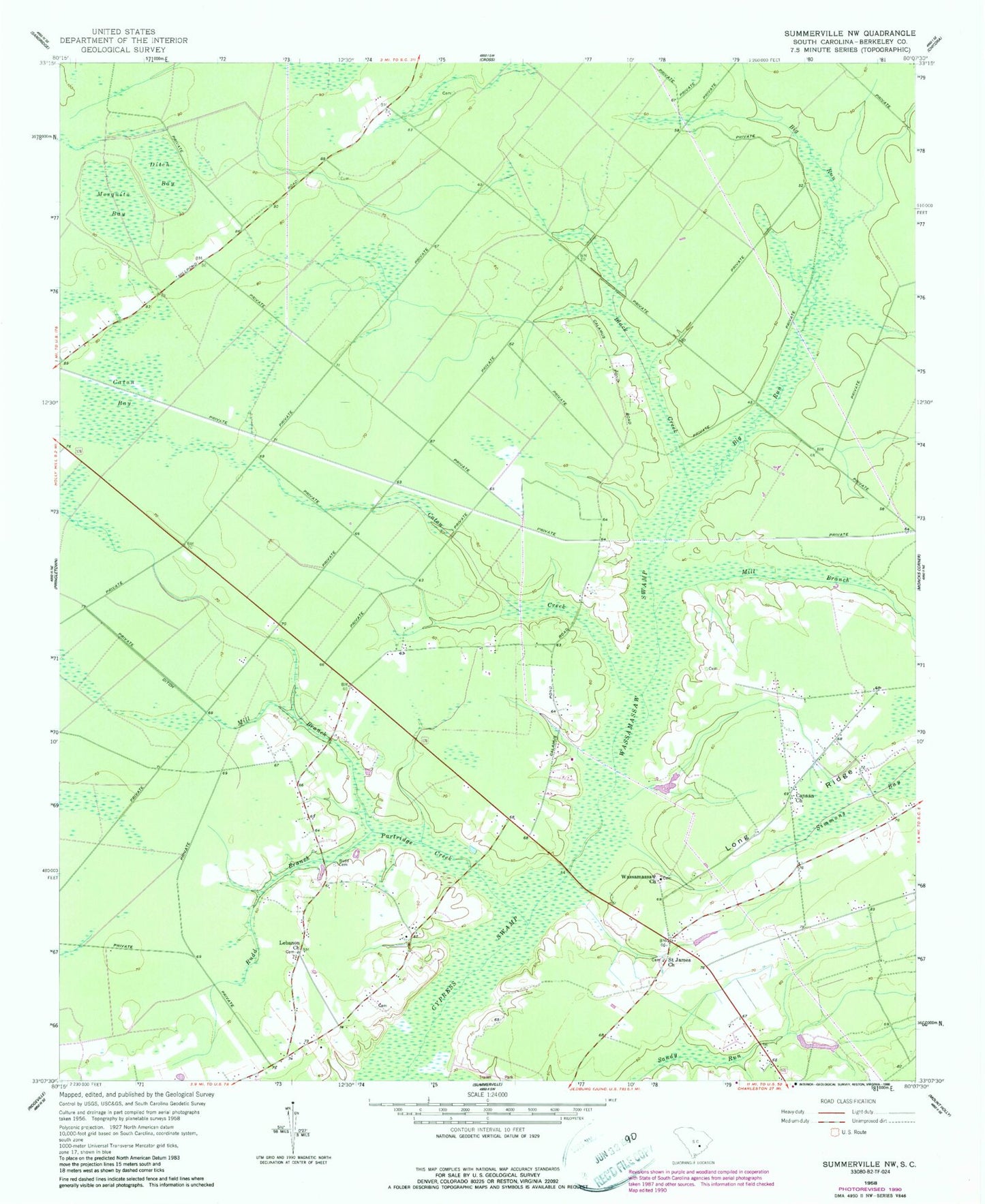
Historical USGS topographic quad map of Summerville NW in the state of South Carolina. Map scale may vary for some years, but is generally around 1:24,000. Print size is approximately 24" x 27"
This quadrangle is in the following counties: Berkeley.
The map contains contour lines, roads, rivers, towns, and lakes. Printed on high-quality waterproof paper with UV fade-resistant inks, and shipped rolled.
Contains the following named places: Big Run, Black Creek, Black Tom, Black Tom School, Blanton Cemetery, Canaan Church, Caton Bay, Caton Creek, Ditch Bay, J Ballentine Pond, Lebanon, Lebanon Cemetery, Lebanon Church, Lebanon Fire Department, Long Ridge, Long Ridge School, Longridge Fire Department, Mill Branch, Mosquito Bay, Omoooo Community Care Center, Partridge Creek, Rudd Branch, Rudd Cemetery, Saint James Church, Sandy Run, Simmons Bay, South Carolina Noname 08045 D-3465 Dam, Wassamassaw, Wassamassaw Baptist Church, Wassamassaw Cemetery, Wassamassaw Swamp