MyTopo
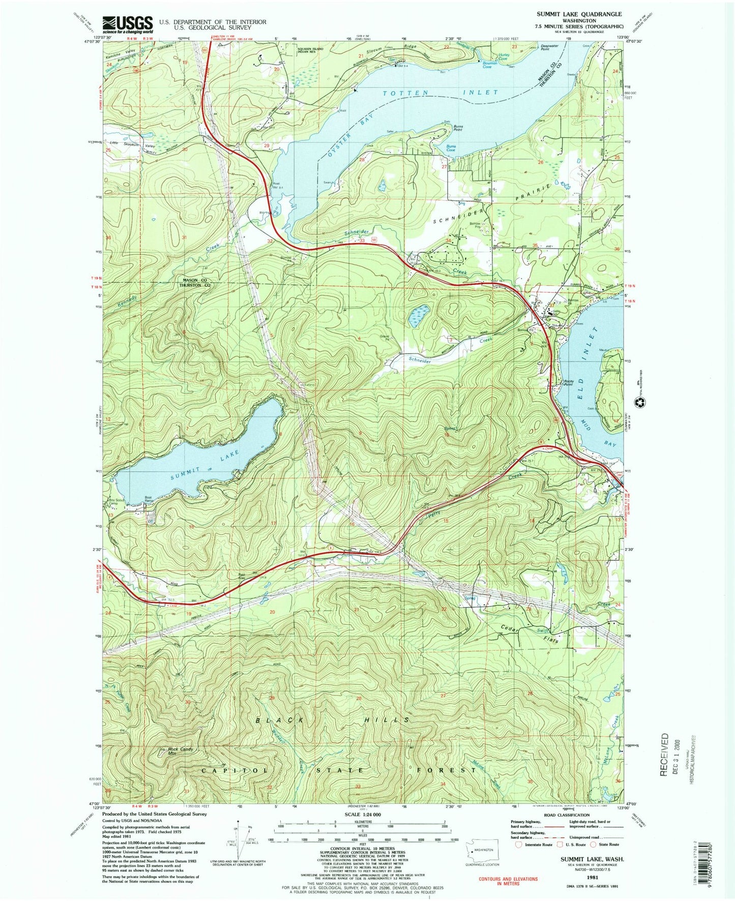
Classic USGS Summit Lake Washington 7.5'x7.5' Topo Map
Couldn't load pickup availability
Historical USGS topographic quad map of Summit Lake in the state of Washington. Map scale may vary for some years, but is generally around 1:24,000. Print size is approximately 24" x 27"
This quadrangle is in the following counties: Mason, Thurston.
The map contains contour lines, roads, rivers, towns, and lakes. Printed on high-quality waterproof paper with UV fade-resistant inks, and shipped rolled.
Contains the following named places: Bowman Cove, Burns Cove, Burns Point, Cedar Flats, Deepwater Point, Forest Shores, Griffin Elementary School, Griggs Creek, Hurley cove, Kamilche Valley, Kennedy Creek, Madrona Beach, McLane / Black Lake Fire Department Station 93, New Kamilche, Olympia West Division, Oyster Bay, Perry Creek, Rock Candy Mountain, Rocky Point, Schneider Creek, Schneider Prairie, Schneiders Prairie, Slocum Ridge, Snodgrass Creek, Summit Lake, Summit Lake Dam, Swift Creek, Thurston County Fire District 13 Griffin Fire Department Station 13 - 1 Headquarters, Thurston County Fire District 13 Griffin Fire Department Station 13 - 4, ZIP Code: 98502