MyTopo
Classic USGS Summit New York 7.5'x7.5' Topo Map
Couldn't load pickup availability
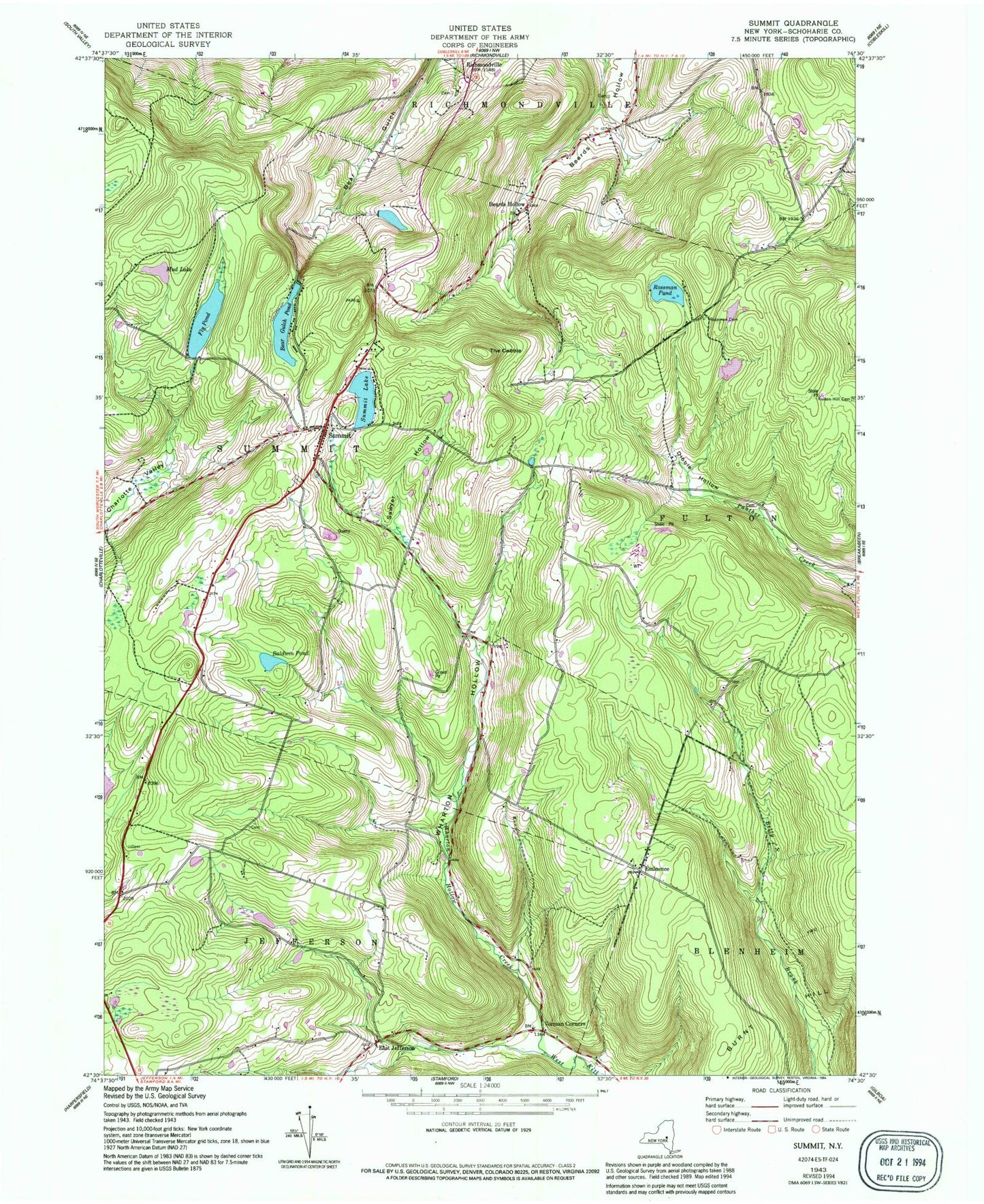
Historical USGS topographic quad map of Summit in the state of New York. Typical map scale is 1:24,000, but may vary for certain years, if available. Print size: 24" x 27"
This quadrangle is in the following counties: Schoharie.
The map contains contour lines, roads, rivers, towns, and lakes. Printed on high-quality waterproof paper with UV fade-resistant inks, and shipped rolled.
Contains the following named places: Bear Gulch Pond, Beards Hollow, Baldwin Pond, Dibble Hollow, Eminence, Fairland Church, Fly Pond, Mud Lake, Rossman Cemetery, Rossman Pond, Sawyer Hollow, Summit, Summit Lake, The Cobble, Wharton Hollow, East Jefferson, School Number 14 (historical), School Number 6 (historical), Cross Hill School, School Number 11 (historical), School Number 13 (historical), School Number 2 (historical), School Number 7 (historical), School Number 9 (historical), Wharton Hollow Creek, Vorman Corners, Town of Summit, Old Summit Cemetery, Summit Cemetery, Eminence Walled Cemetery, New Eminence Cemetery, School Number 2 (historical), School Number 8 (historical), School Number 10 (historical), Summit United Methodist Church, Saint Anna's Catholic Church, Summit Town Hall, Summit Post Office, Camp Summit (historical), Summit Volunteer Fire Department