MyTopo
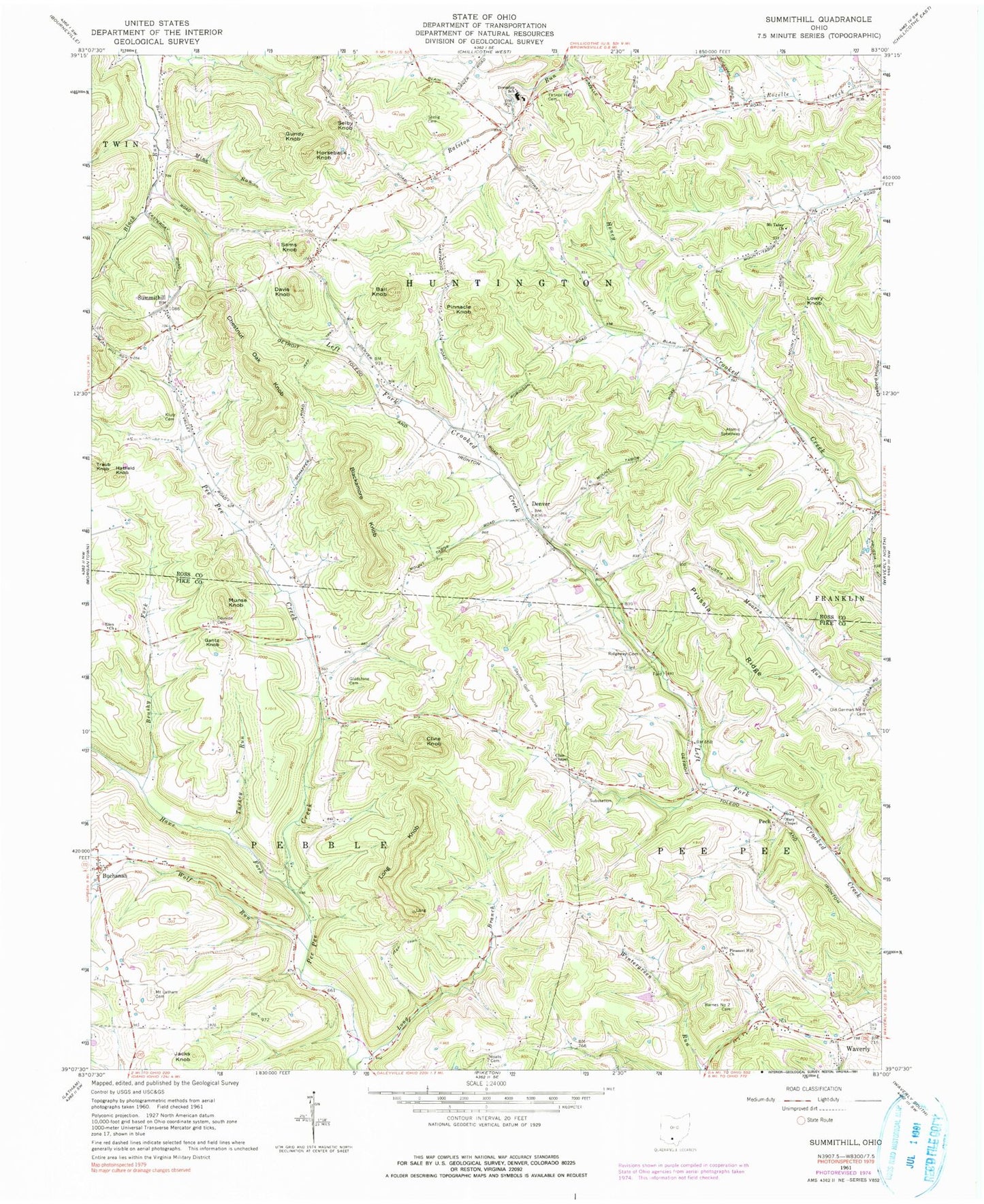
Classic USGS Summithill Ohio 7.5'x7.5' Topo Map
Couldn't load pickup availability
Historical USGS topographic quad map of Summithill in the state of Ohio. Map scale may vary for some years, but is generally around 1:24,000. Print size is approximately 24" x 27"
This quadrangle is in the following counties: Pike, Ross.
The map contains contour lines, roads, rivers, towns, and lakes. Printed on high-quality waterproof paper with UV fade-resistant inks, and shipped rolled.
Contains the following named places: Asbury Chapel Cemetery, Atomic Speedway, Ball Knob, Barnes Number 2 Cemetery, Blackamore Knob, Brushy Fork, Buchanan, Buchanan Post Office, Chestnut Oak Knob, Cline Chapel, Cline Knob, Cline School, Cousins Cemetery, Crooked Creek School, Davis Knob, Denver, Denver Post Office, Echodale School, Eden Church, Gantz Knob, Gladstone Cemetery, Glenwood School, Gundy Knob, Hartwood School, Hatfield Knob, Hawe Fork, Hills, Honey Creek, Honey Creek School, Horseback Knob, Huntington High School, Huntington Township Volunteer Fire Department, Jacks Knob, Klutz Cemetery, Long Knob, Lowry Knob, Mary Chapel, Mine Run, Moats Cemetery, Mount Latham Cemetery, Mount Tabor Church, Munse Knob, Old German Number 1 Cemetery, Peck, Peck Post Office, Peepee School, Pinnacle Knob, Pleasant Hill Church, Pleasant Valley Christian Union Church, Pleasant View School, Potato Ridge, Prichard School, Prussia Ridge, Ridgeway Cemetery, Ruly School, Sams Knob, Seelig Cemetery, Selby Knob, Skyline Golf Course, Summithill, Summithill Post Office, Township of Huntington, Township of Pebble, Township of Pee Pee, Traub Knob, Turkey Run, Turkey Run School, Wolf Run, WXIC-AM (Waverly), Yankee Hill Cemetery, Yankeetown, ZIP Code: 45690