MyTopo
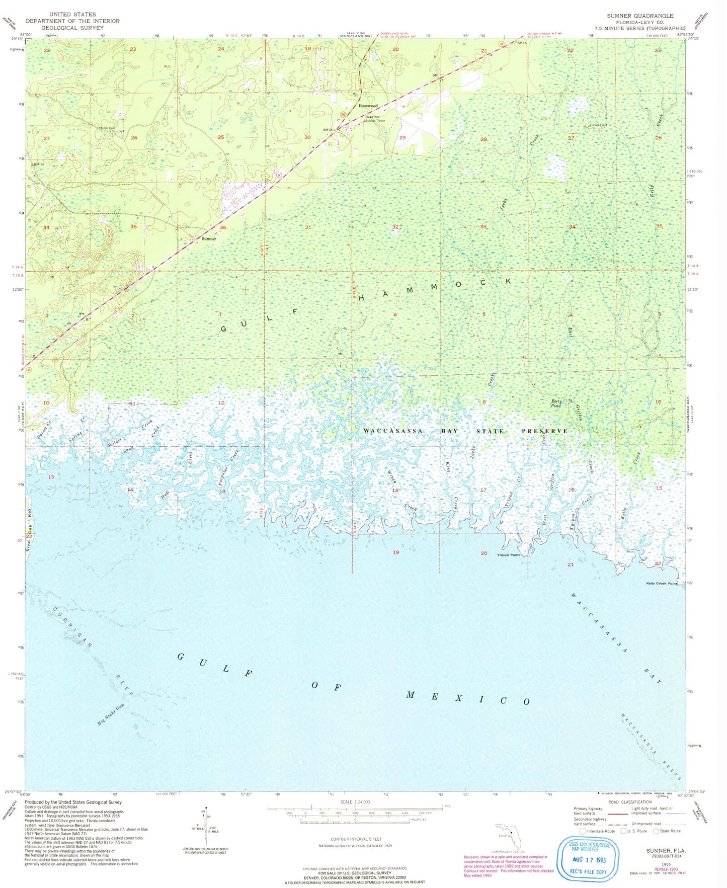
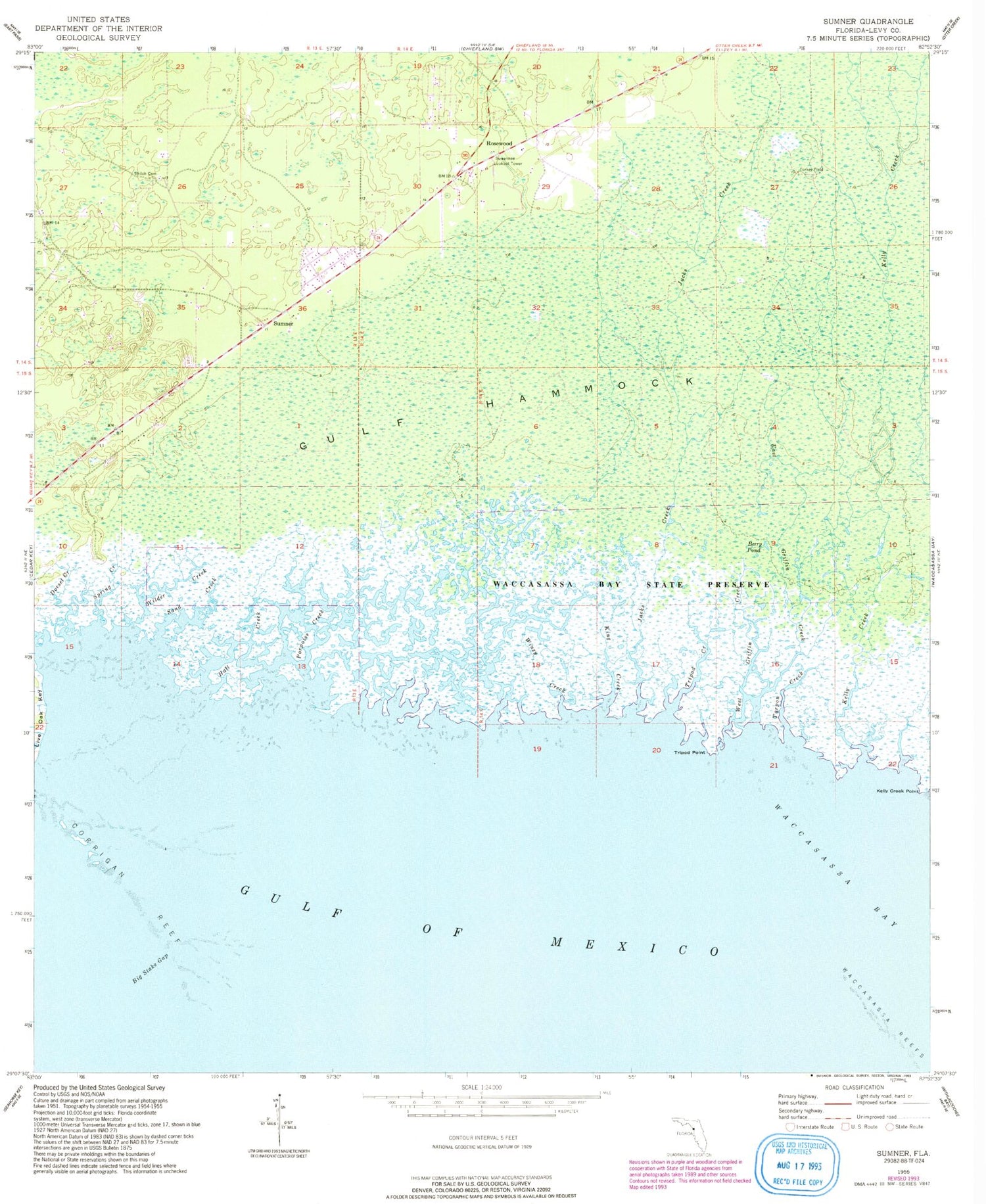
Classic USGS Sumner Florida 7.5'x7.5' Topo Map
Couldn't load pickup availability
Historical USGS topographic quad map of Sumner in the state of Florida. Map scale may vary for some years, but is generally around 1:24,000. Print size is approximately 24" x 27"
This quadrangle is in the following counties: Levy.
The map contains contour lines, roads, rivers, towns, and lakes. Printed on high-quality waterproof paper with UV fade-resistant inks, and shipped rolled.
Contains the following named places: Berry Pond, Big Stake Gap, Cedar Key-Yankeetown Division, Cedars Airfield, Corrigan Reef, Dorset Creek, East Griffin Creek, Hall Creek, Jacks Creek, Kelly Creek, Kelly Creek Point, King Creek, Porpoise Creek, Rosewood, Rosewood Volunteer Fire Department, Sand Creek, Shiloh Cemetery, South Bar Channel, Spring Creek, Sumner, Suwannee Lookout Tower, Tarpon Creek, Tripod Creek, Tripod Point, West Griffin Creek, Wilder Creek, Winzy Creek