MyTopo
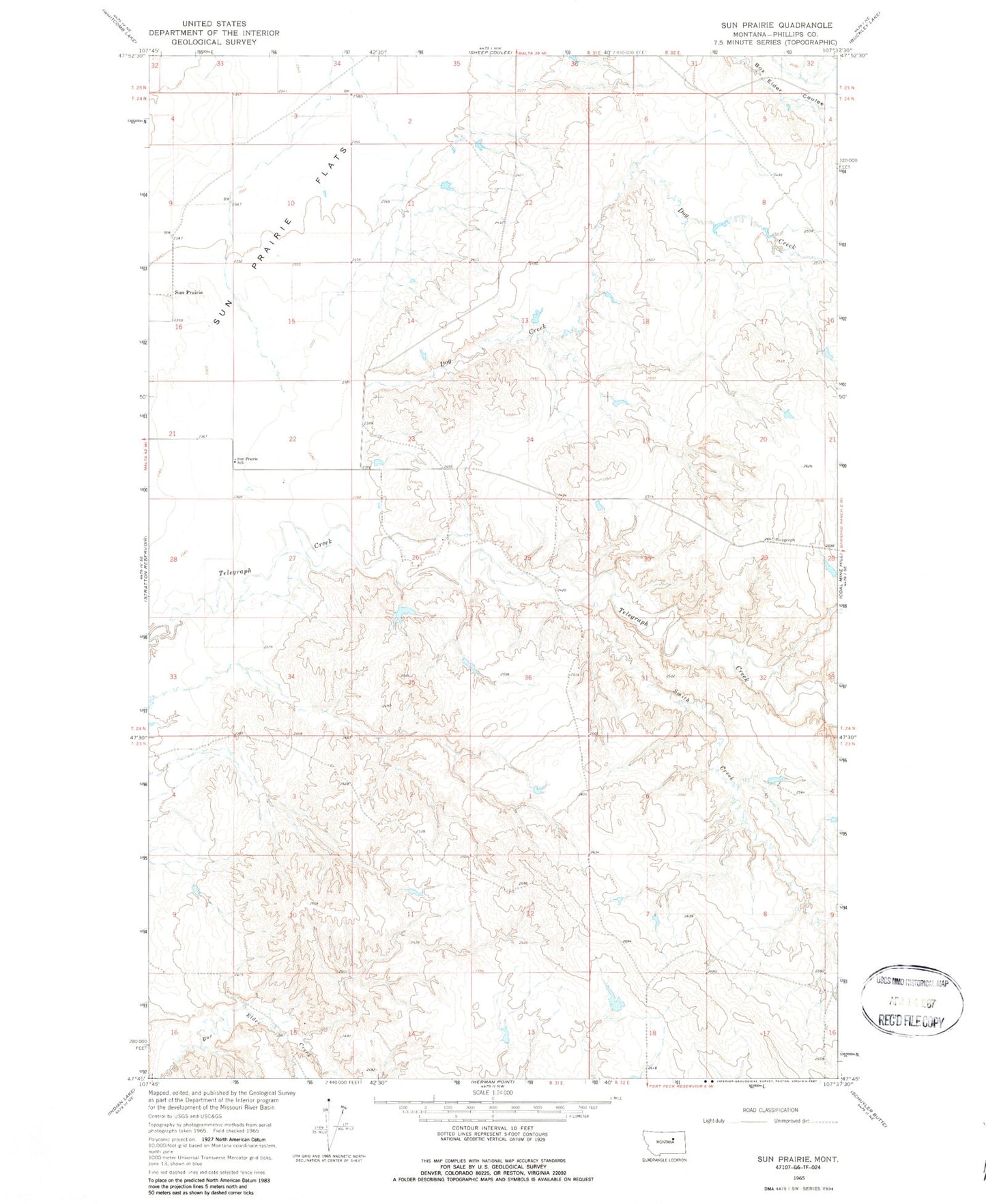
Classic USGS Sun Prairie Montana 7.5'x7.5' Topo Map
Regular price
$16.95
Regular price
Sale price
$16.95
Unit price
per
Couldn't load pickup availability
Historical USGS topographic quad map of Sun Prairie in the state of Montana. Map scale may vary for some years, but is generally around 1:24,000. Print size is approximately 24" x 27"
This quadrangle is in the following counties: Phillips.
The map contains contour lines, roads, rivers, towns, and lakes. Printed on high-quality waterproof paper with UV fade-resistant inks, and shipped rolled.
Contains the following named places: 23N31E11CA__01 Well, 24N31E11AA__01 Well, 24N31E15ACC_01 Well, Dog Creek, Koss Number 2 Dam, Smith Creek, Sun Prairie, Sun Prairie Post Office, Sun Prairie School, Telegraph Creek Post Office