MyTopo
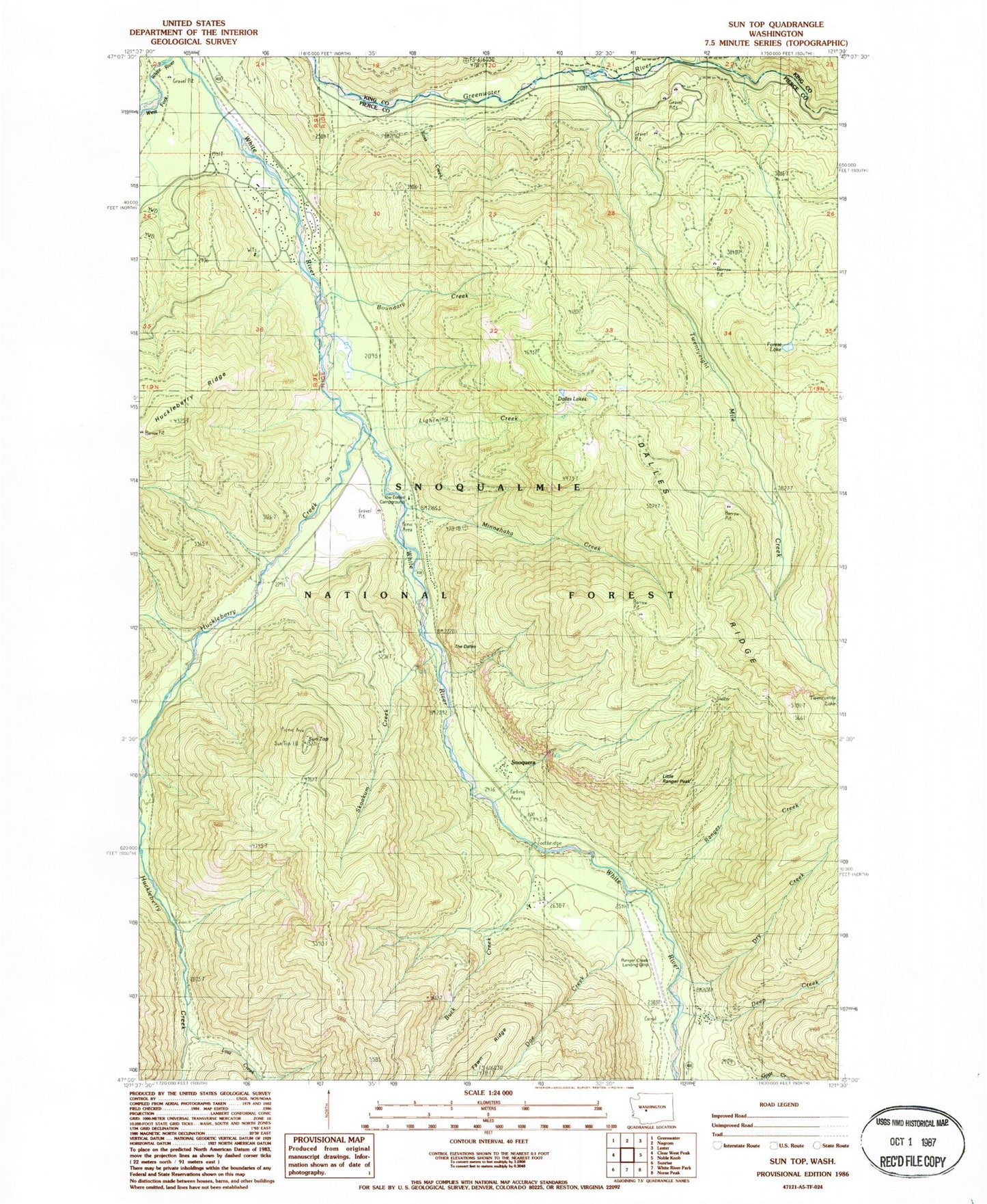
Classic USGS Sun Top Washington 7.5'x7.5' Topo Map
Couldn't load pickup availability
Historical USGS topographic quad map of Sun Top in the state of Washington. Typical map scale is 1:24,000, but may vary for certain years, if available. Print size: 24" x 27"
This quadrangle is in the following counties: King, Pierce.
The map contains contour lines, roads, rivers, towns, and lakes. Printed on high-quality waterproof paper with UV fade-resistant inks, and shipped rolled.
Contains the following named places: Boundary Creek, Boundary Guard Station, Buck Creek, Burns Creek, Camp Sheppard Boy Scout Camp, Dalles Lakes, Dalles Ridge, Deep Creek, Doe Creek, Dry Creek, Forest Lake, Foss Creek, Huckleberry Creek, Lightning Creek, Lost Creek, Minnehaha Creek, Ranger Creek, Ranger Creek Camp, Skookum Creek, Slide Creek, Snoquera, Sun Top, Sun Top Trail, The Dalles, Twentyeight Mile Creek, Twentyeight Mile Creek Trail, Twentyeight Mile Lake, West Fork White River, The Dalles Campground, Little Ranger Peak, Alta Crystal Chalets, Dry Creek Campground, Sun Top Viewpoint, White River Ranger District, Seattle University Lodge, The Dalles Recreation Area, Ranger Creek Airport, Pierce County Fire District 26 Station 2