MyTopo
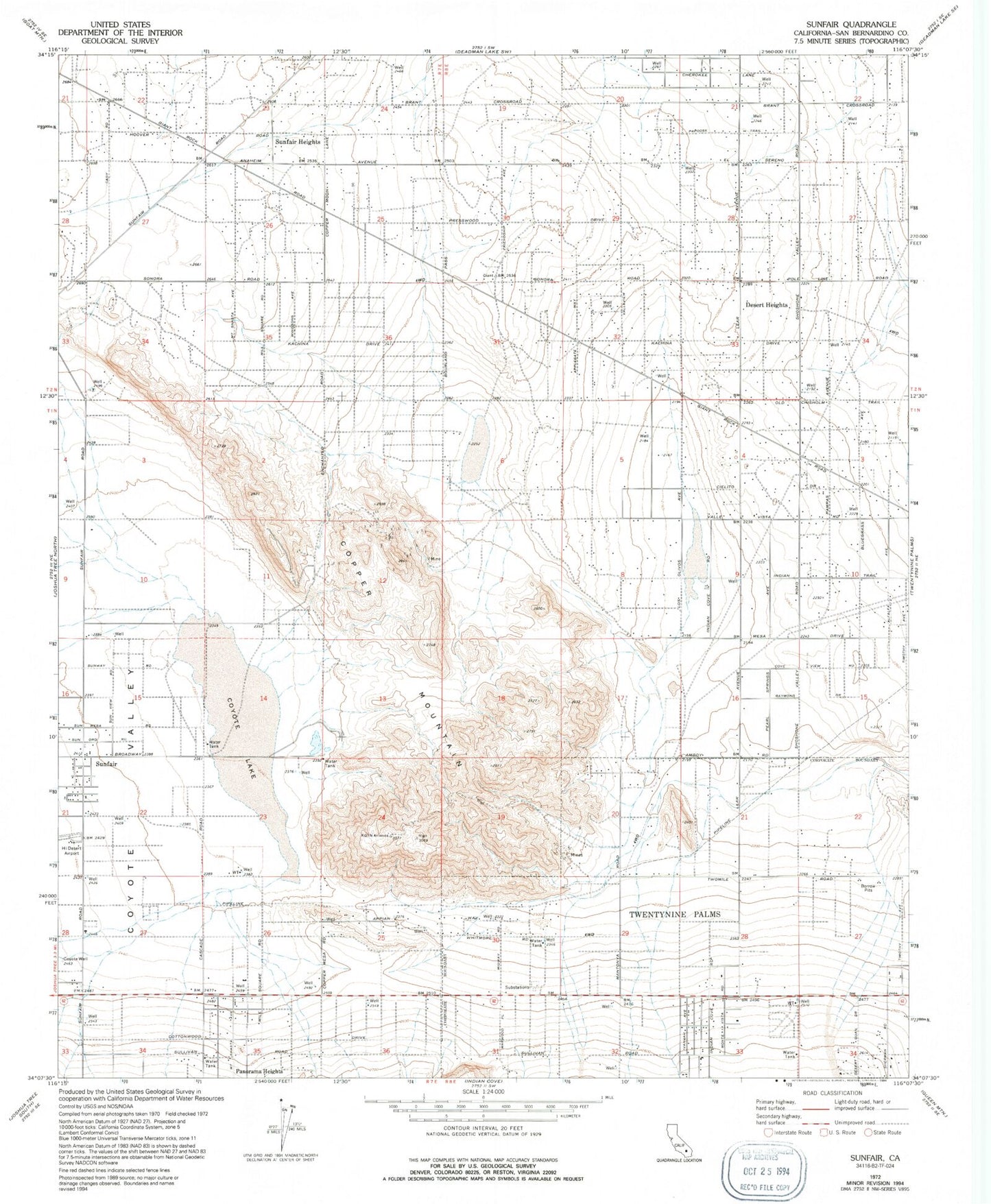
Classic USGS Sunfair California 7.5'x7.5' Topo Map
Couldn't load pickup availability
Historical USGS topographic quad map of Sunfair in the state of California. Map scale may vary for some years, but is generally around 1:24,000. Print size is approximately 24" x 27"
This quadrangle is in the following counties: San Bernardino.
The map contains contour lines, roads, rivers, towns, and lakes. Printed on high-quality waterproof paper with UV fade-resistant inks, and shipped rolled.
Contains the following named places: Copper Mountain, Copper Mountain College, Coyote Lake, Coyote Valley, Desert Heights, KCDZ-FM (Twentynine Palms), KDHI-AM (Twentynine Palms), Keys Dam Upper, KQYN-FM (Twentynine Palms), Roy Williams Airport, San Bernardino County Fire Department Station 35 Panorama Heights, San Bernardino County Fire Department Station 44 - Copper Mountain Mesa, Sunfair, Sunfair Heights, Twentynine Palms Fire Department Station 422 Desert Heights