MyTopo
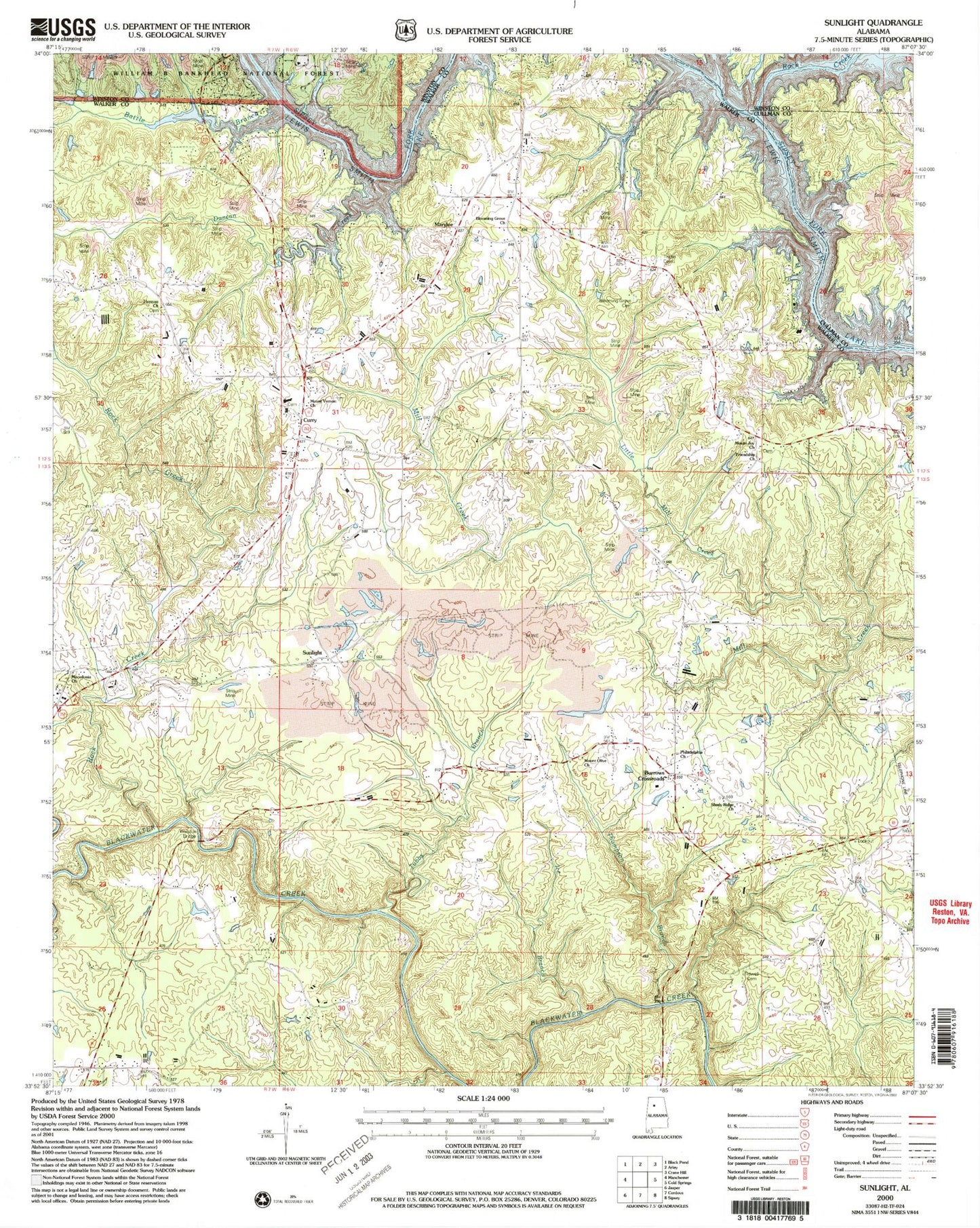
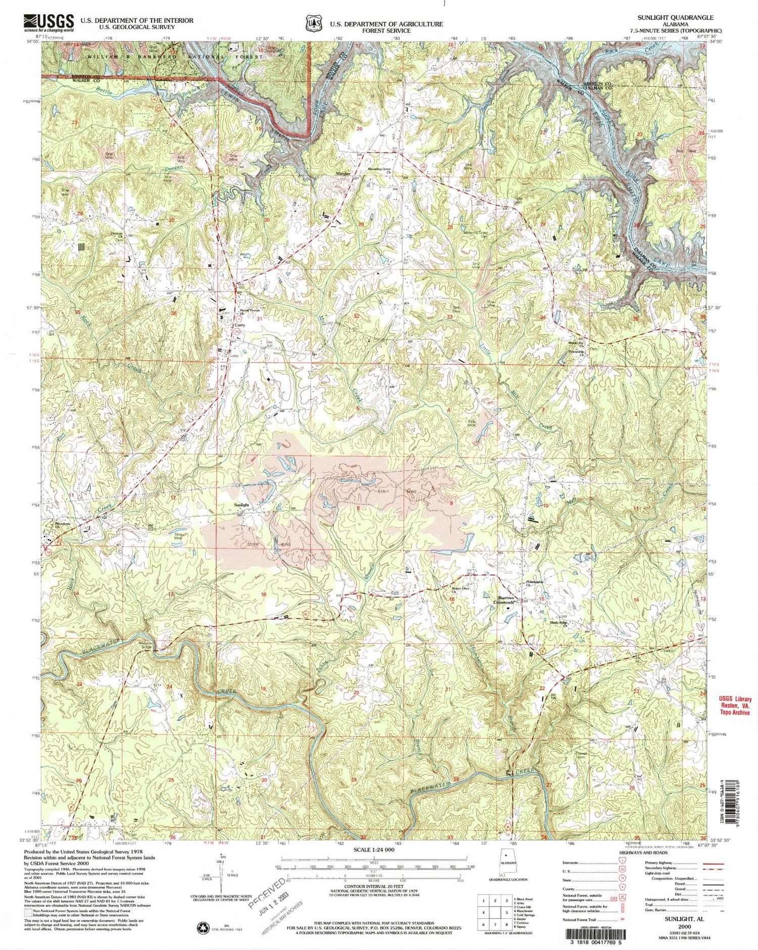
Classic USGS Sunlight Alabama 7.5'x7.5' Topo Map
Couldn't load pickup availability
Historical USGS topographic quad map of Sunlight in the state of Alabama. Map scale may vary for some years, but is generally around 1:24,000. Print size is approximately 24" x 27"
This quadrangle is in the following counties: Cullman, Walker, Winston.
The map contains contour lines, roads, rivers, towns, and lakes. Printed on high-quality waterproof paper with UV fade-resistant inks, and shipped rolled.
Contains the following named places: Aaron Cemetery, Battle Branch, Bear Branch, Blooming Grove Baptist Church, Blooming Grove Cemetery, Burrows Crossroads, Camp Jimmy Goodwin, Camp O'Rear, Curry, Curry Cemetery, Curry Church, Curry Church of Christ, Curry Elementary School, Curry High School, Curry Volunteer Fire and Rescue, Duncan Creek, Friendship Church, Herman Church, Ice Branch, Jasper Fire Department Station 3, Little Mill Creek, Macedonia Baptist Church, Marylee, Mill Creek Mine, Mount Joy Baptist Church, Mount Olive Church, Mount Vernon Baptist Church, New Hope Church, Philadelphia Church, Pleasant Field Church, Racoon Branch, Rock Creek, Shady Ridge Church, Sipsey Division, Smith Lake Church, Sunlight, Sunlight Baptist Church, Thompson Branch, Tidwell Cemetery, Tingle Cemetery, Trimbles Mill, Tubbs Branch, Valley Hill Church, Walston Bridge, Walston Church, Wilson Cemetery, ZIP Code: 35504