
MyTopo
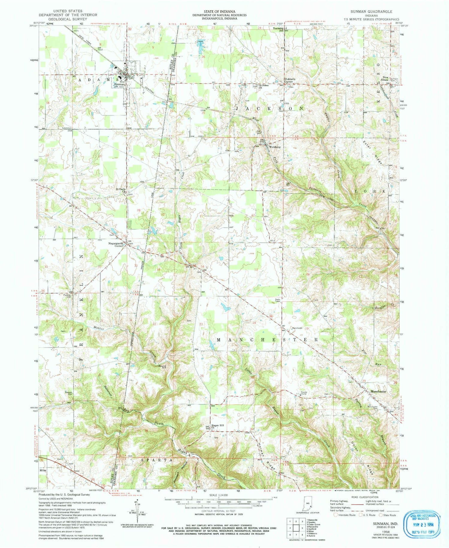
Classic USGS Sunman Indiana 7.5'x7.5' Topo Map
Couldn't load pickup availability
Historical USGS topographic quad map of Sunman in the state of Indiana. Map scale may vary for some years, but is generally around 1:24,000. Print size is approximately 24" x 27"
This quadrangle is in the following counties: Dearborn, Ripley.
The map contains contour lines, roads, rivers, towns, and lakes. Printed on high-quality waterproof paper with UV fade-resistant inks, and shipped rolled.
Contains the following named places: Butternut Run, Franklin Church Cemetery, Harmans Station, Hogan Hill Church, Holman Post Office, Holman Ridge, Hubbells Corner, Johnson Hollow, Lake Perrine, Mahler Creek, Manchester, Manchester Cemetery, Manchester Township Volunteer Fire and Rescue, Negangards Corner, New Alsace, Perrine Lake Dam, Ransom Cemetery, Round Hill, Saint Johns Church, Saint Pauls Cemetery, Sunman, Sunman Area Life Squad, Sunman Police Department, Sunman Post Office, Sunman Rural Fire Department, Taylor Creek, Town of Sunman, Township of Manchester, Union Ridge, Weber's Greenhouse, Weisburg, ZIP Code: 47041


