
MyTopo
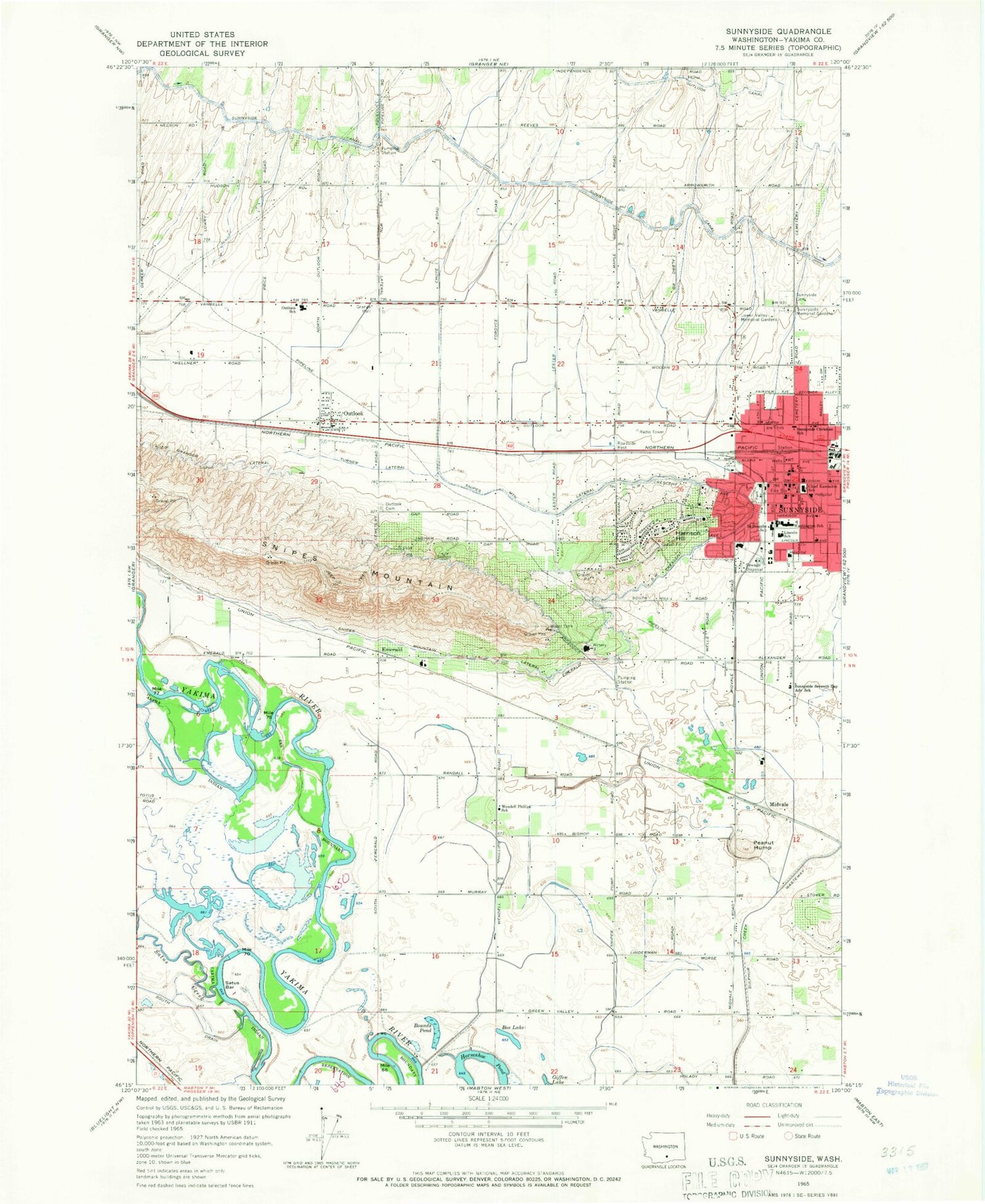
Classic USGS Sunnyside Washington 7.5'x7.5' Topo Map
Couldn't load pickup availability
Historical USGS topographic quad map of Sunnyside in the state of Washington. Map scale may vary for some years, but is generally around 1:24,000. Print size is approximately 24" x 27"
This quadrangle is in the following counties: Yakima.
The map contains contour lines, roads, rivers, towns, and lakes. Printed on high-quality waterproof paper with UV fade-resistant inks, and shipped rolled.
Contains the following named places: Bos Lake, Bounds Pond, Chief Kamiakin School, City of Sunnyside, Emerald, Harrison Hill, Horseshoe Pond, KREW-AM (Sunnyside), KREW-FM (Sunnyside), Lincoln School, Lower Valley Memorial Gardens, McBride Slough, Midvale, Old Sunnyside Cemetery, Outlook, Outlook Canal, Outlook Cemetery, Outlook Census Designated Place, Outlook Elementary School, Outlook Post Office, Peanut Hump, Saint Josephs School, Satus Bar, Satus Creek, Servu, Snipes Mountain, Snipes Mountain Lateral, Sulphur Creek Wasteway, Sunnyside, Sunnyside Christian School, Sunnyside Community Hospital, Sunnyside Fire Department and Emergency Medical Services, Sunnyside Memorial Gardens, Sunnyside Museum, Sunnyside Police Department, Sunnyside Post Office, Sunnyside Seventh Day Adventist School, Turner Lateral, Washington Elementary School, Wendell Phillips School, Yakima County Fire District 5 Station 12 Outlook, Yakima County Fire District 5 Station 13 Sunnyside


