
MyTopo
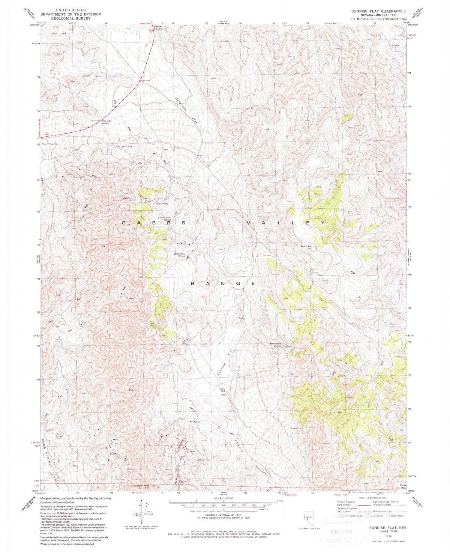
Classic USGS Sunrise Flat Nevada 7.5'x7.5' Topo Map
Couldn't load pickup availability
Historical USGS topographic quad map of Sunrise Flat in the state of Nevada. Typical map scale is 1:24,000, but may vary for certain years, if available. Print size: 24" x 27"
This quadrangle is in the following counties: Mineral.
The map contains contour lines, roads, rivers, towns, and lakes. Printed on high-quality waterproof paper with UV fade-resistant inks, and shipped rolled.
Contains the following named places: Western Metals Mine, Muller Mountain, Calavada Summit, Calavada Flat, York Spring, Stone Cabin Spring, Buffington Spring, Dunbarton Spring, Sunrise Flat, Volcano Peak, Wallstreet and Turk Mines, Champion Anderson Mine, Ideal Mine, Iron Gate Mine, Mayflower Mine, Iron Butte Mine, Copper Head Mine, Emma Mine, Eagle Mine, Copper Queen Mine, Wedge Copper Mine, York Mine, Giroux Mine, Santa Fe Mining District, Jasper Mine


