MyTopo
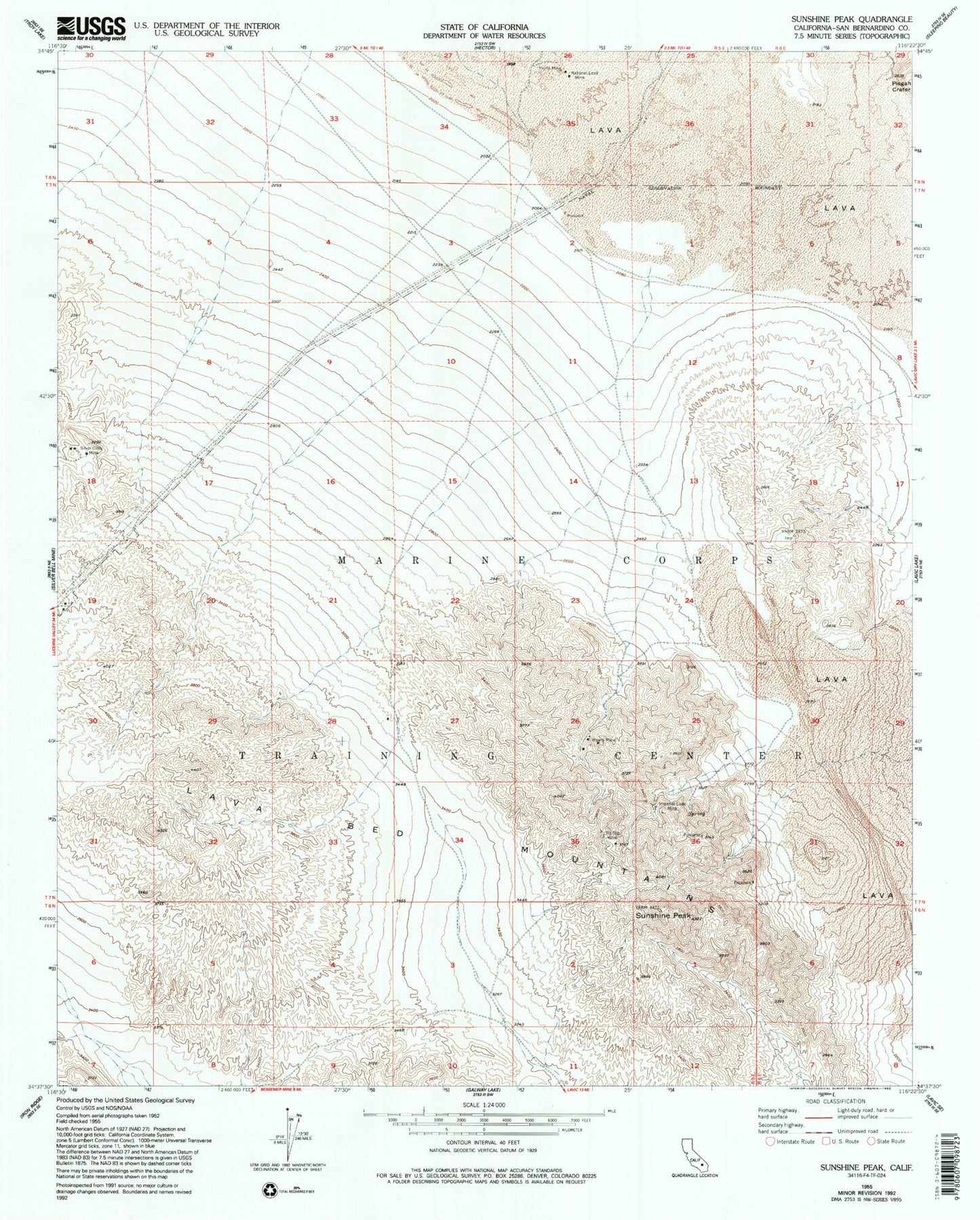
Classic USGS Sunshine Peak California 7.5'x7.5' Topo Map
Regular price
$16.95
Regular price
Sale price
$16.95
Unit price
per
Couldn't load pickup availability
Historical USGS topographic quad map of Sunshine Peak in the state of California. Map scale may vary for some years, but is generally around 1:24,000. Print size is approximately 24" x 27"
This quadrangle is in the following counties: San Bernardino.
The map contains contour lines, roads, rivers, towns, and lakes. Printed on high-quality waterproof paper with UV fade-resistant inks, and shipped rolled.
Contains the following named places: Imperial Lode Mine, Inerto Mine, Lava Bed Mountains, Mowry Mine, National Lead Mine, Pisgah Crater, Silver Cliffs Mine, Sunshine Peak, Tip Top Mine