MyTopo
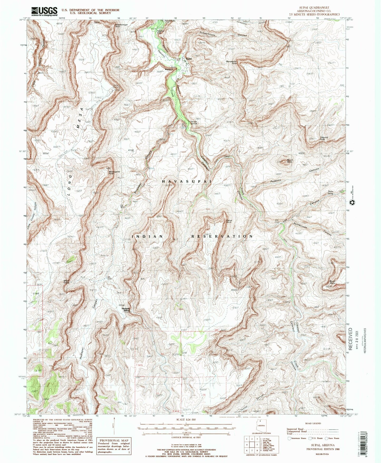
USGS Classic Supai Arizona 7.5'x7.5' Topo Map
Couldn't load pickup availability
Historical USGS topographic quad map of Supai in the state of Arizona. Scale: 1:24000. Print size: 24" x 27"
This quadrangle is in the following counties: Coconino.
The map contains contour lines, roads, rivers, towns, lakes, and grids including latitude / longitude and UTM / MGRS. Printed on high-quality waterproof paper with UV fade-resistant inks.
Contains the following named places: Driftwood Canyon, Havasu Springs, Hualapai Canyon, Hualapai Hilltop, Hundred and Fifty Mile Canyon, Lee Canyon, Long Mesa, Manakacha Point, Panya Point, Putesoy Canyon, Rattlesnake Canyon, Supai, Fiftyfoot Falls, Tithumiji Point, Tunnel Canyon, Watahomigie Point, Wescogame Point, Wigleeva, Mount Wodo, Havasupai Trail Thirty, Mount Burro, Panya Tank, Schoolhouse Canyon, Willow Spring, Burro Spring, Cataract Canyon, Cataract Creek, Cub Headland, Supai Census Designated Place, Havasupai Elementary School, Supai Post Office