MyTopo
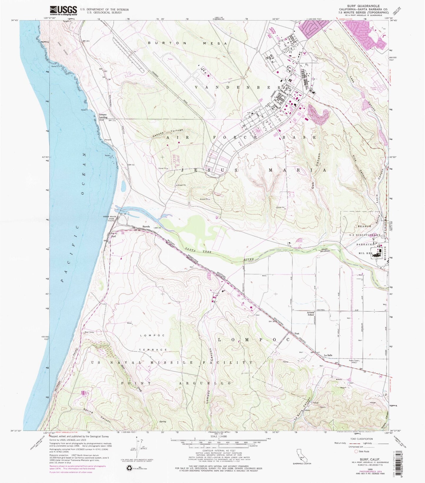
Classic USGS Surf California 7.5'x7.5' Topo Map
Couldn't load pickup availability
Historical USGS topographic quad map of Surf in the state of California. Map scale may vary for some years, but is generally around 1:24,000. Print size is approximately 24" x 27"
This quadrangle is in the following counties: Santa Barbara.
The map contains contour lines, roads, rivers, towns, and lakes. Printed on high-quality waterproof paper with UV fade-resistant inks, and shipped rolled.
Contains the following named places: Artesia School, Baroda, Bear Creek, Burton Mesa, Canada Tortuga, KNEZ-AM (Lompoc), La Salle, La Salle Canyon, La Salle Stables, Lake Canyon, Lompoc Canyon, Lompoc Landing, Lompoc Terrace, Manzanita Public Charter School, Maple High School, Oak Canyon, Ocean Beach Park, Pine Canyon, Post, Santa Lucia Canyon, Santa Ynez River, Sloans Canyon, Spring Canyon, Surf, United States Penitentiary Lompoc, Vandenberg Air Force Base, Vandenberg Air Force Base Census Designated Place, Vandenberg Air Force Base Fire Department Station 1, Vandenberg Air Force Base Fire Department Station 5, Vandenberg Air Force Base Post Office, Vandenberg Fire Department, Weser Spur, ZIP Code: 93437