MyTopo
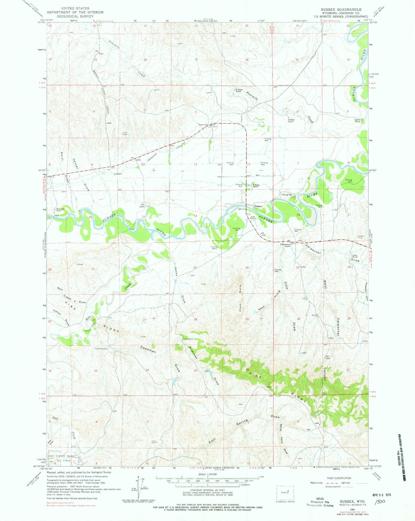
Classic USGS Sussex Wyoming 7.5'x7.5' Topo Map
Couldn't load pickup availability
Historical USGS topographic quad map of Sussex in the state of Wyoming. Map scale may vary for some years, but is generally around 1:24,000. Print size is approximately 24" x 27"
This quadrangle is in the following counties: Johnson.
The map contains contour lines, roads, rivers, towns, and lakes. Printed on high-quality waterproof paper with UV fade-resistant inks, and shipped rolled.
Contains the following named places: Andrews Draw, Carpenter Draw, Center Draw, Chalk Butte, Cole Draw, Deadman Draw, E Meike Ranch, E Patterson Ranch, Fourmile Creek, Garrett Ranch, H Meike Ranch, Indian Draw, Jenks Draw, Losey Ranch, Matthews Ranch, Meike Pit Number Three Mine, P Meike Ranch, Patrick Dam, Patrick Reservoir, Raitt Draw, Rider Draw, Salt Creek, Salt Creek V Draw, Skiles Pit Number One, Sussex, Sussex School, The Chimney, Turk Ranch, Vest Ranch, West Carpenter Canyon, West Prong Cole Draw, Windy Point Draw