MyTopo
Classic USGS Sutter Buttes California 7.5'x7.5' Topo Map
Couldn't load pickup availability
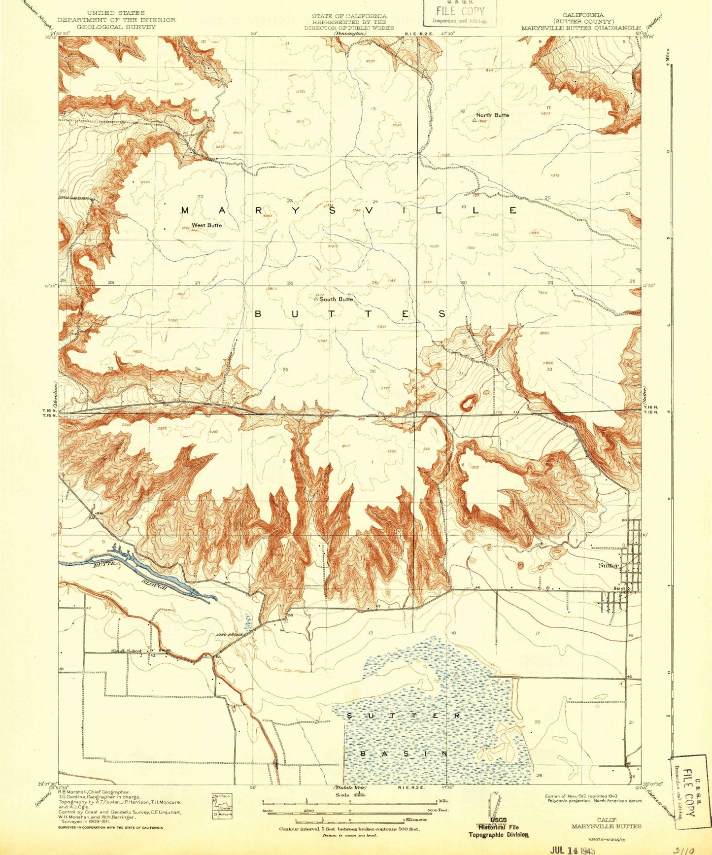
Historical USGS topographic quad map of Sutter Buttes in the state of California. Map scale may vary for some years, but is generally around 1:24,000. Print size is approximately 24" x 27"
This quadrangle is in the following counties: Sutter.
The map contains contour lines, roads, rivers, towns, and lakes. Printed on high-quality waterproof paper with UV fade-resistant inks, and shipped rolled.
Contains the following named places: Braggs Canyon, Brockman Canyon, Butte View High School, Dean Place, Fig Tree, Huff Canyon, KCEO-TV (Oroville), KKCY-FM (Colusa), KRFD-FM (Marysville), Lira, Long Bridge, Moore Canyon, Morehead Pit, Mount Vernon, North Butte, Old Craggy, Slough School, South Butte, Stohlman Cemetery, Sutter, Sutter Assembly of God Church, Sutter Buttes, Sutter Division, Sutter High School, Sutter Park, Sutter United Methodist Church, Tarke, The Falls, Twin Peaks, West Butte, ZIP Code: 95982