MyTopo
Classic USGS Sutton Vermont 7.5'x7.5' Topo Map
Couldn't load pickup availability
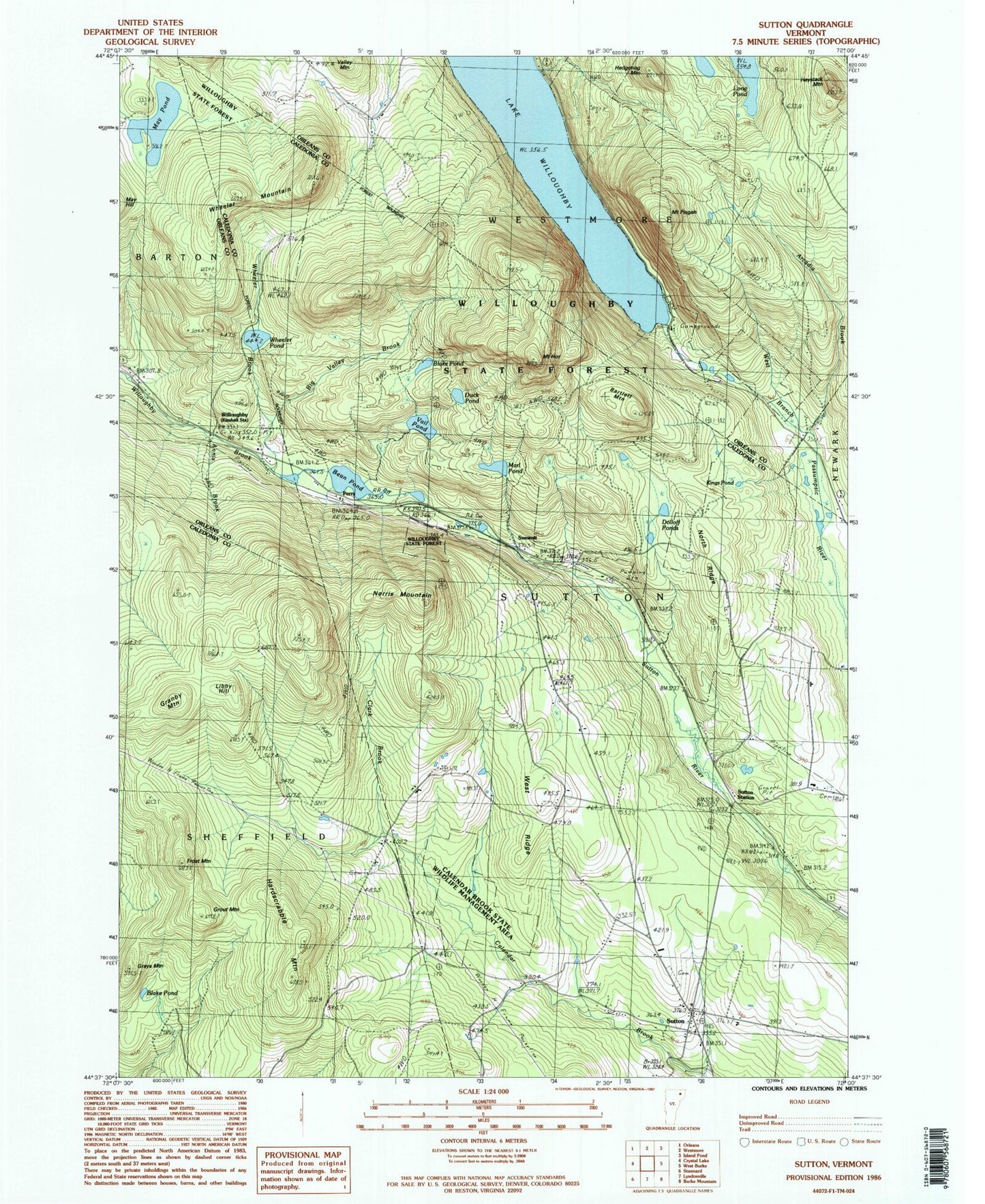
Historical USGS topographic quad map of Sutton in the state of Vermont. Typical map scale is 1:24,000, but may vary for certain years, if available. Print size: 24" x 27"
This quadrangle is in the following counties: Caledonia, Orleans.
The map contains contour lines, roads, rivers, towns, and lakes. Printed on high-quality waterproof paper with UV fade-resistant inks, and shipped rolled.
Contains the following named places: Annis Brook, Arcadia Brook, Bean Pond, Big Valley Brook, Blake Pond, Blake Pond, Clark Brook, Dolloff Ponds, Duck Pond, Frost Mountain, Granby Mountain, Grays Mountain, Grout Mountain, Hardscrabble Mountain, Haystack Mountain, Hedgehog Mountain, Highland School, Mount Hor, Kings Pond, Libby Hill, Marl Pond, May Pond, Mount Pisgah Trail, Mud Pond, Norris Mountain, North Ridge, Perry, Mount Pisgah, Sunmit, Sutton, Sutton Station, Vail Pond, West Ridge, Wheeler Brook, Wheeler Mountain, Wheeler Pond, Willoughby School, Bartlett Mountain, Town of Sutton, May Pond Dam, Calendar Brook State Wildlife Management Area, Herbert Hawkes Hiking Trail, North Ridge Cemetery, Sheffield Municipal Forest, Summit, Sutton Free Public Library, Sutton Village Cemetery, Sutton Village School, Union House - King James Cemetery, South Shore Hiking Trail, White Caps Campground, Willoughby, Willoughby State Forest, Sutton Fire Department, King George School, Richies Run, Sutton Census Designated Place