MyTopo
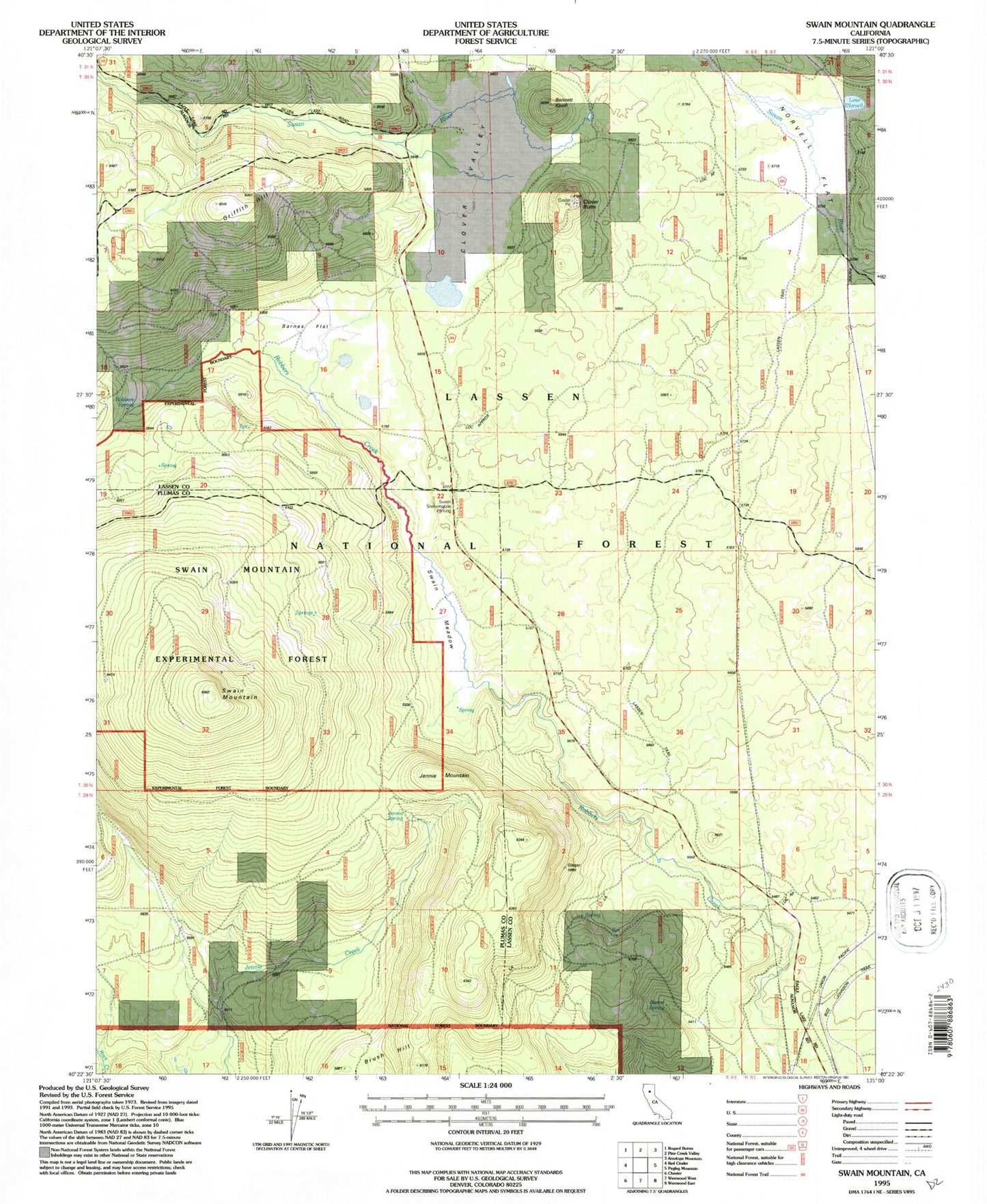
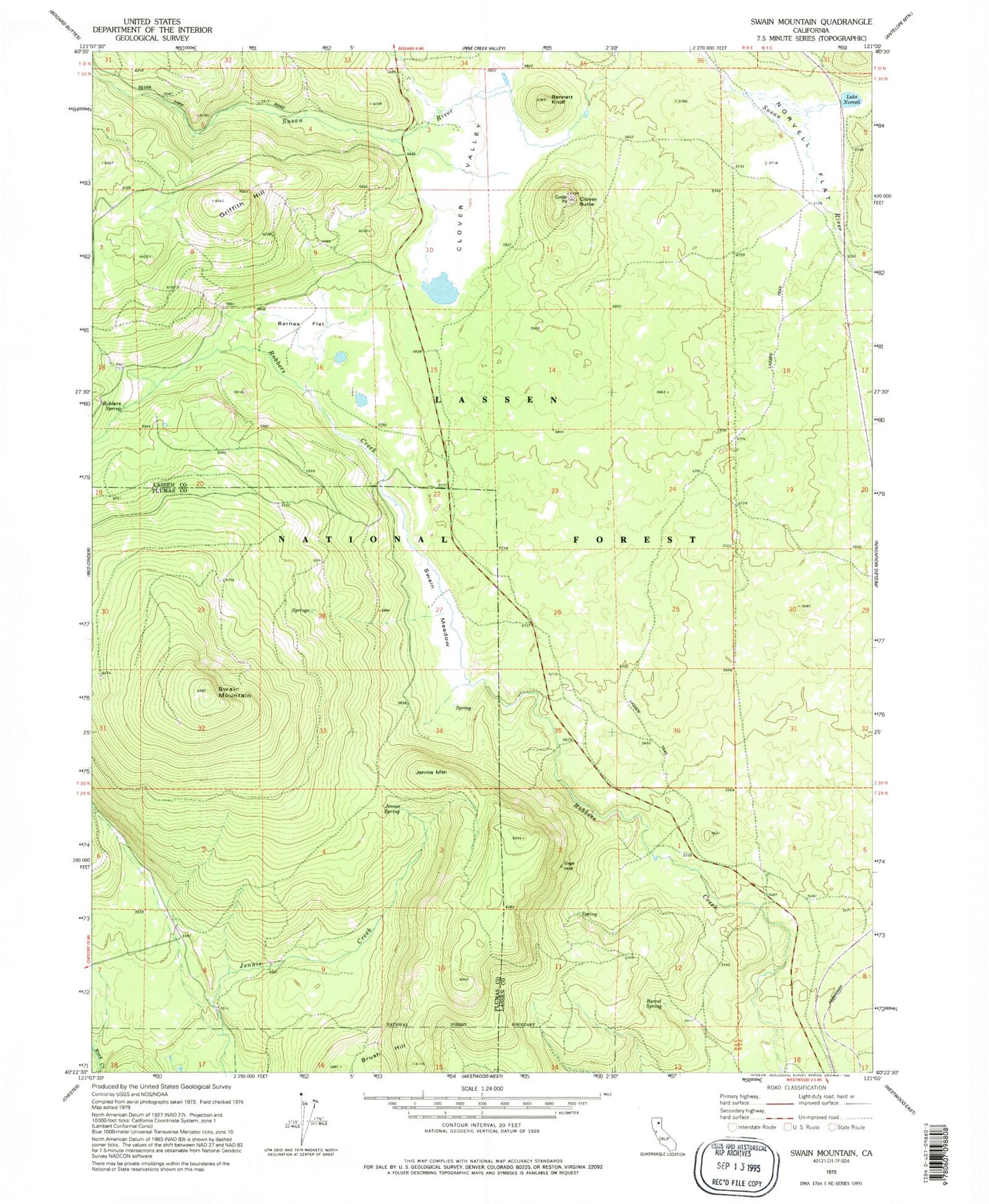
Classic USGS Swain Mountain California 7.5'x7.5' Topo Map
Couldn't load pickup availability
Historical USGS topographic quad map of Swain Mountain in the state of California. Typical map scale is 1:24,000, but may vary for certain years, if available. Print size: 24" x 27"
This quadrangle is in the following counties: Lassen, Plumas.
The map contains contour lines, roads, rivers, towns, and lakes. Printed on high-quality waterproof paper with UV fade-resistant inks, and shipped rolled.
Contains the following named places: Brush Hill, Clover Butte, Clover Valley, Jennie Spring, Norvell Flat, Susan River Campground, Swain Meadow, Swain Mountain, Swain Mountain Experimental Forest, Johnson Trail, Swain Mountain Experimental Forest, Jennie Mountain, Norvell, Lake Norvell, Barnes Flat, Barrel Spring, Bennett Knoll, Griffith Hill, Swain Snowmobile Parking