MyTopo
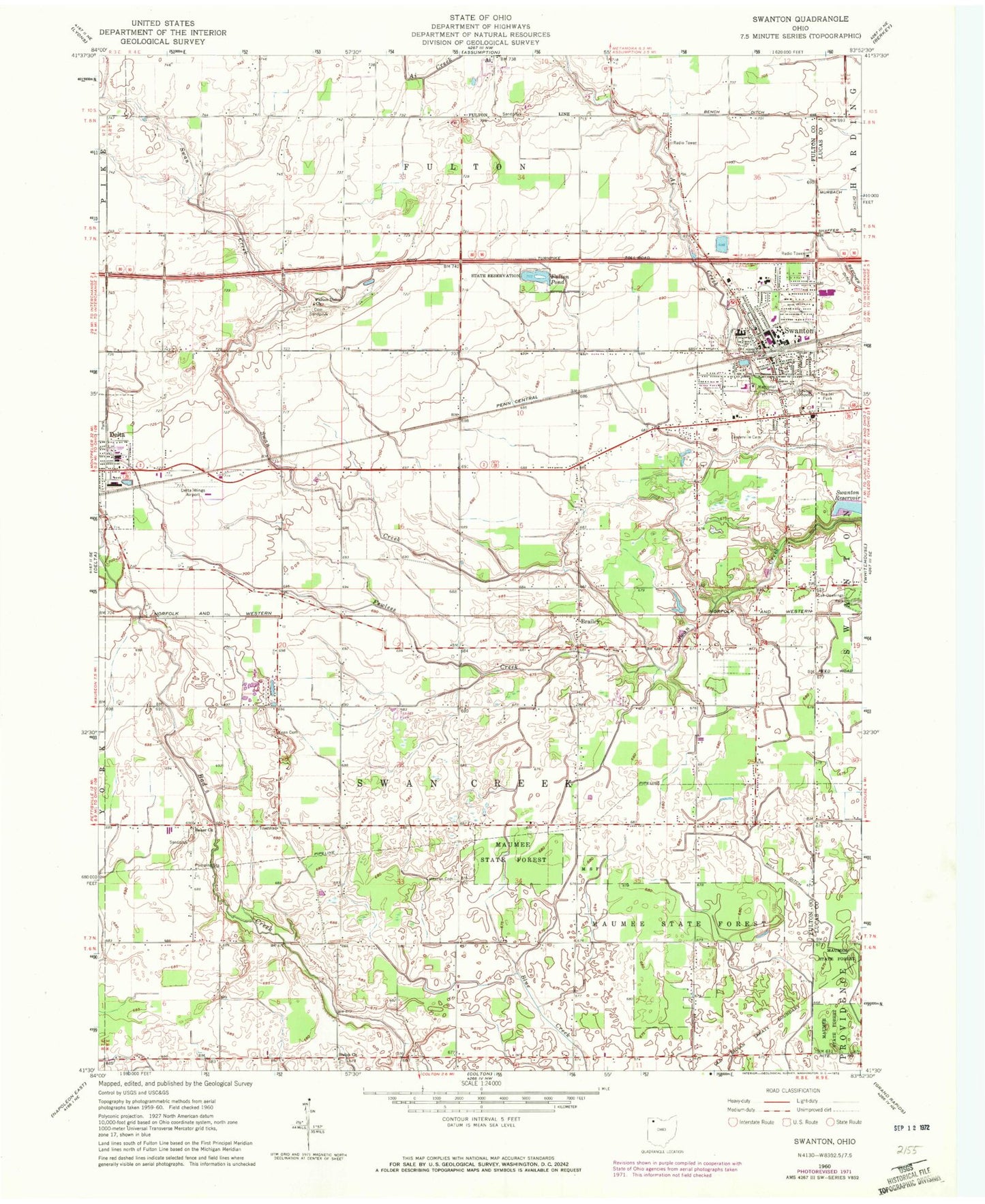
Classic USGS Swanton Ohio 7.5'x7.5' Topo Map
Couldn't load pickup availability
Historical USGS topographic quad map of Swanton in the state of Ohio. Map scale may vary for some years, but is generally around 1:24,000. Print size is approximately 24" x 27"
This quadrangle is in the following counties: Fulton, Lucas.
The map contains contour lines, roads, rivers, towns, and lakes. Printed on high-quality waterproof paper with UV fade-resistant inks, and shipped rolled.
Contains the following named places: Beecher Ditch, Blake School, Brailey, Brailey School, Brailey Union Church, Brehm's Dairy Farm, Cately School, Center School, Centerville Cemetery, Crestwood Elementary School, Delta Industrial Park, Delta Post Office, Delta Wings Airport, Elton School, Fewless Creek, Fulton Pond, Fulton Pond Wildlife Area, Fulton Union Cemetery, Fulton Union Church, Hill Ditch, Hoyt School, Keen Cemetery, King Cemetery, Leggett School, Linwood Court Mobile Home Park, Lutheran Cemetery, Lutz School, Maplewood Park, Memorial Park, Park Elementary School, Peaceful Valley, Raker Cemetery, Raker Corners, Raker School, Raker Union Church, Saint Richards Catholic Church, Saint Richards Cemetery, Saint Richards School, School Number 12, Shiloh Cemetery, Shiloh Christian Union Church, South Delta, Swanton, Swanton Fire and Rescue Division Station 1, Swanton High School, Swanton Junior High School, Swanton Meadows, Swanton Missionary Alliance Church, Swanton Missionary Church, Swanton Police Division, Swanton Post Office, Swanton Public Library, Swanton Reservoir, Swanton Sewage Treatment Plant, Swissaire Estates, Township of Fulton, Township of Swan Creek, Trinity United Methodist Church, Village of Swanton, Village of Swanton Fire Department Station 2, Wagner School, WMHE-FM (Delta), ZIP Code: 43558