
MyTopo
USGS Classic Swarthout California 7.5'x7.5' Topo Map
Couldn't load pickup availability
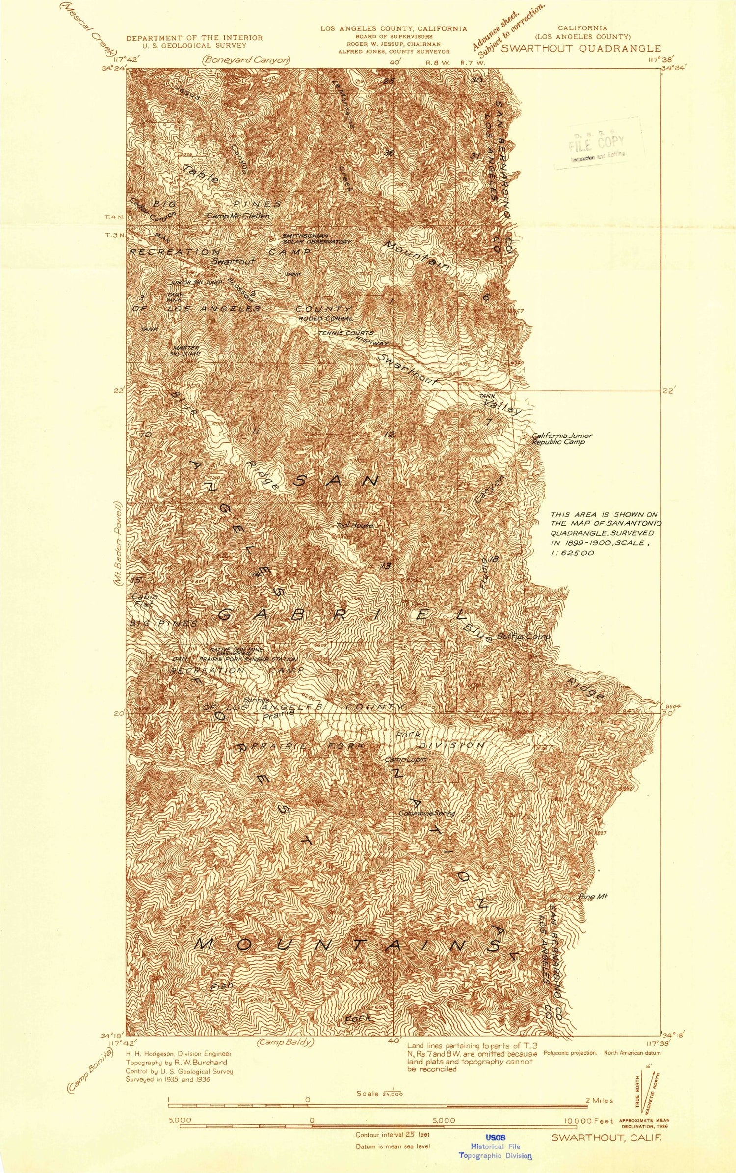
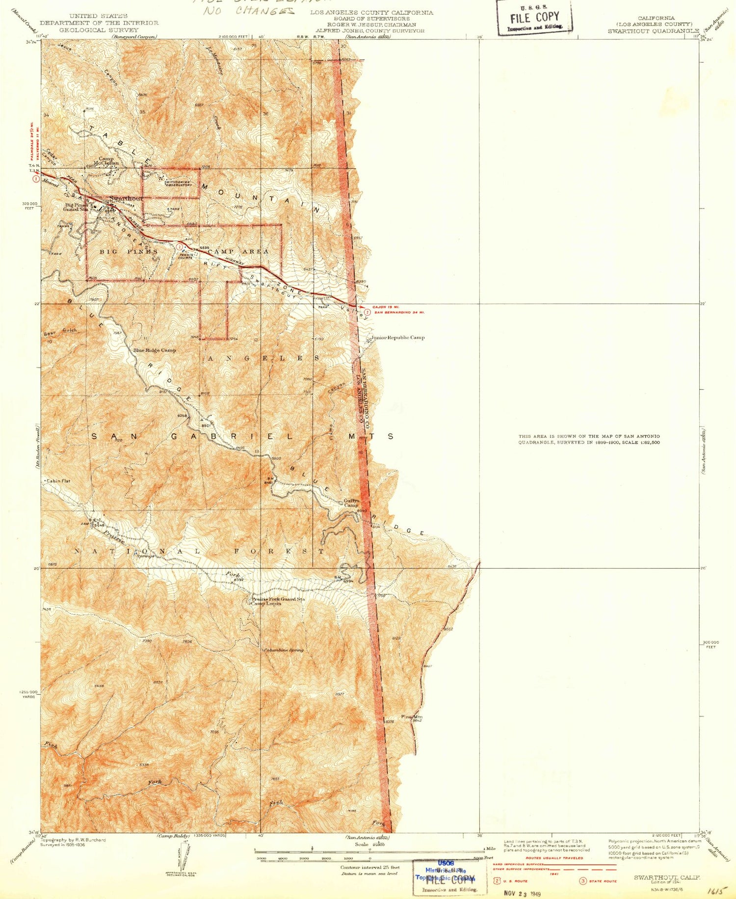
Historical USGS topographic quad map of Swarthout in the state of California. Scale: 1:24000. Print size: 24" x 27"
This quadrangle is in the following counties: Los Angeles, San Bernardino.
The map contains contour lines, roads, rivers, towns, lakes, and grids including latitude / longitude and UTM / MGRS. Printed on high-quality waterproof paper with UV fade-resistant inks.
Contains the following named places: Heath Canyon, Sheep Canyon, Slover Canyon, Swarthout Valley, Acorn Canyon, Big Pines, Blue Ridge, Blue Ridge Camp, Cabin Flat, Camp Lupine, Camp Maria Stella, Camp Marion, Camp McClellan, Centinela Valley Camp, Columbine Spring, Dawson Peak, Deer Ridge Camp, Flume Canyon, Government Canyon, Guffy Camp, Native Son Mine, Oak Spring Ranch, Pine Mountain, Pine Mountain Ridge, Prairie Fork Guard Station, Sawmill Canyon, Smithsonian Observatory, Table Mountain, Table Mountain Campground, Twin Lakes, Wright Lake, Wright Mountain, Mount View Organizational Camp, Mount High East Ski Area, Blue RIdge Electronic Site, Arch Picnic Ground, Pacific Crest Reservoir, Mount High West Ski Area, Big Pine Station, Pauite Campground, Mount View Organizational Camp, Mount High East Ski Lift, Wrightwood, Blue Ridge Ski Lift, Holiday Hill Ski Lift, Mount High West Ski Lift, Dog Bone Canyon, Big Pines Guard Station (historical), Kare Camp Campground, Prairie Fork Guard Station (historical), Sunrise Ski Area, Dawson Peak Trail, McClellean Flat, Wildhorse Canyon, Wrightwood Elementary School, Wrightwood Post Office, Junior Republic Camp (historical), Wrightwood Census Designated Place, East Table Mountain, San Bernardino County Fire Department Station 14 Wrightwood


