
MyTopo
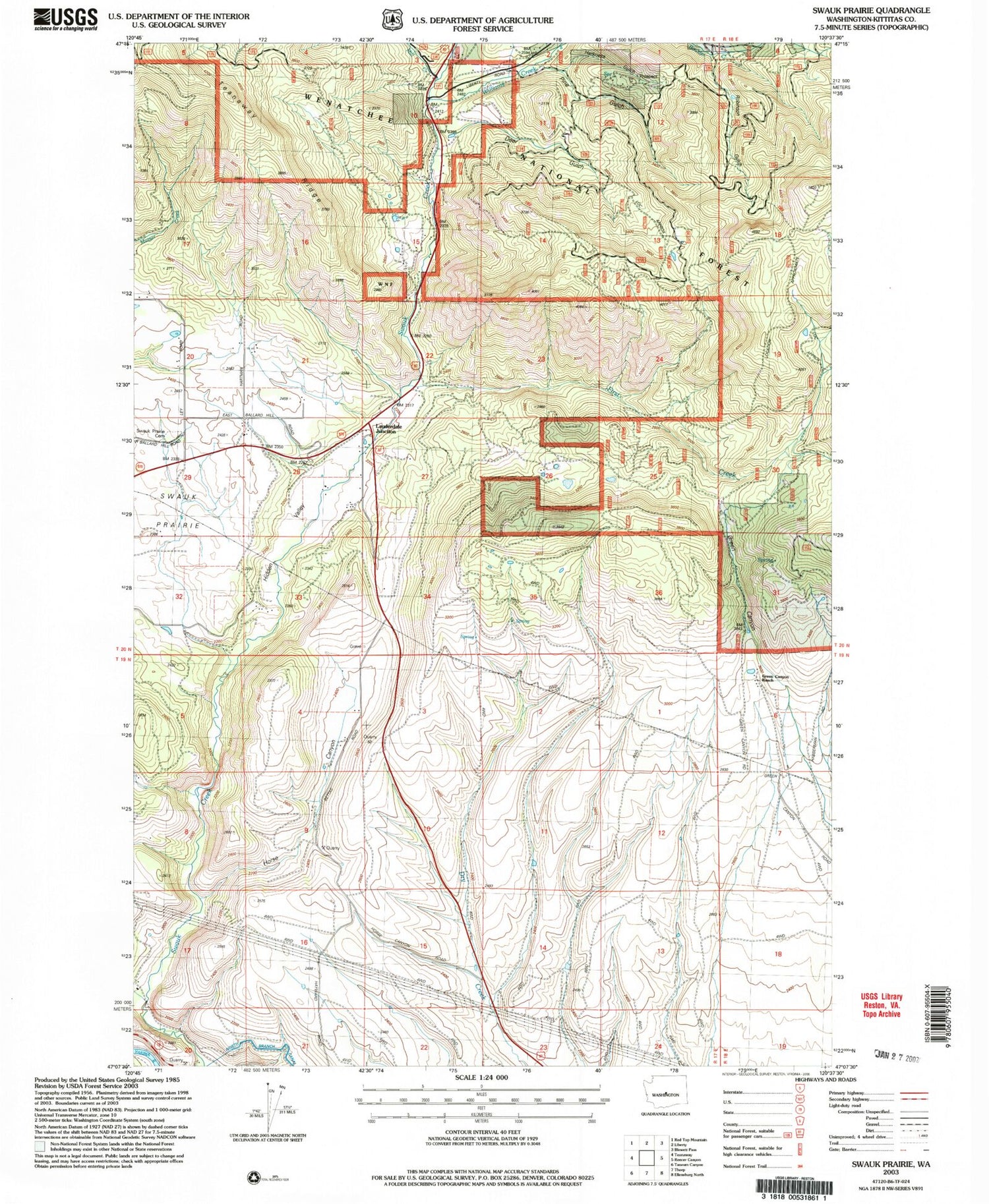
Classic USGS Swauk Prairie Washington 7.5'x7.5' Topo Map
Couldn't load pickup availability
Historical USGS topographic quad map of Swauk Prairie in the state of Washington. Map scale may vary for some years, but is generally around 1:24,000. Print size is approximately 24" x 27"
This quadrangle is in the following counties: Kittitas.
The map contains contour lines, roads, rivers, towns, and lakes. Printed on high-quality waterproof paper with UV fade-resistant inks, and shipped rolled.
Contains the following named places: Deer Gulch, First Creek, Flying Rock Airpark, Green Canyon, Green Canyon Ranch, Harness Gulch, Hidden Valley, Horse Canyon, Lauderdale Junction, Liberty Guard Station, Mill Creek, Mill Pond, Old Placer Mine, Pine Gulch, Robinson Gulch, Swauk Prairie, Swauk Prairie Cemetery, Williams Creek


