

MyTopo
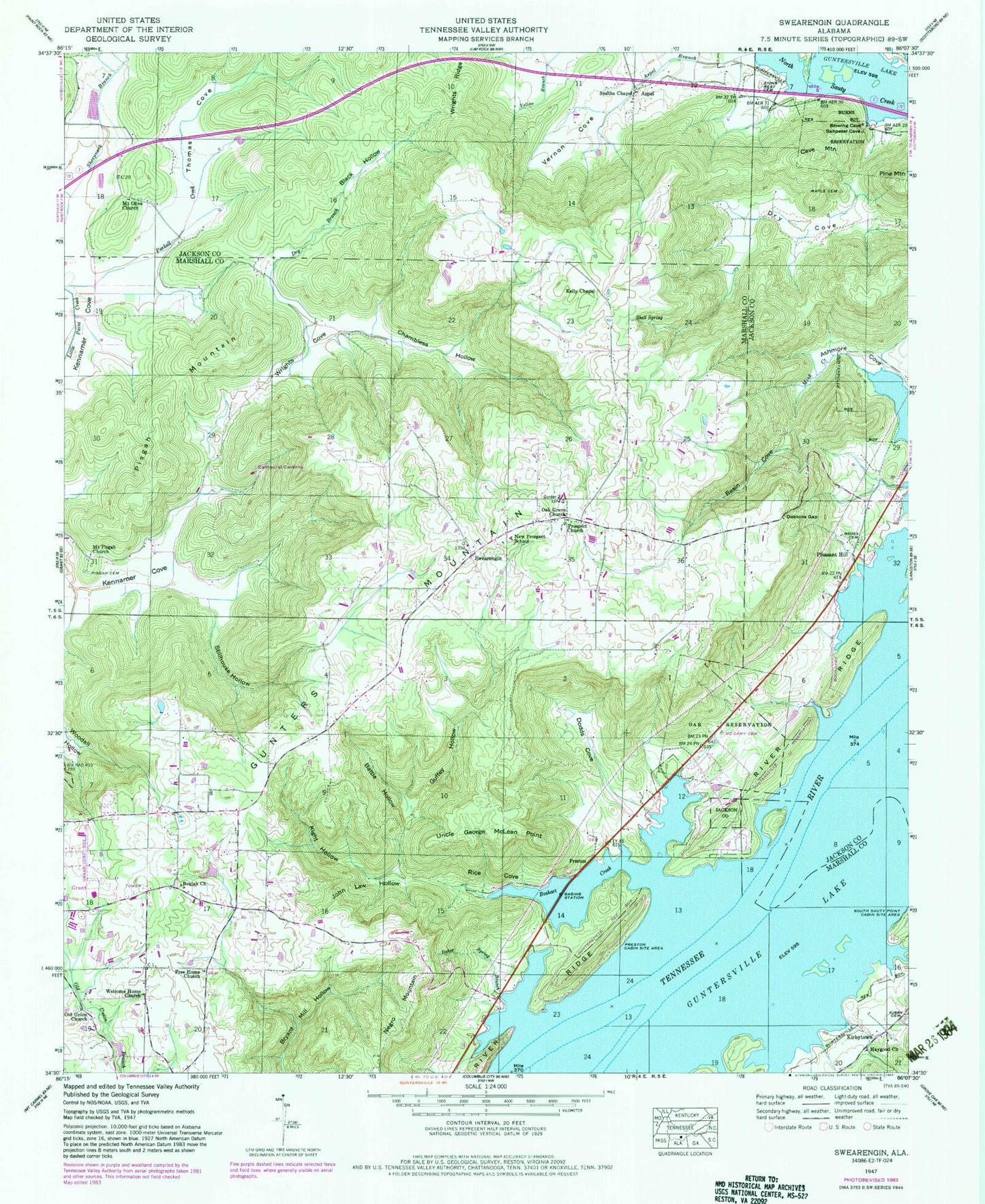
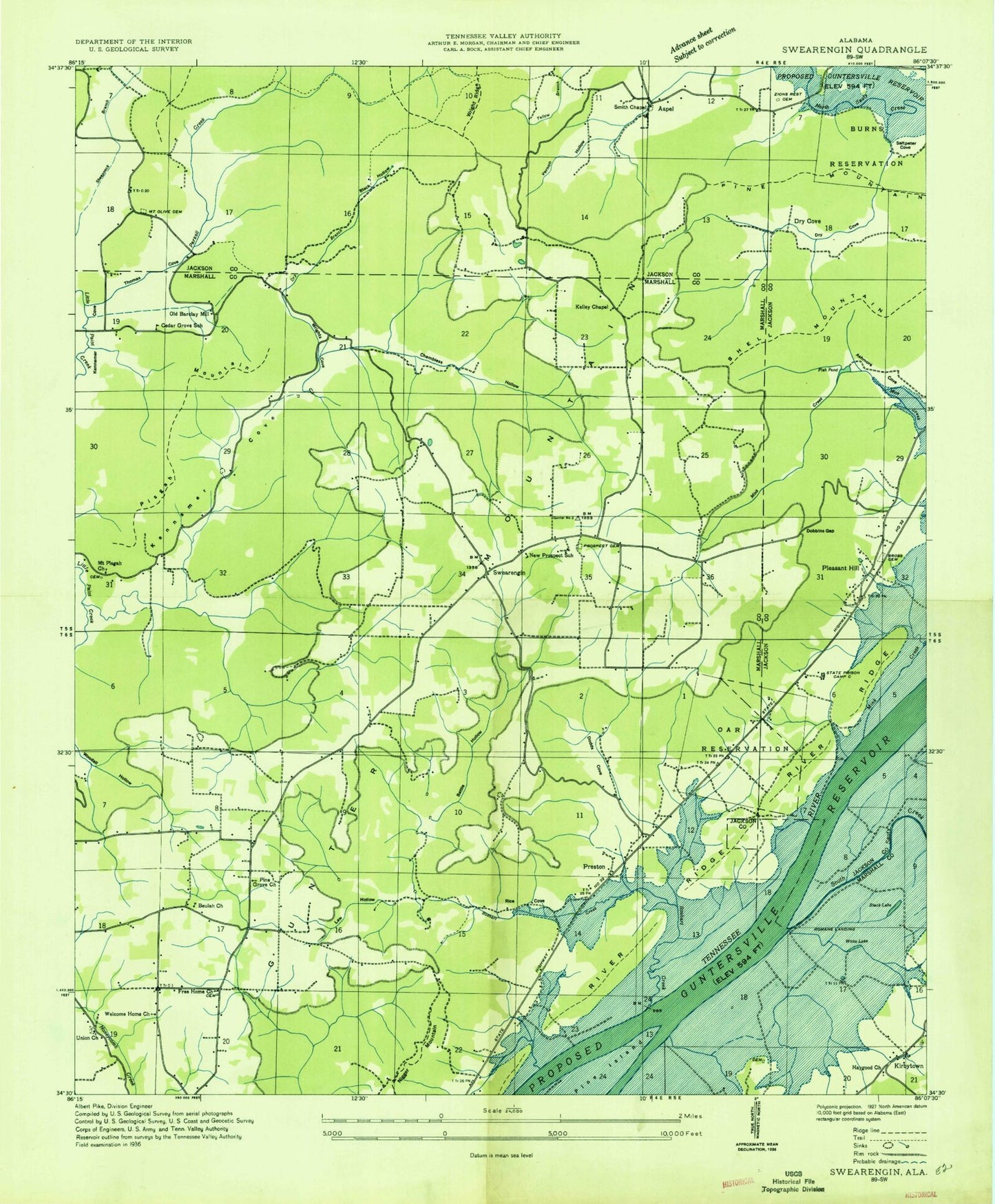
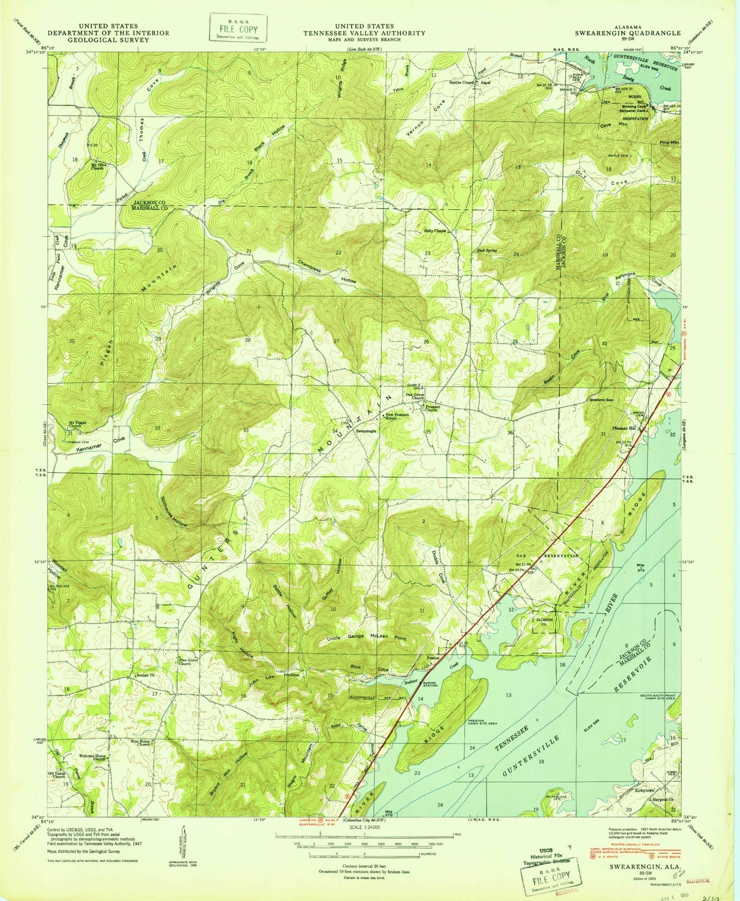
Classic USGS Swearengin Alabama 7.5'x7.5' Topo Map
Couldn't load pickup availability
Historical USGS topographic quad map of Swearengin in the state of Alabama. Typical map scale is 1:24,000, but may vary for certain years, if available. Print size: 24" x 27"
This quadrangle is in the following counties: Jackson, Marshall.
The map contains contour lines, roads, rivers, towns, and lakes. Printed on high-quality waterproof paper with UV fade-resistant inks, and shipped rolled.
Contains the following named places: Aspel, Baker Spring Branch, Basin Cove, Battle Hollow, Beulah Church, Black Hollow, Boshart Creek, Burns Reservation, Cave Mountain, Chambless Hollow, Dobbins Gap, Dodds Cove, Dry Branch, Free Home Baptist Church, Gross Cemetery, Guffey Hollow, Gunters Mountain, Haygood Church, John Law Hollow, Kelly Chapel, Kennamer Cove, Kight Hollow, Kirby Cemetery, Maple Cemetery, McCamy Cemetery, McFarlane Cemetery, Mount Olive Church, New Prospect School, Oak Grove Church, Oar Reservation, Pisgah Mountain, Preston Cabin Site Area, Prospect Church, Rice Cove, River Ridge, Shell Spring, Stillhouse Hollow, Thomas Cove, Uncle George McLean Point, Vernon Cove, Welcome Home Church, Wrights Cove, Zions Rest Cemetery, Alabama State Prison Camp (historical), Cooleys Landing (historical), Cowley Landing (historical), Dry Cove (historical), Free Home Church Cemetery, Mannings Store (historical), Mount Zion Church, New Home Church, Oak Grove, Preston Cemetery, Roman Landing (historical), Romans Bar, Scotts Chapel (historical), Swearengin Church, Upper Bar, Old Union Cemetery, Lakeview Beach, Breezeway Bay, McFarland Cemetery, Saint Bernard College Camp, Barkley Spring, Blowing Wind Cave National Wildlife Refuge, Mount Pisgah Primitive Baptist Church, Old Union Church, Pisgah Cemetery, Smiths Chapel, Kirbytown, Pleasant Hill, Preston, Swearengin, Dunn Cemetery, Black Lake (historical), Cedar Grove School (historical), Old Barclay Mill, Pine Grove Church (historical), Prospect Cemetery, White Lake (historical), Fish Pond, Mount Olive Cemetery, Saltpeter Cove, State Prison Camp C (historical), Mount Olive School (historical), Swearengin Volunteer Fire Department, Kirkland Farms, Sauta Cave National Wildlife Refuge, Aspel, Baker Spring Branch, Basin Cove, Battle Hollow, Beulah Church, Black Hollow, Boshart Creek, Burns Reservation, Cave Mountain, Chambless Hollow, Dobbins Gap, Dodds Cove, Dry Branch, Free Home Baptist Church, Gross Cemetery, Guffey Hollow, Gunters Mountain, Haygood Church, John Law Hollow, Kelly Chapel, Kennamer Cove, Kight Hollow, Kirby Cemetery, Maple Cemetery, McCamy Cemetery, McFarlane Cemetery, Mount Olive Church, New Prospect School, Oak Grove Church, Oar Reservation, Pisgah Mountain, Preston Cabin Site Area, Prospect Church, Rice Cove, River Ridge, Shell Spring, Stillhouse Hollow, Thomas Cove, Uncle George McLean Point, Vernon Cove, Welcome Home Church, Wrights Cove, Zions Rest Cemetery, Alabama State Prison Camp (historical), Cooleys Landing (historical), Cowley Landing (historical), Dry Cove (historical), Free Home Church Cemetery, Mannings Store (historical), Mount Zion Church, New Home Church, Oak Grove, Preston Cemetery, Roman Landing (historical), Romans Bar, Scotts Chapel (historical), Swearengin Church, Upper Bar, Old Union Cemetery, Lakeview Beach, Breezeway Bay, McFarland Cemetery, Saint Bernard College Camp, Barkley Spring, Blowing Wind Cave National Wildlife Refuge, Mount Pisgah Primitive Baptist Church, Old Union Church, Pisgah Cemetery, Smiths Chapel, Kirbytown, Pleasant Hill, Preston, Swearengin, Dunn Cemetery, Black Lake (historical), Cedar Grove School (historical), Old Barclay Mill, Pine Grove Church (historical), Prospect Cemetery, White Lake (historical), Fish Pond, Mount Olive Cemetery, Saltpeter Cove, State Prison Camp C (historical), Mount Olive School (historical), Swearengin Volunteer Fire Department, Kirkland Farms, Sauta Cave National Wildlife Refuge