MyTopo
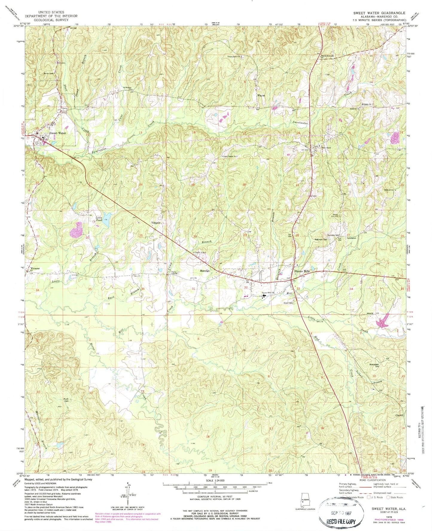
Classic USGS Sweet Water Alabama 7.5'x7.5' Topo Map
Couldn't load pickup availability
Historical USGS topographic quad map of Sweet Water in the state of Alabama. Map scale may vary for some years, but is generally around 1:24,000. Print size is approximately 24" x 27"
This quadrangle is in the following counties: Marengo.
The map contains contour lines, roads, rivers, towns, and lakes. Printed on high-quality waterproof paper with UV fade-resistant inks, and shipped rolled.
Contains the following named places: Buck Branch, Camp Branch, Cane Creek, Central Baptist Church, Clayhill, Dixon Cemetery, Dixon Mills Church of God Pentecostal, Dixons Mill Church, Dixons Mills, Dixons Mills Post Office, Dixons Mills School, Dixons Mills Station, Dixons Mills United Methodist Church, Dixons Mills Volunteer Fire Department, Doyle, Dunning Cemetery, Exmoor, Exmoor Elementary School, Faith Temple Number 2, Freedomland Church, Holiness Church, House of Prayer Church, Jones Chapel, Jones Chapel Elementary School, Lewis Branch, Lewis Pond, Little Creek, Little Zion Church, Marengo, Marengo High School, Mill Creek, Morrisette Cemetery, Mud Creek, Nolan Atkins Stadium, Payne Chapel, Paynes Chapel Methodist Cemetery, Pearson Cemetery, Pruitt Cemetery, Quinney Branch, Robinson Cemetery, Rock Babylon Missionary Baptist Church, Saint Wisdom Church, Sheep Branch, Shell Creek, Shiloh Church, Steeles Landing Park, Sweet Water, Sweet Water Baptist Church, Sweet Water Dam, Sweet Water High School, Sweet Water Post Office, Sweet Water Volunteer Fire Department Station 1, Sweet Water Volunteer Fire Department Station 2, Talbert Branch, Town of Sweet Water, Union Grove Baptist Church, Union Grove Cemetery, Vangale, Wayne, Wayne Baptist Church, ZIP Code: 36736