MyTopo
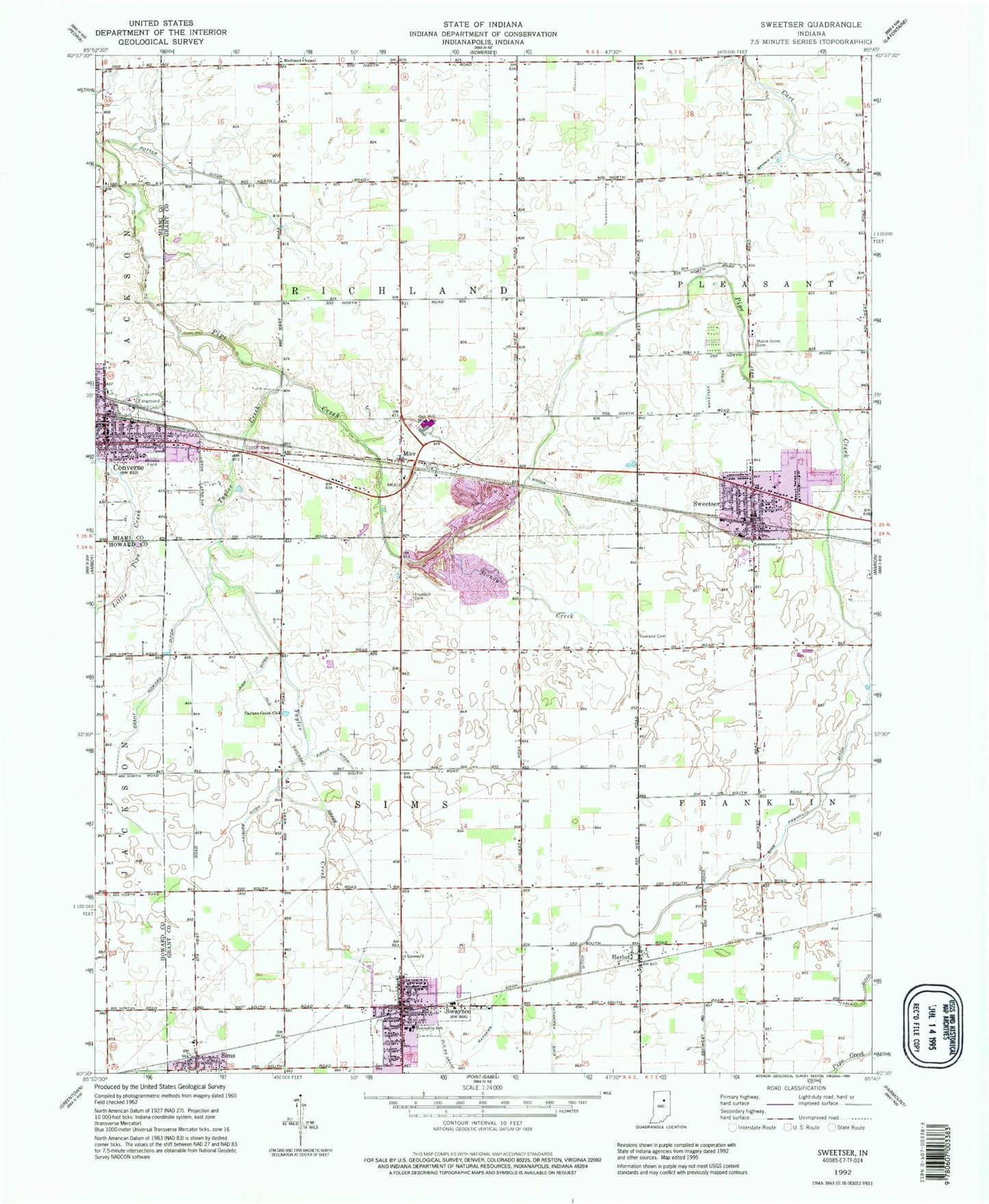
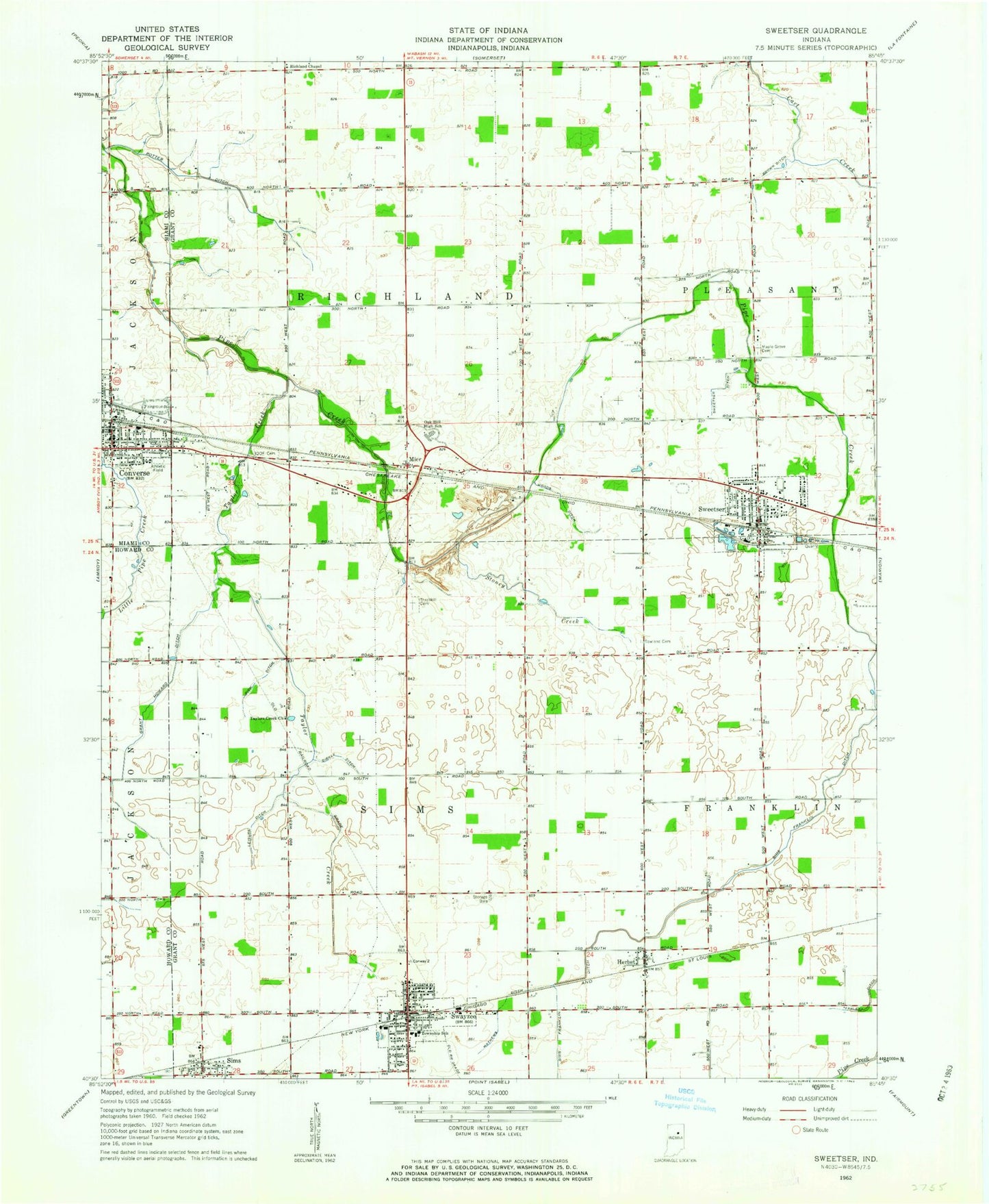
Classic USGS Sweetser Indiana 7.5'x7.5' Topo Map
Couldn't load pickup availability
Historical USGS topographic quad map of Sweetser in the state of Indiana. Map scale may vary for some years, but is generally around 1:24,000. Print size is approximately 24" x 27"
This quadrangle is in the following counties: Grant, Howard, Miami.
The map contains contour lines, roads, rivers, towns, and lakes. Printed on high-quality waterproof paper with UV fade-resistant inks, and shipped rolled.
Contains the following named places: Brown Ditch, Converse, Converse Elementary School, Converse Police Department, Converse Post Office, Converse Volunteer Ambulance Headquarters, Converse Volunteer Fire Company, Converse Volunteer Fire Department, Grant Howard Ditch, Herbst, Herbst Census Designated Place, Independent Order of Odd Fellows Cemetery, Leisure Ditch, Maple Grove Cemetery, Mathews Ditch, Mier, Mier Census Designated Place, Oak Hill High School, Oak Hill Junior High School, Pleasant Township Volunteer Fire Department, Potter Ditch, Rich Ditch, Richland Chapel, Rowland Cemetery, Sims Census Designated Place, Sims-Franklin Ditch, Southwest Medic Ambulance, Stoney Creek, Swayzee, Swayzee Elementary School, Swayzee Fire Department, Swayzee Police Department, Swayzee Post Office, Sweetser, Sweetser Ditch, Sweetser Elementary School, Sweetser Police Department, Taylor Creek, Taylors Creek Church, Thraikill Cemetery, Town of Converse, Town of Swayzee, Town of Sweetser, Township of Richland, Township of Sims, Woods Ditch, Zirkle Ditch, ZIP Codes: 46919, 46987