MyTopo
Classic USGS Sweetwater Creek Nevada 7.5'x7.5' Topo Map
Couldn't load pickup availability
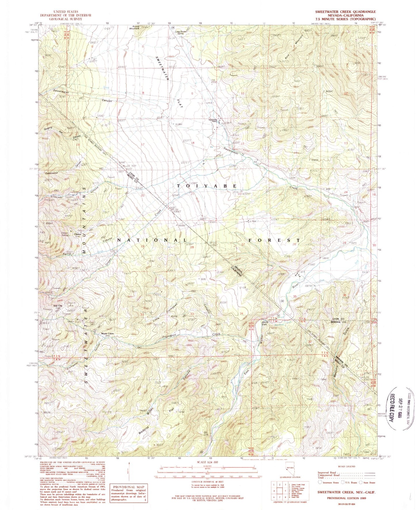
Historical USGS topographic quad map of Sweetwater Creek in the states of Nevada, California. Map scale may vary for some years, but is generally around 1:24,000. Print size is approximately 24" x 27"
This quadrangle is in the following counties: Lyon, Mineral, Mono.
The map contains contour lines, roads, rivers, towns, and lakes. Printed on high-quality waterproof paper with UV fade-resistant inks, and shipped rolled.
Contains the following named places: Atcheson Ranch, Clinton, Clinton Spring, Cottonwood Canyon, Devils Gate, Feridell Ranch, Ferris Canyon, Fredericks Ranch, Fryingpan Canyon, Fryingpan Creek, Green Creek, Little Fryingpan Canyon, Long Doctor Spring, Masonic Gulch, Monte Cristo, Murphy Pond, Philatro Ranch, Quaking Asp Canyon, Roach Ranch, Round Mountain, Silverado Canyon, Star City, Sweetwater, Sweetwater Canyon, Sweetwater Creek, Sweetwater Flat, Sweetwater Guard Station, Sweetwater Natural Area, Sweetwater Post Office, Sweetwater Ranch, Water Canyon, Wedertz Flat, Williams Stage Station Historical Site