MyTopo
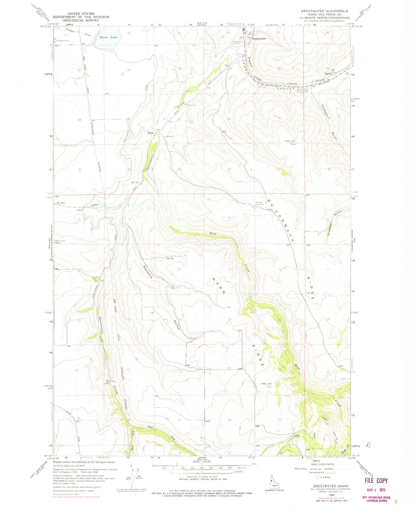
Classic USGS Sweetwater Idaho 7.5'x7.5' Topo Map
Couldn't load pickup availability
Historical USGS topographic quad map of Sweetwater in the state of Idaho. Map scale may vary for some years, but is generally around 1:24,000. Print size is approximately 24" x 27"
This quadrangle is in the following counties: Nez Perce.
The map contains contour lines, roads, rivers, towns, and lakes. Printed on high-quality waterproof paper with UV fade-resistant inks, and shipped rolled.
Contains the following named places: Bundy, Bundy Station, East Fork Sweetwater Creek, Mann Lake, Mann Lake Public Fishing Area, McCormack Ridge, Nez Perce County, Packers Gulch, Polly Canyon, Red Elk Cemetery, Reservoir A Dam, Snow, Sweetwater, Sweetwater Canal, Sweetwater Cemetery, Sweetwater Census Designated Place, Sweetwater Creek, Thiessen Gulch, Webb, Webb Creek, Webb Creek Canal, Webb Ridge, West Fork Sweetwater Creek, William Craig Historical Monument, ZIP Code: 83540