MyTopo
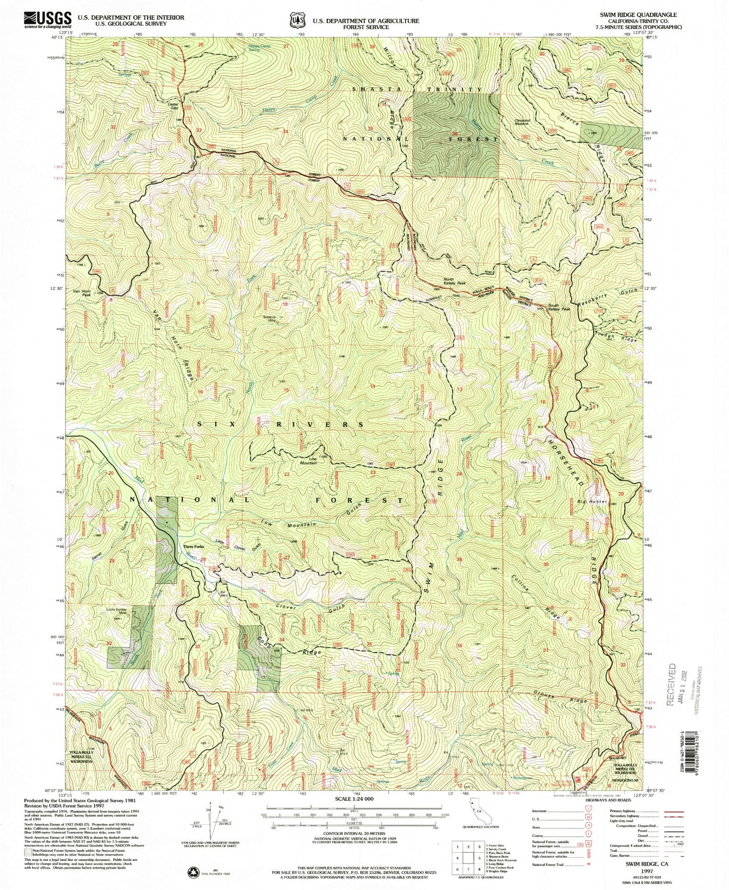
Classic USGS Swim Ridge California 7.5'x7.5' Topo Map
Couldn't load pickup availability
Historical USGS topographic quad map of Swim Ridge in the state of California. Map scale may vary for some years, but is generally around 1:24,000. Print size is approximately 24" x 27"
This quadrangle is in the following counties: Trinity.
The map contains contour lines, roads, rivers, towns, and lakes. Printed on high-quality waterproof paper with UV fade-resistant inks, and shipped rolled.
Contains the following named places: Bierce Ridge, Big Hunter, Bonanza Mine, Cedar Gap, Cleveland Meadow, Clover Gulch, Cobb Ridge, Collins Ridge, Double Cabins, East Fork South Fork Trinity River, Grouse Ridge, Happy Camp Spring, Horsehead Mountain, Horsehead Ridge, Little Clover Gulch, Little Doe Wilderness Trailhead, Low Mountain, Low Mountain Gulch, Lucky Sunday Mine, North Fork Mud River, North Kelsey Peak, Secret Gulch, South Fork Mad River, South Kelsey Peak, Swim Ridge, Trough Ridge, Trout Creek, Van Horn Peak, Van Horn Ridge, Water Spout Parking, Water Spout Spring, Waterspout, Wilcox Ridge, ZIP Code: 95552