MyTopo
Classic USGS Sycamore Ohio 7.5'x7.5' Topo Map
Couldn't load pickup availability
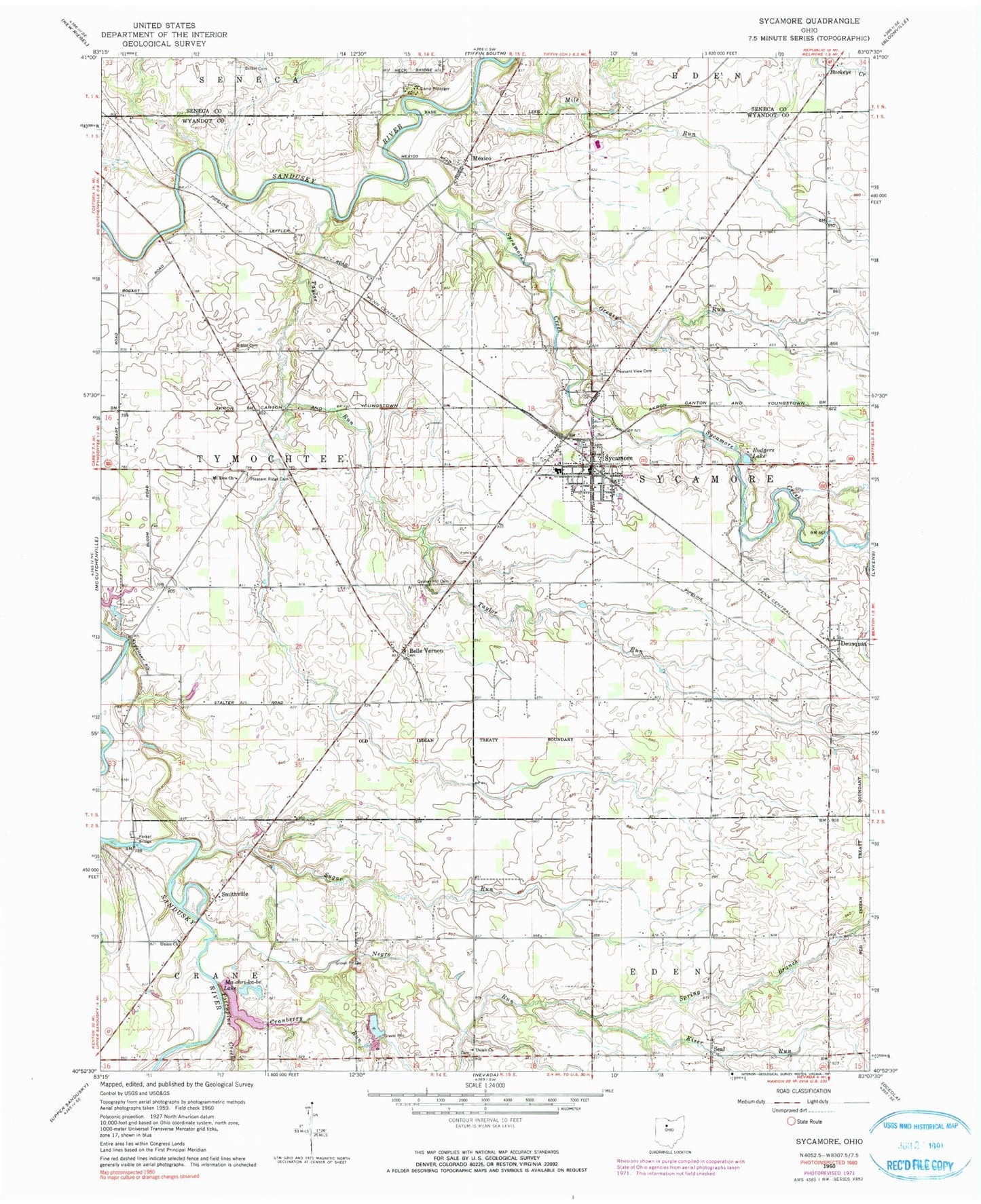
Historical USGS topographic quad map of Sycamore in the state of Ohio. Map scale may vary for some years, but is generally around 1:24,000. Print size is approximately 24" x 27"
This quadrangle is in the following counties: Seneca, Wyandot.
The map contains contour lines, roads, rivers, towns, and lakes. Printed on high-quality waterproof paper with UV fade-resistant inks, and shipped rolled.
Contains the following named places: Badger Cemetery, Beaver Cemetery, Belle Vernon, Belle Vernon Cemetery, Belle Vernon Post Office, Bethel Cemetery, Bibler Cemetery, Bretz Cemetery, Bretz Farm Cemetery, Camp Pittenger, Cranberry Run, Curlis Cemetery, Cutting Cemetery, Deunquat, Deunquat Post Office, Duenquat Lutheran Church, Ellis Lake, Ellis Lake Dam, Freefall Field, Greasy Run, Kiser Run, Ma-chri-ka-be Lake, Mexico, Mexico Cemetery, Mexico Post Office, Mile Run, Mohawk High School, Mount Zion Church, Negro Run, Old Sycamore Cemetery, Pleasant Ridge Cemetery, Pleasant View Cemetery, Porcupine Creek, Quaker Hill Cemetery, Rodgers Lake, Saint Pius Catholic Church, Seal, Smithville, Smithville Cemetery, Spring Branch, Stalter Cemetery, Sugar Run, Sycamore, Sycamore Creek, Sycamore Elementary School, Sycamore Fire Department and Emergency Medical Services, Sycamore Post Office, Sycamore Village Police Department, Taylor Run, Touch of Gold Quarterhorse Farm, Township of Sycamore, Township of Tymochtee, Union Church, Village of Sycamore, West Union Cemetery, ZIP Code: 44882