MyTopo
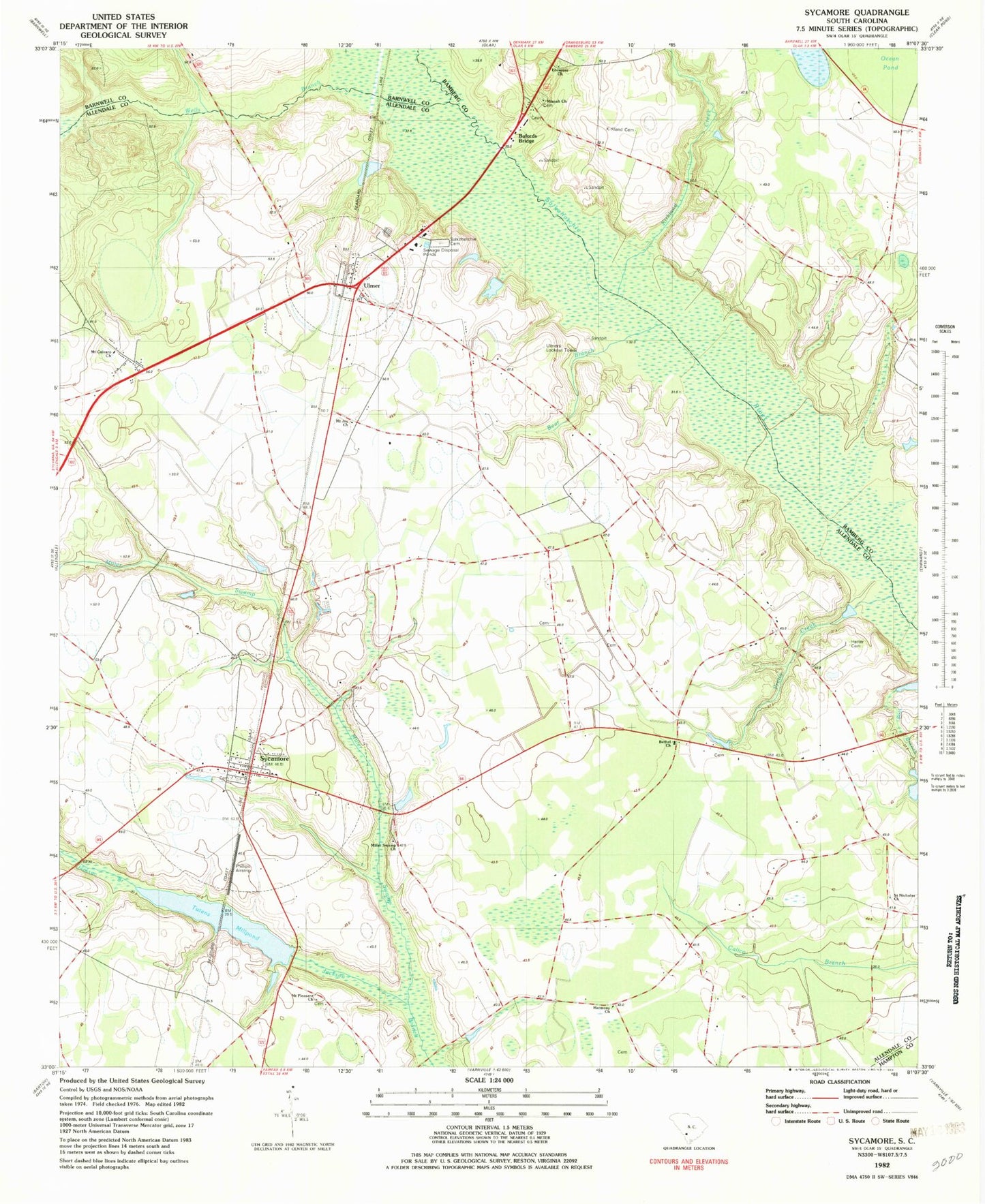
Classic USGS Sycamore South Carolina 7.5'x7.5' Topo Map
Couldn't load pickup availability
Historical USGS topographic quad map of Sycamore in the state of South Carolina. Map scale may vary for some years, but is generally around 1:24,000. Print size is approximately 24" x 27"
This quadrangle is in the following counties: Allendale, Bamberg, Barnwell, Hampton.
The map contains contour lines, roads, rivers, towns, and lakes. Printed on high-quality waterproof paper with UV fade-resistant inks, and shipped rolled.
Contains the following named places: Allendale County Law Enforcement Center, Allendale Fire Department Station 300, Bear Branch, Beaufort Bridge, Bethel Church, Bufords Bridge, Caddins Branch, Cones Store, Copes Mill, Ebenezer Baptist Church, Harmony Church, Harmony School, Harter Cemetery, Kirkland Cemetery, Kirkland Creek, Mennonite Church, Miller Creek Cemetery, Miller Swamp, Miller Swamp Church, Mizpah Church, Mount Calvary Cemetery, Mount Calvary Church, Mount Calvary School, Mount Joy Church, Mount Pleasant Church, Ocean Pond, Phillips Airstrip, Pretty Creek, Saint Nicholas Church, Salkehatchie Cemetery, Salkehatchie Church, Shady Grove School, Sycamore, Sycamore Division, Sycamore Post Office, Town of Sycamore, Town of Ulmer, Tuten, Tutens Mill Pond Dam D-2569, Tutens Millpond, Ulmer, Ulmer Post Office, Ulmers Lookout Tower, Union School, Weekleys Store, Wells Branch, ZIP Code: 29849