MyTopo
Classic USGS Sylacauga East Alabama 7.5'x7.5' Topo Map
Couldn't load pickup availability
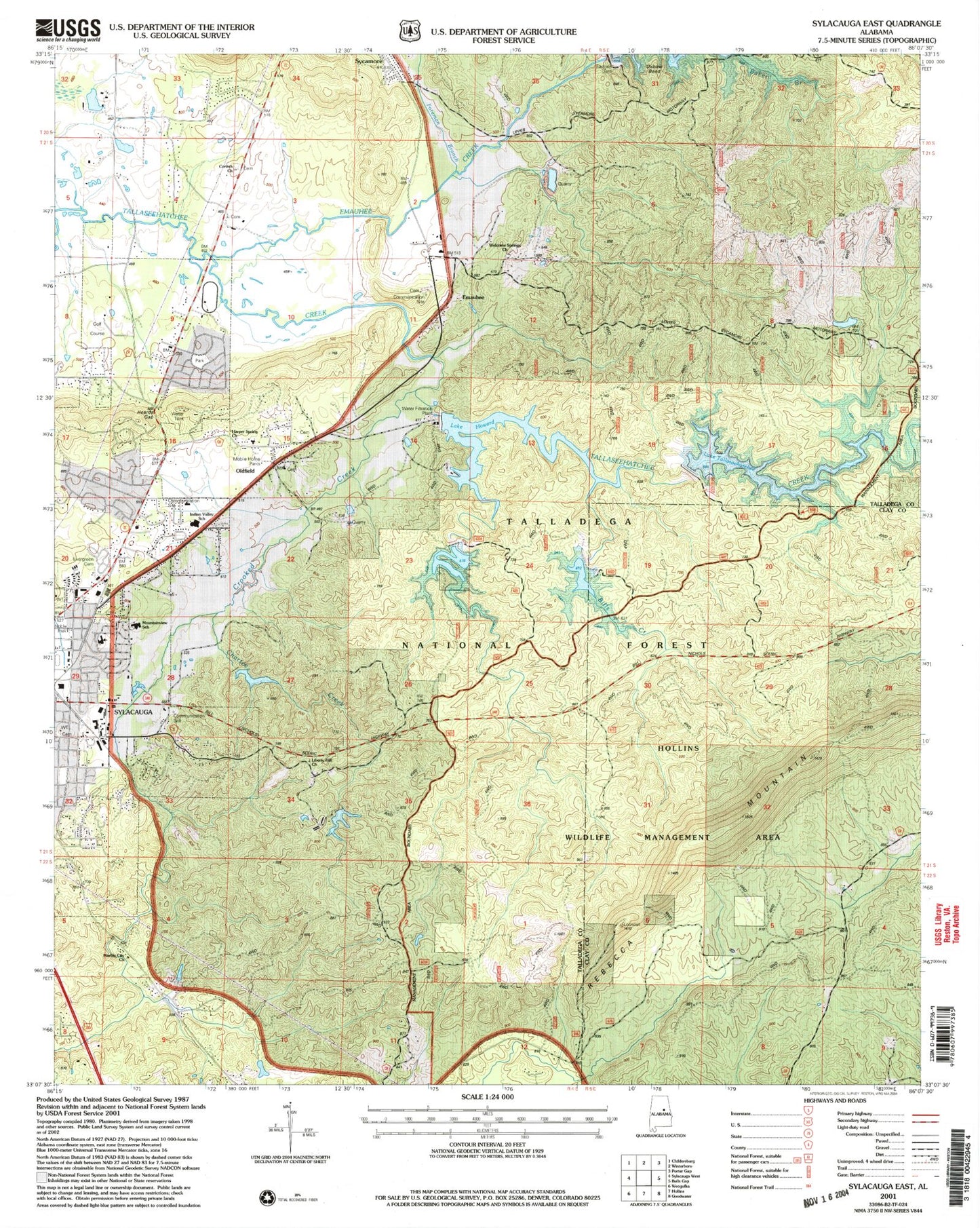
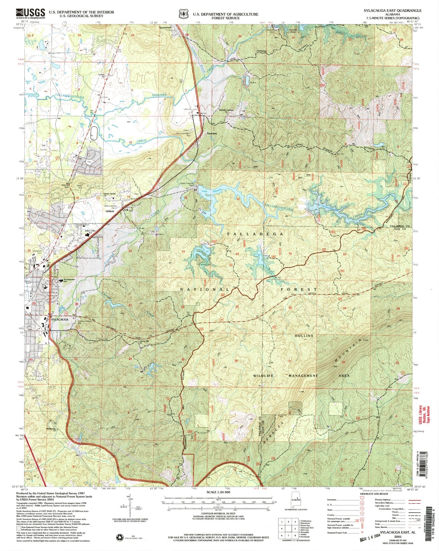
Historical USGS topographic quad map of Sylacauga East in the state of Alabama. Map scale may vary for some years, but is generally around 1:24,000. Print size is approximately 24" x 27"
This quadrangle is in the following counties: Clay, Talladega.
The map contains contour lines, roads, rivers, towns, and lakes. Printed on high-quality waterproof paper with UV fade-resistant inks, and shipped rolled.
Contains the following named places: Big Cut, Bledsoe Place Plantation, Bulls Creek, Chartee Creek, Chico, Corinth Church, Crooked Creek, East Highland Middle School, Elbon, Emauhee, Emauhee Creek, Evergreen Cemetery, First United Methodist Church, Foreman Branch, Gascot, Harper Spring Church, Heards Gap, Herds Mountain, Howard Dam, Indian Valley Elementary School, Lake Howard, Liberty Hill, Liberty Hill Church, London Creek, Main Avenue Grammar School, Marble City Church, Marble City Plaza Shopping Center, Mesaba Mine, Mount Olive Baptist Church, Mount Zion Baptist Church, Mountainview Elementary School, Nix Marble Quarry, Oldfield, Oldfield Baptist Church, Paces Branch, Plank Road Gap, Popes Ford, Rebecca Mountain, Saint Thomas United Methodist Church, Sico, Summer Hill Cemetery, Sunrise, Sylacauga Ambulance Service, Sylacauga Fire Department Station 2, Talimachusy, Tallaseehatchee Creek Watershed N, Tallaseehatchee Watershed Number 1, The Moon, Welcome Springs Methodist Church, Wests Chapel, Westview Cemetery, WFEB-AM (Sylacauga), Wills Creek, WMLS-FM (Sylacauga), WYEA-AM (Sylacauga), ZIP Codes: 35082, 35149, 35150