MyTopo
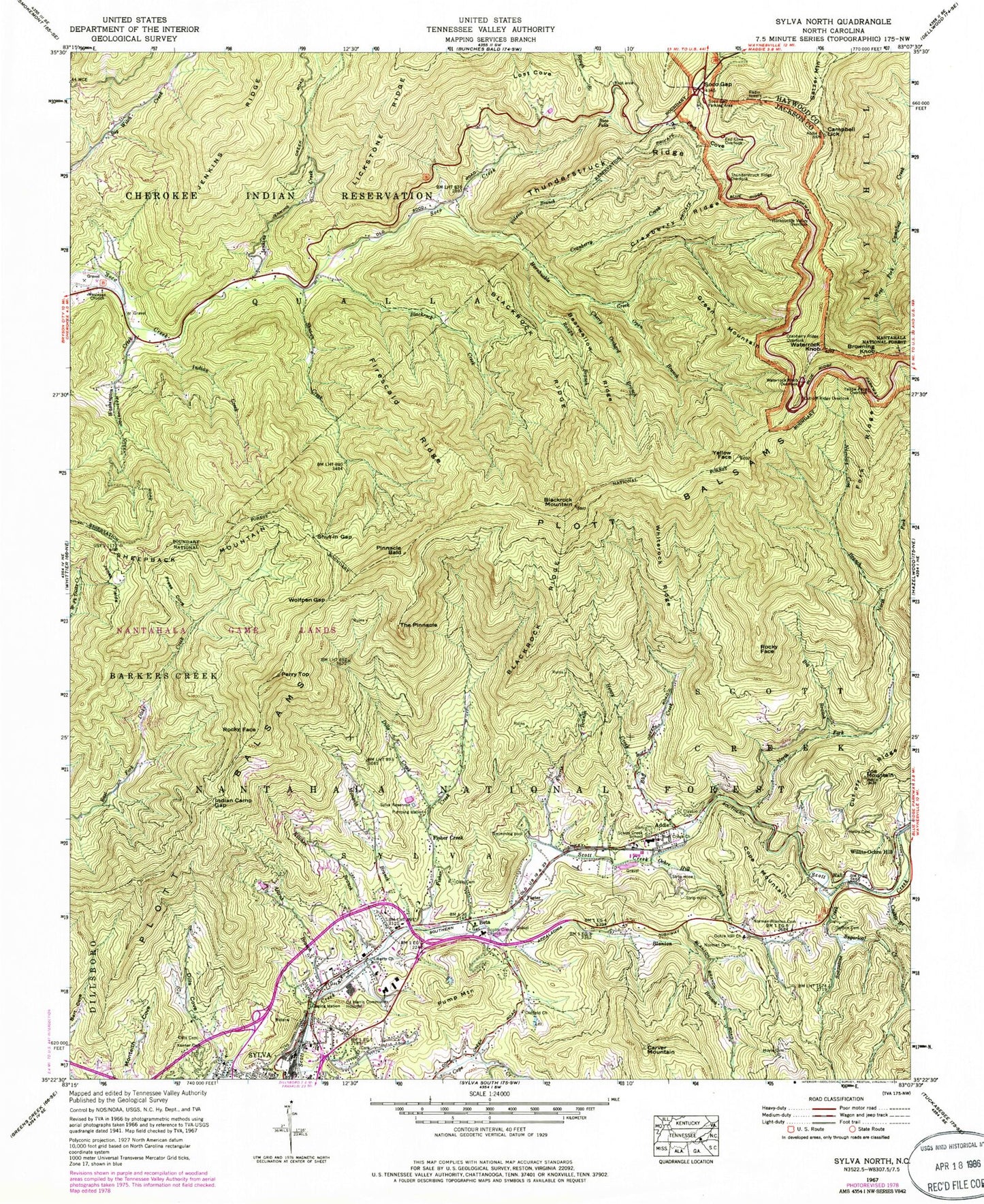
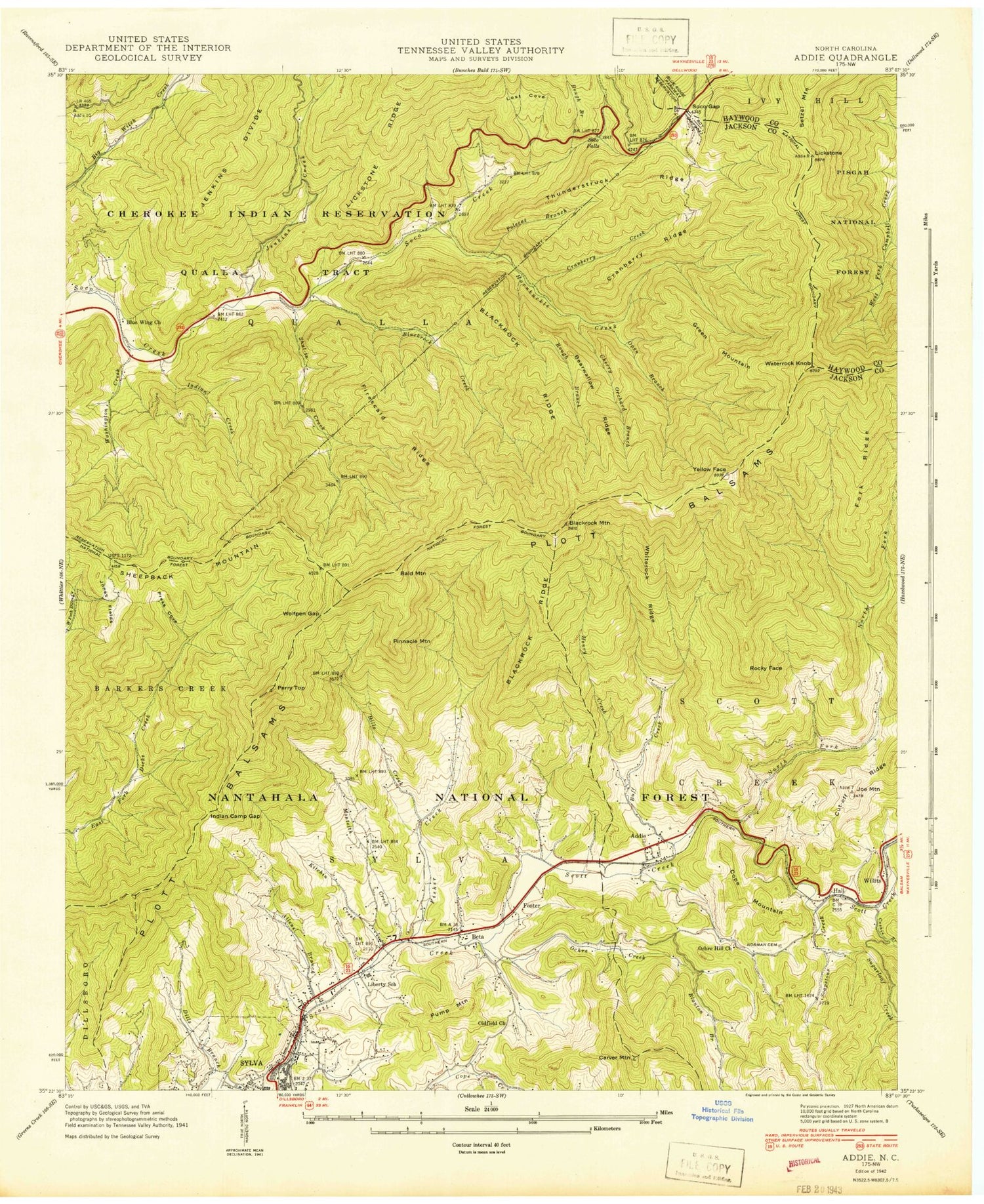
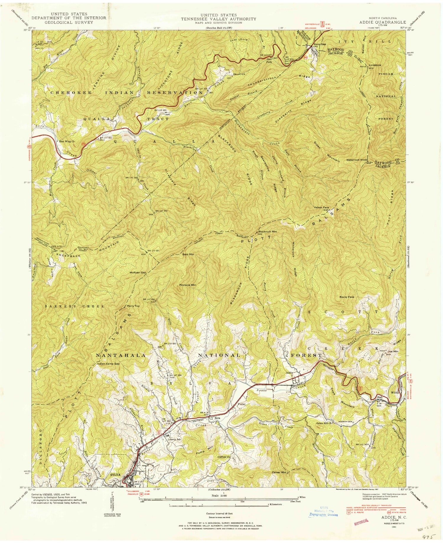
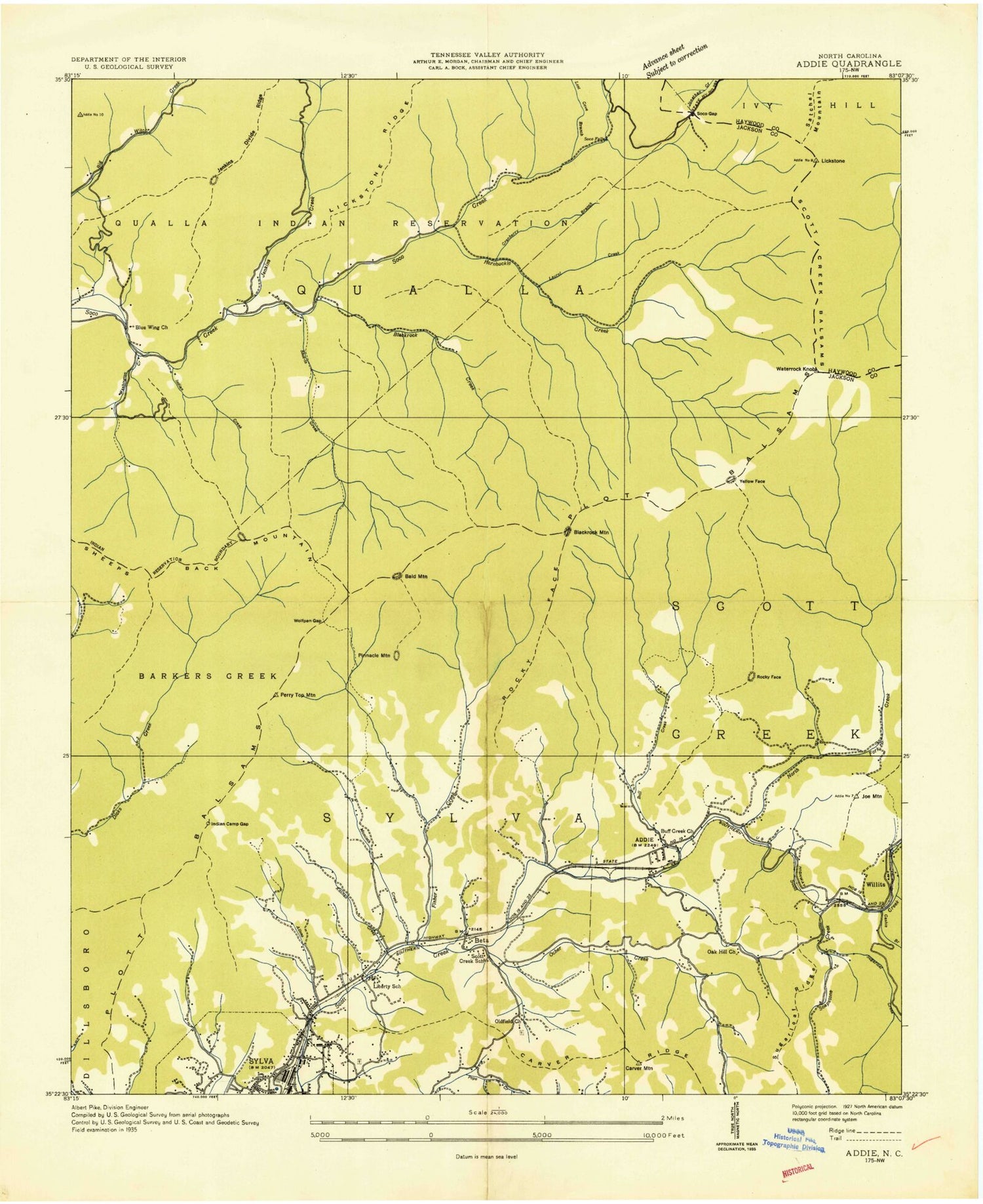
Classic USGS Sylva North North Carolina 7.5'x7.5' Topo Map
Couldn't load pickup availability
Historical USGS topographic quad map of Sylva North in the state of North Carolina. Typical map scale is 1:24,000, but may vary for certain years, if available. Print size: 24" x 27"
This quadrangle is in the following counties: Haywood, Jackson.
The map contains contour lines, roads, rivers, towns, and lakes. Printed on high-quality waterproof paper with UV fade-resistant inks, and shipped rolled.
Contains the following named places: Allens Branch, Bearwallow Ridge, Beta, Big Branch, Blackrock Creek, Blackrock Ridge, Blanton Branch, Buff Creek, Buff Creek Church, Campbell Lick, Cherry Orchard Branch, Clayton Cemetery, Cranberry Creek, Cranberry Ridge, Cranberry Ridge Overlook, Dills Cemetery, Dills Cemetery, Dills Cove, Dills Creek, East Fork Jenkins Creek, Fed Cove, Fed Cove Overlook, Firescald Ridge, Fisher Creek, Green Mountain, Hall, Henry Cemetery, Henry Creek, Hornbuckle Creek, Hornbuckle Valley Overlook, Hoyle Cemetery, Indian Camp Gap, Indian Creek, Jenkins Creek, Joe Mountain, Keener Cemetery, Kitchen Branch, Liberty Church, Lost Cove, Monteith Branch, Narrows Cove Branch, Norman Cemetery, Norman - Blanton Cemetery, Ochre Hill Church, Oldfield Church, Open Branch, Out-Off Ridge Overlook, Parris Branch, Polecat Branch, Press Cove, Rough Branch, Rough Branch, Scotts Creek Church, Scotts Creek School, Shut-in Creek, Shut-In Gap, Soapstone Creek, Soco Falls, Soco Gap, Soco Gap Parking Area, Sutton Cemetery, Sylva Reservoir, Thunderstruck Ridge, Thunderstruck Ridge Overlook, Washington Creek, Waterrock Knob, Waterrock Knob Overlook, Wesleyan Church, West Fork Jenkins Creek, Whiterock Ridge, Wolfpen Gap, Yellow Face, Yellow-Face Overlook, Jackson Plaza, Blackrock Mountain, Ochre Hill Creek, Cashie Branch, Fork Ridge, North Fork Scott Creek, Plott Balsams, Sugarloaf Creek, Blue Wing Church, WRGC-AM (Sylva), Addie, Browning Knob, Carver Mountain, Cope Mountain, Fisher Creek, Foster, Jonas Fields, Perry Top, Pinnacle Bald, Pump Mountain, Rocky Face, Rocky Face, Setzer Mountain, Sheepback Mountain, The Pinnacle, Willits-Ochre Hill, Harris Regional Hospital, Township of Sylva, Town of Sylva, Wolftown Community, Jackson County Sheriff's Office, Sylva Post Office, Allens Branch, Bearwallow Ridge, Beta, Big Branch, Blackrock Creek, Blackrock Ridge, Blanton Branch, Buff Creek, Buff Creek Church, Campbell Lick, Cherry Orchard Branch, Clayton Cemetery, Cranberry Creek, Cranberry Ridge, Cranberry Ridge Overlook, Dills Cemetery, Dills Cemetery, Dills Cove, Dills Creek, East Fork Jenkins Creek, Fed Cove, Fed Cove Overlook, Firescald Ridge, Fisher Creek, Green Mountain, Hall, Henry Cemetery, Henry Creek, Hornbuckle Creek, Hornbuckle Valley Overlook, Hoyle Cemetery, Indian Camp Gap, Indian Creek, Jenkins Creek, Joe Mountain, Keener Cemetery, Kitchen Branch, Liberty Church, Lost Cove, Monteith Branch, Narrows Cove Branch, Norman Cemetery, Norman - Blanton Cemetery, Ochre Hill Church, Oldfield Church, Open Branch, Out-Off Ridge Overlook, Parris Branch, Polecat Branch, Press Cove, Rough Branch, Rough Branch, Scotts Creek Church, Scotts Creek School, Shut-in Creek, Shut-In Gap, Soapstone Creek, Soco Falls, Soco Gap, Soco Gap Parking Area, Sutton Cemetery, Sylva Reservoir, Thunderstruck Ridge, Thunderstruck Ridge Overlook, Washington Creek, Waterrock Knob, Waterrock Knob Overlook, Wesleyan Church, West Fork Jenkins Creek, Whiterock Ridge, Wolfpen Gap, Yellow Face, Yellow-Face Overlook, Jackson Plaza, Blackrock Mountain, Ochre Hill Creek, Cashie Branch, Fork Ridge, North Fork Scott Creek, Plott Balsams, Sugarloaf Creek, Blue Wing Church, WRGC-AM (Sylva), Addie, Browning Knob, Carver Mountain, Cope Mountain, Fisher Creek, Foster, Jonas Fields, Perry Top, Pinnacle Bald, Pump Mountain, Rocky Face, Rocky Face, Setzer Mountain, Sheepback Mountain, The Pinnacle, Willits-Ochre Hill, Harris Regional Hospital, Township of Sylva, Town of Sylva, Wolftown Community, Jackson County Sheriff's Office, Sylva Post Office, Allens Branch, Bearwallow Ridge, Beta, Big Branch, Blackrock Creek, Blackrock Ridge, Blanton Branch, Buff Creek, Buff Creek Church, Campbell Lick, Cherry Orchard Branch, Clayton Cemetery, Cranberry Creek, Cranberry Ridge, Cranberry Ridge Overlook, Dills Cemetery, Dills Cemetery, Dills Cove, Dills Creek, East Fork Jenkins Creek, Fed Cove, Fed Cove Overlook, Firescald Ridge, Fisher Creek, Green Mountain, Hall