
MyTopo
Classic USGS Table Rock Maryland 7.5'x7.5' Topo Map
Couldn't load pickup availability
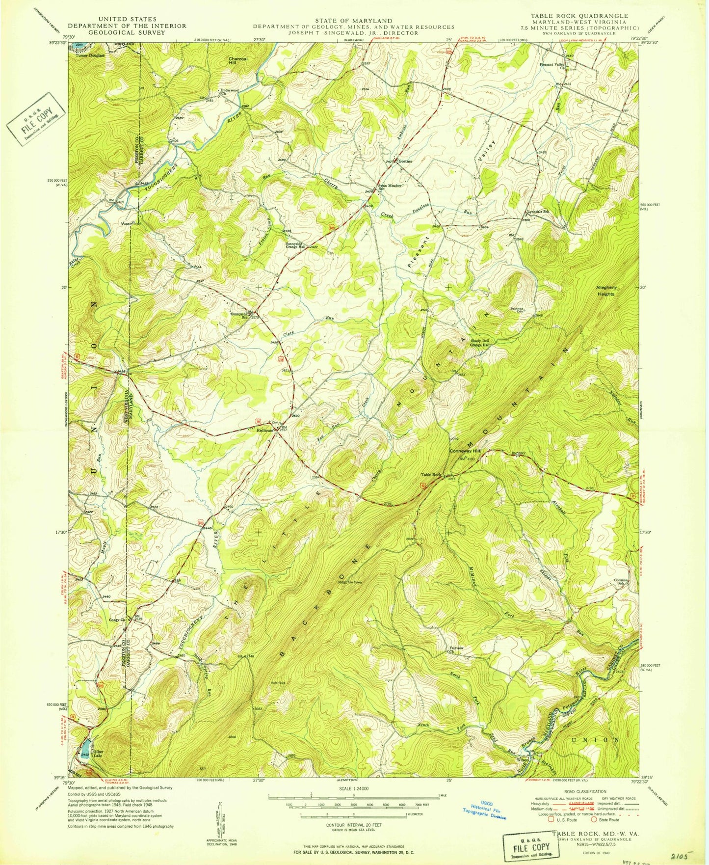
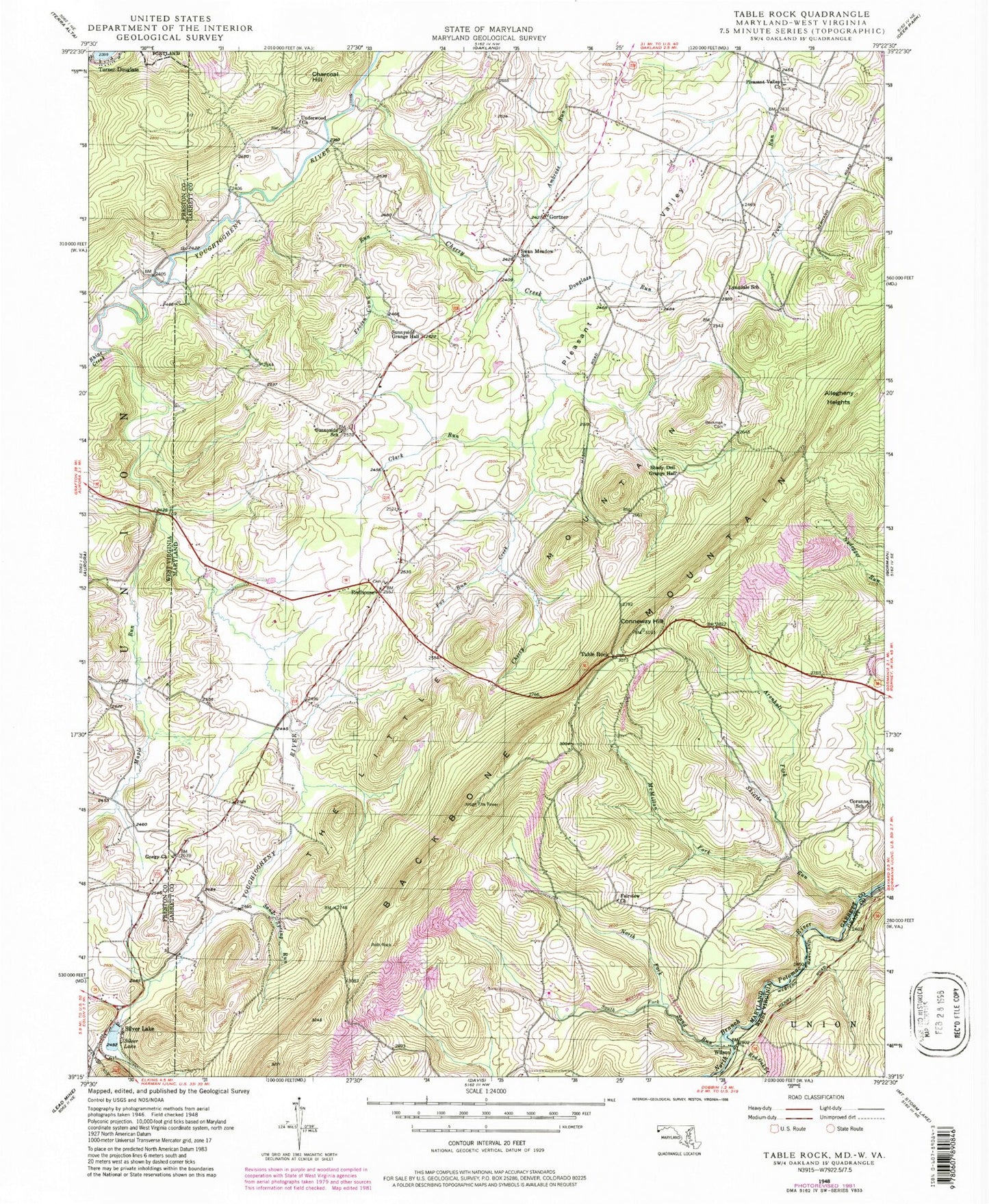
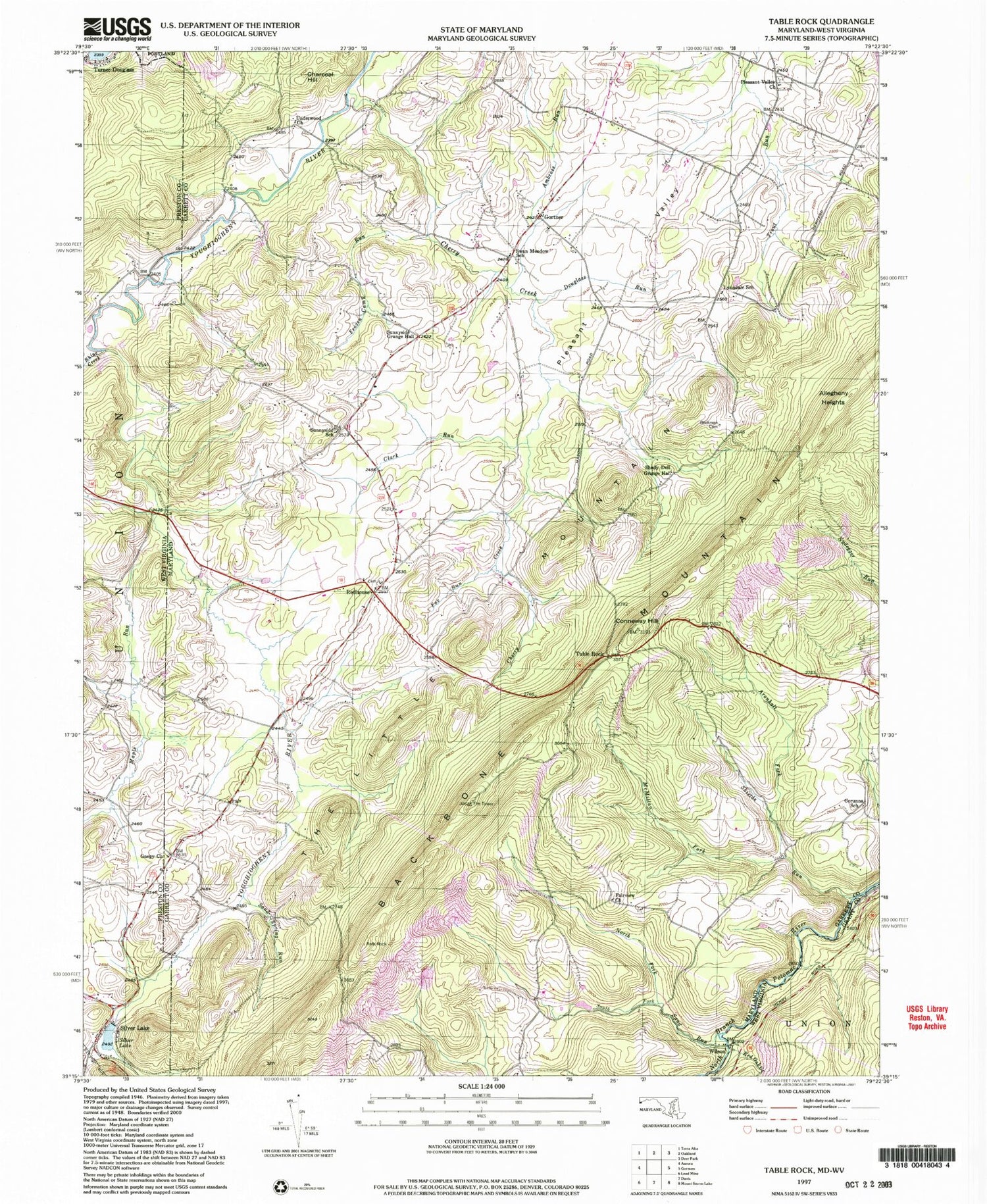
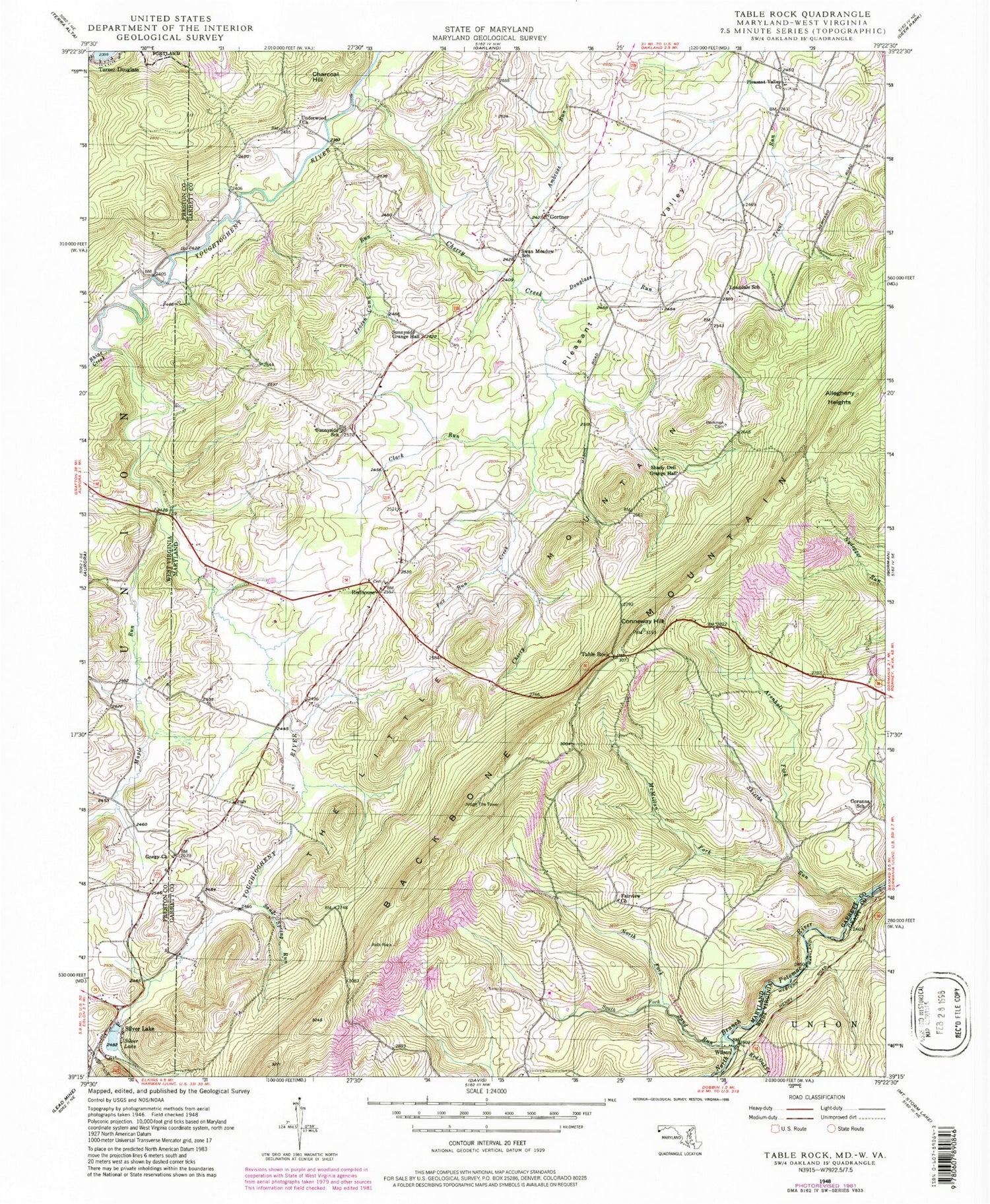
Historical USGS topographic quad map of Table Rock in the states of Maryland, West Virginia. Typical map scale is 1:24,000, but may vary for certain years, if available. Print size: 24" x 27"
This quadrangle is in the following counties: Garrett, Grant, Preston.
The map contains contour lines, roads, rivers, towns, and lakes. Printed on high-quality waterproof paper with UV fade-resistant inks, and shipped rolled.
Contains the following named places: Ambrose Run, Aronhalt Fork, Beckman Cemetery, Cherry Creek, Clark Run, Conneway Hill, Corunna School, Douglass Run, Fairview Church, Fox Run, Frozen Camp Run, Gnegy Church, Gortner, Lynndale School, McMillan Fork, North Fork Sand Run, Pleasant Valley, Pleasant Valley Church, Redhouse, Sand Run, Sand Spring Run, Shields Run, South Fork Sand Run, Sunnyside School, Swan Meadow K - 8 School, Table Rock, Allegheny Heights, Charcoal Hill, Roth Rock, Greater Gortner Airport, Shady Dell Grange Hall, Sunnyside Grange Hall, Wilson, Fairview Cemetery, Glade View Church of the Brethren, Gnegy Cemetery, Gortner Cemetery, Gortner Union Church, Moon Ridge, Pleasant Valley Cemetery, Red House Cemetery, Red House Elementary School, Saint Johns Lutheran Church, Sunnyside, Swans Meadow, District 8 Red House, Triple Silo Farm, Pleasant Valley Greenhouse, Silver Lake, Maple Run, Red Oak Creek, Rhine Creek, Silver Lake, Wilson Post Office (historical), Ambrose Run, Aronhalt Fork, Beckman Cemetery, Cherry Creek, Clark Run, Conneway Hill, Corunna School, Douglass Run, Fairview Church, Fox Run, Frozen Camp Run, Gnegy Church, Gortner, Lynndale School, McMillan Fork, North Fork Sand Run, Pleasant Valley, Pleasant Valley Church, Redhouse, Sand Run, Sand Spring Run, Shields Run, South Fork Sand Run, Sunnyside School, Swan Meadow K - 8 School, Table Rock, Allegheny Heights, Charcoal Hill, Roth Rock, Greater Gortner Airport, Shady Dell Grange Hall, Sunnyside Grange Hall, Wilson, Fairview Cemetery, Glade View Church of the Brethren, Gnegy Cemetery, Gortner Cemetery, Gortner Union Church, Moon Ridge, Pleasant Valley Cemetery, Red House Cemetery, Red House Elementary School, Saint Johns Lutheran Church, Sunnyside, Swans Meadow, District 8 Red House, Triple Silo Farm, Pleasant Valley Greenhouse, Silver Lake, Maple Run, Red Oak Creek, Rhine Creek, Silver Lake, Wilson Post Office (historical)