MyTopo
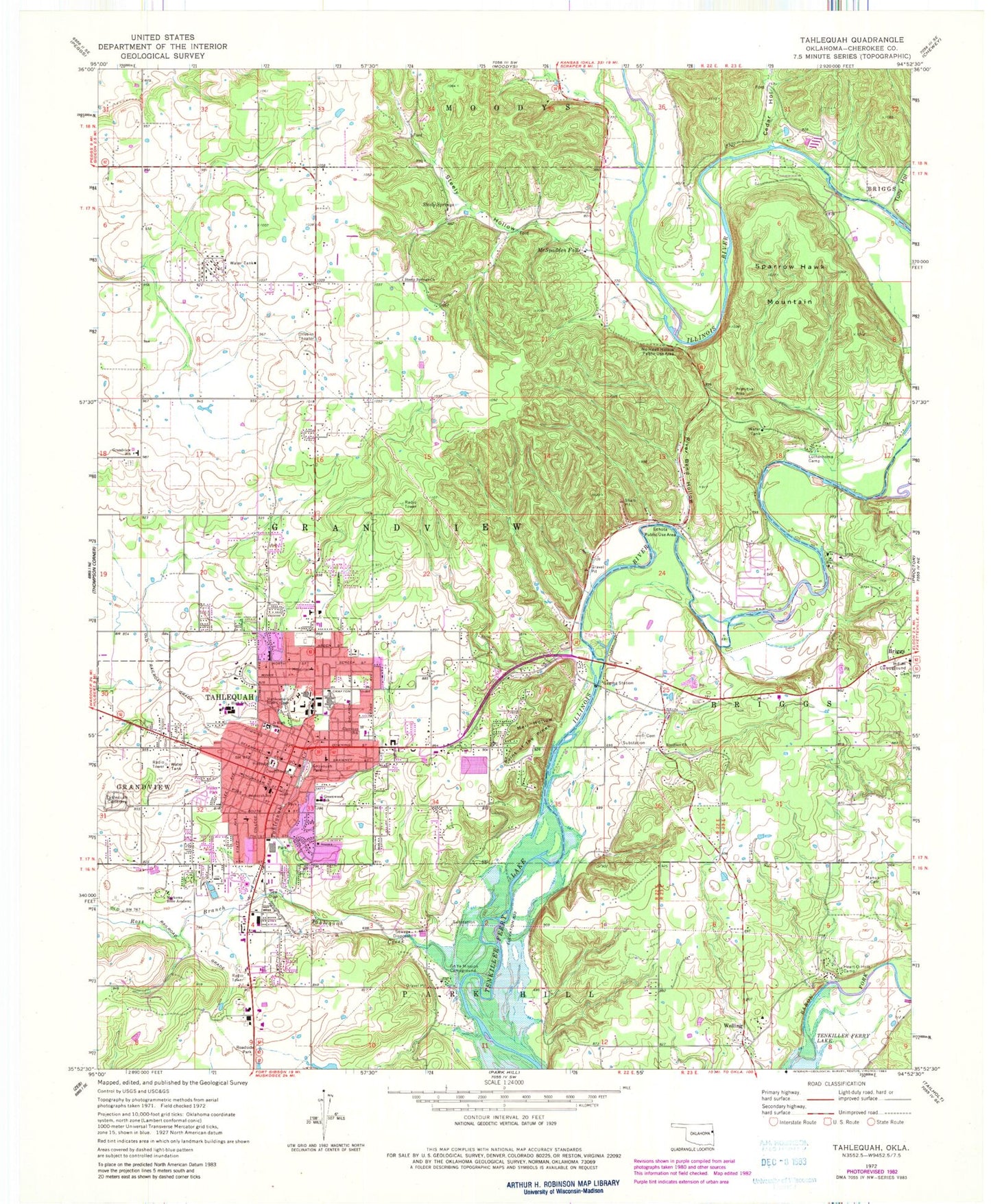
Classic USGS Tahlequah Oklahoma 7.5'x7.5' Topo Map
Couldn't load pickup availability
Historical USGS topographic quad map of Tahlequah in the state of Oklahoma. Typical map scale is 1:24,000, but may vary for certain years, if available. Print size: 24" x 27"
This quadrangle is in the following counties: Cherokee.
The map contains contour lines, roads, rivers, towns, and lakes. Printed on high-quality waterproof paper with UV fade-resistant inks, and shipped rolled.
Contains the following named places: Boudinot Church, Cedar Hollow, Cherokee Elementary School, Echota Public Use Area, Go Ye Mission Campground, Grandview School, Greenwood Elementary School, Heart-Of-Hills Camp, Indian Campground, Lutherhoma Camp, Mail Hollow, Manus Cemetery, Markoma Bible Academy, McSpadden Falls, No Head Hollow Public Use Area, Northeastern State University, Point of the Pines, River Bend Hollow, Ross Branch, Sequoyah Park, Sequoyah Elementary School, Sparrow Hawk Mountain, Steely Hollow, Steely Springs, Steely Springs Church, Tahlequah, Tahlequah Cemetery, Tahlequah Creek, Tully Hollow, Welling, Cherokee County, KTLQ-AM (Tahlequah), KEOK-FM (Tahlequah), Box Shopping Center, Cherokee Hills Shopping Center, Wal-Mart Shopping Center, Indian Capital Technology Center - Tahlequah, Grand View School, Calvary Indian Baptist Church, Church of Christ South College, Church of Christ Student Center, The Church of Jesus Christ of Latter Day Saints, Cornerstone Fellowship, First Baptist Church, First United Methodist Church, First Presbyterian Church, First Lutheran Church, Grace Baptist Church, Kingdom Hall Jehovahs Witnesses, Light of Christ Community Church, Northeastern Christian Church, Philadelphia Bible Academy, Southside Baptist Church, Saint Basils Episcopal Church, Saint Brigid Catholic Church, Tahlequah Christian Outreach, Wesley Foundation United Methodist Church, World of Life Fellowship Church, Tahlequah Post Office, Tahlequah High School, Tahlequah Middle School, Central Independent School, Township of Grandview, Grandview Cemetery, Briggs Census Designated Place, Sparrowhawk Census Designated Place, City of Tahlequah, Old Cherokee Nation Capitol Building, Grandview Census Designated Place, Steely Hollow Census Designated Place, Sparrowhawk, Steely Hollow, Tahlequah Fire Department Station 1, Sparrow Hawk Fire Department Station 1, Welling Tri - Community Fire Department Station 1, Gideon Volunteer Fire Department Station 2, Illinois River Volunteer Fire Department, Sparrow Hawk Village Fire Department Station 2, Tahlequah City Hospital, W W Hastings Indian Hospital, Cedar Tree Cemetery, Shiloh Christian School, Cherokee County Sheriff's Office, Northeastern State University Police Department