MyTopo
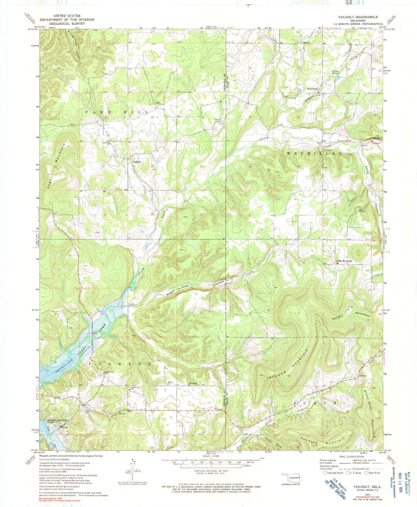
Classic USGS Tailholt Oklahoma 7.5'x7.5' Topo Map
Couldn't load pickup availability
Historical USGS topographic quad map of Tailholt in the state of Oklahoma. Map scale may vary for some years, but is generally around 1:24,000. Print size is approximately 24" x 27"
This quadrangle is in the following counties: Adair, Cherokee.
The map contains contour lines, roads, rivers, towns, and lakes. Printed on high-quality waterproof paper with UV fade-resistant inks, and shipped rolled.
Contains the following named places: Assembly Church, Barber, Barber Cemetery, Barber Census Designated Place, Barber Church, Bidding Creek, Bitting Spring, Caney Cemetery, Caney Census Designated Place, East Cherokee Division, Highway 100 West Volunteer Fire Department, Hungry Mountain, Independent Church, Indian Home Church, Jackson Mountain, July Spring, Negro Jake Hollow, North Fork Dry Creek, Rocky Mountain, Rocky Mountain Census Designated Place, Rocky Mountain School, Sanders Mountain, Smith Hollow, South Fork Dry Creek, Stony Point Cemetery, Sugar Mountain, Tailholt, Tenkiller, Tenkiller Census Designated Place, Tenkiller Elementary School, Township of Wauhillau, Wauhillau, Wauhillau Census Designated Place, Welling, Welling Tri - Community Fire Department Station 3, ZIP Code: 74471