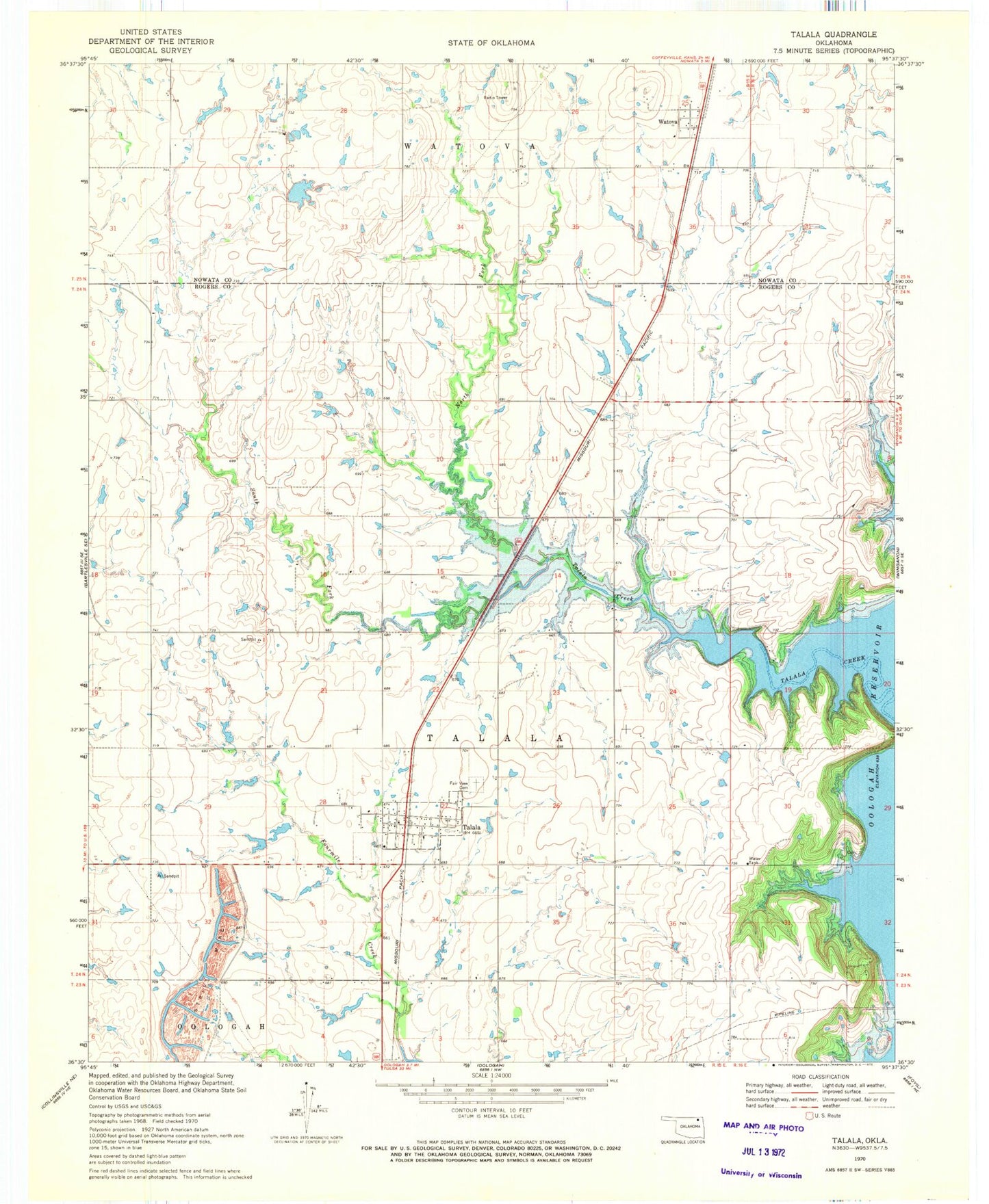
MyTopo
Classic USGS Talala Oklahoma 7.5'x7.5' Topo Map
Couldn't load pickup availability
Historical USGS topographic quad map of Talala in the state of Oklahoma. Map scale may vary for some years, but is generally around 1:24,000. Print size is approximately 24" x 27"
This quadrangle is in the following counties: Nowata, Rogers.
The map contains contour lines, roads, rivers, towns, and lakes. Printed on high-quality waterproof paper with UV fade-resistant inks, and shipped rolled.
Contains the following named places: Bible Cemetery, Fair View Cemetery, Jamestown, KQLL-FM (Owasso), Lariat Ranch Airport, North Fork Talala Creek, Northwest Rogers County Fire Protection District Station 2, Oknoname 131011 Dam, Oknoname 131011 Reservoir, Oknoname Number 105001 Reservoir, Oknoname Number 10501 Dam, South Fork Talala Creek, Talala, Talala Christian Academy, Talala Police Department, Talala Post Office, Town of Jamestown, Town of Talala, Township of Talala, Watova, Watova Census Designated Place, ZIP Code: 74080