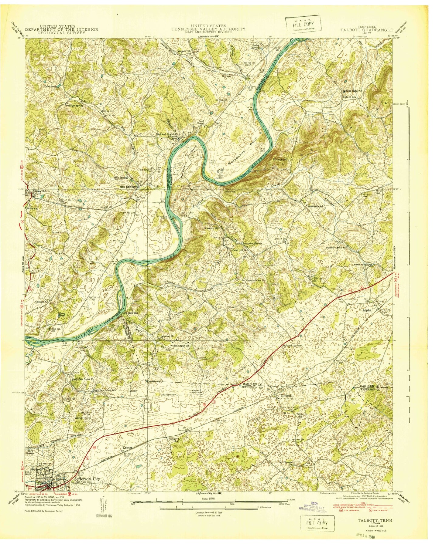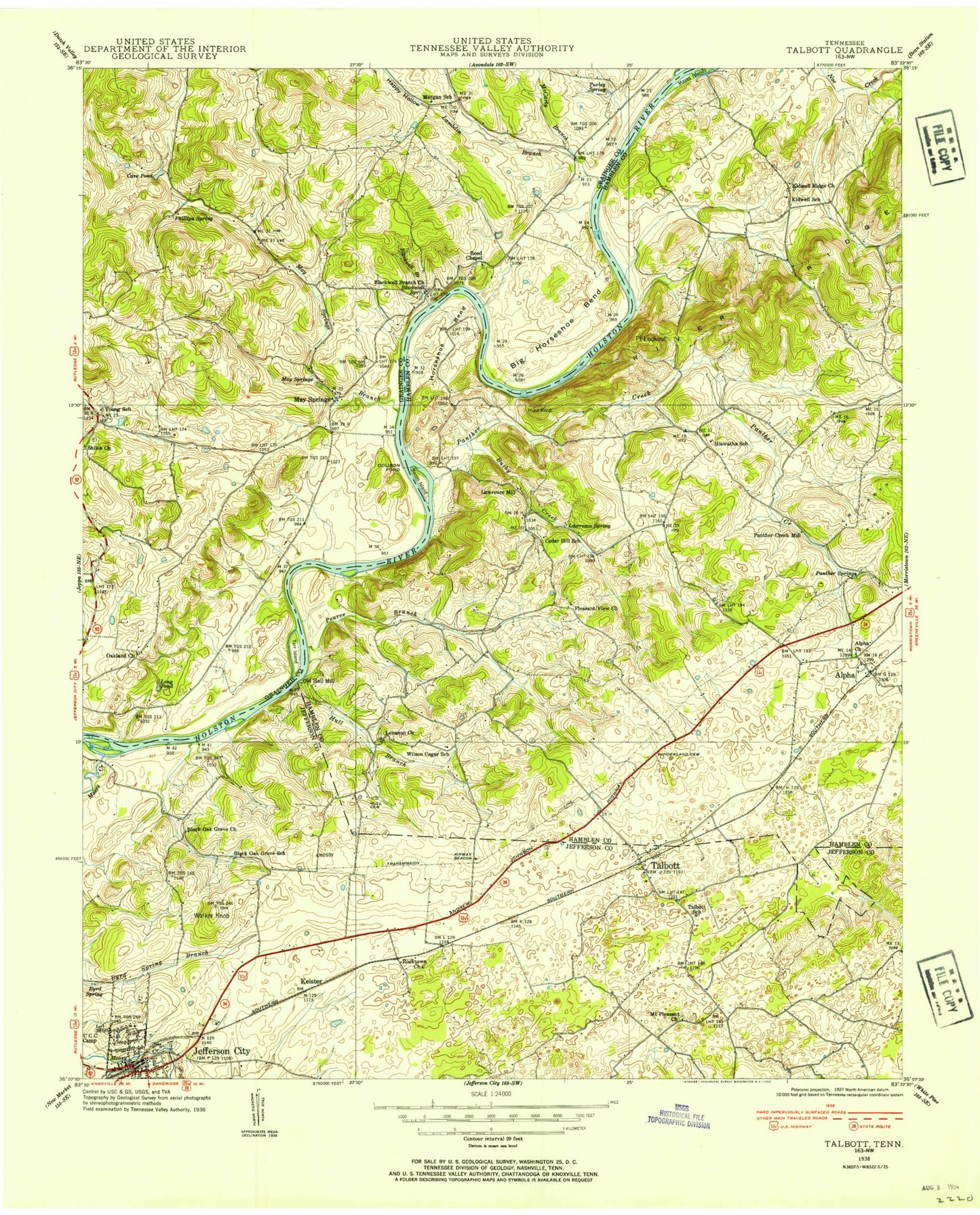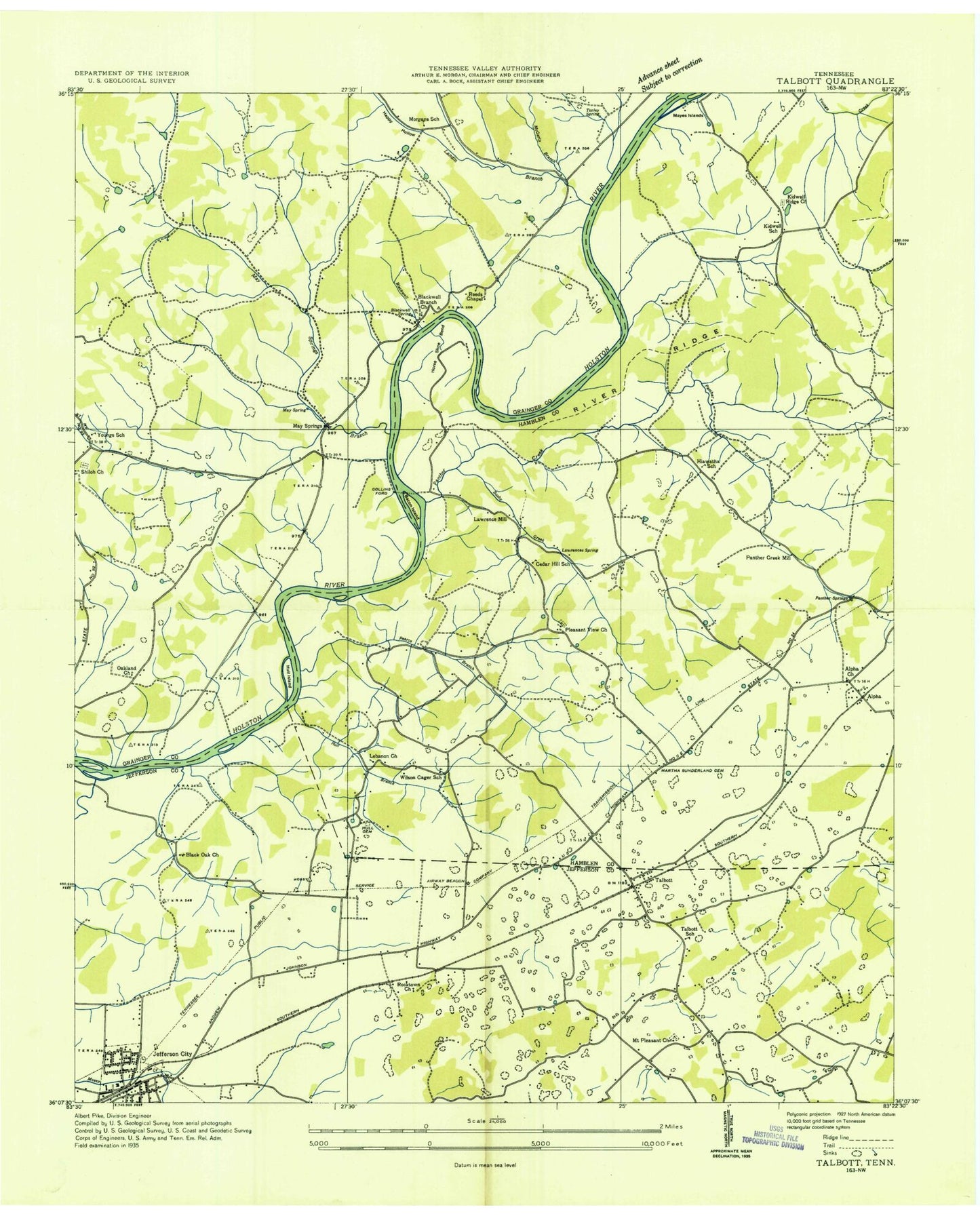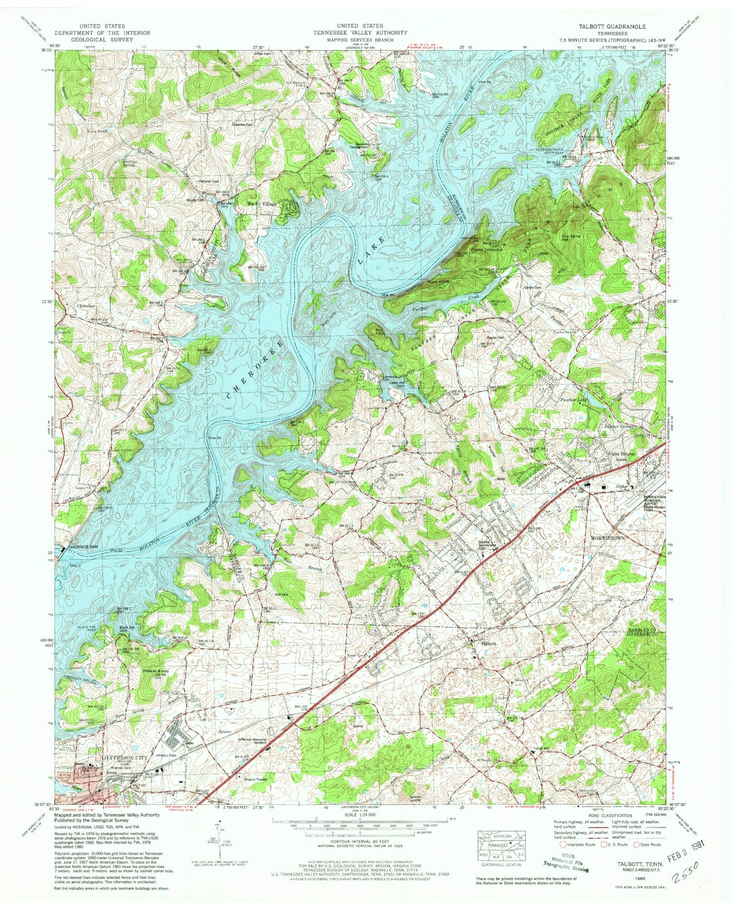
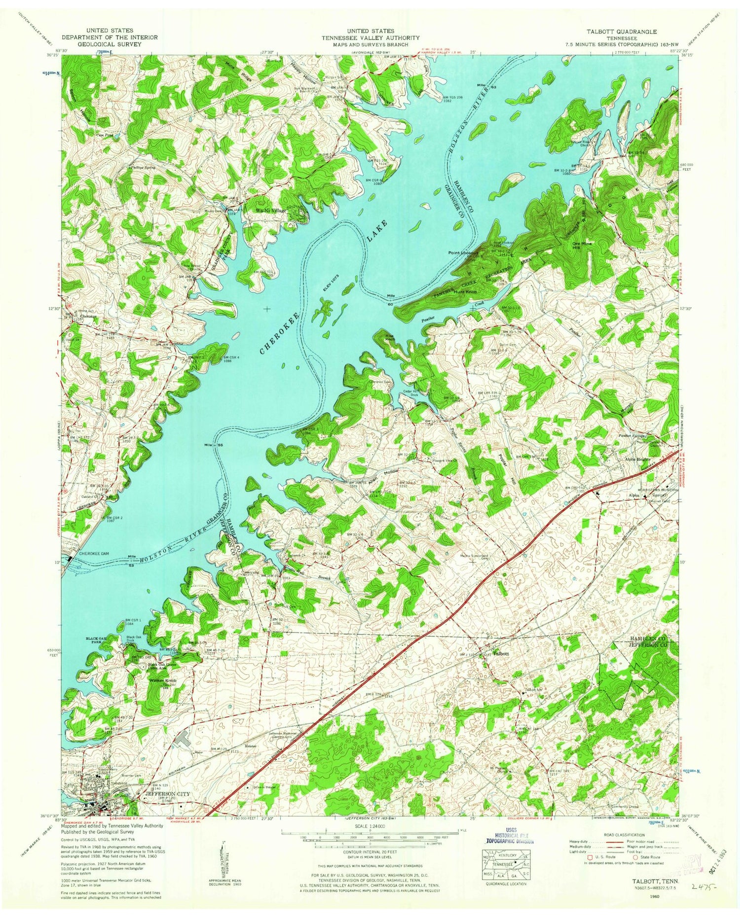


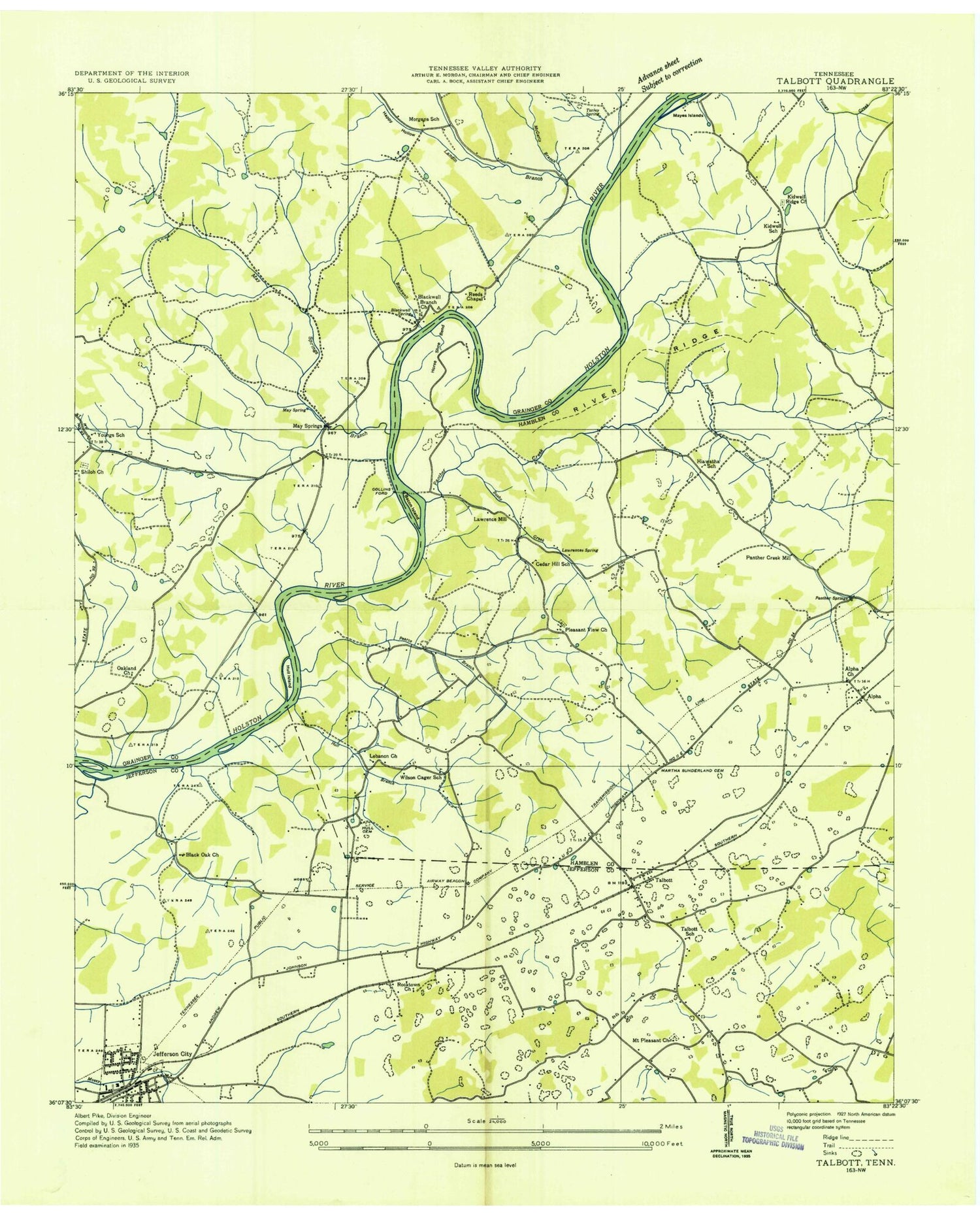
MyTopo
Classic USGS Talbott Tennessee 7.5'x7.5' Topo Map
Couldn't load pickup availability
Historical USGS topographic quad map of Talbott in the state of Tennessee. Typical map scale is 1:24,000, but may vary for certain years, if available. Print size: 24" x 27"
This quadrangle is in the following counties: Grainger, Hamblen, Jefferson.
The map contains contour lines, roads, rivers, towns, and lakes. Printed on high-quality waterproof paper with UV fade-resistant inks, and shipped rolled.
Contains the following named places: Spoon Hollow, Wa-Ni Village, Walker Knob, Allen Hollow, Alpha Heights, Bacon Cemetery, Black Oak Doock, Black Oak Grove Cabin Area, Black Oak Park, Branner Cemetery, Cave Pond, Cedar Hill Dock, Grainger County Park, Happy Hollow, Hull Branch, Hull Cemetery, Hunt Knob, Ivey Hollow, Jefferson Memorial Gardens Cemetery, Kidwell Ridge Church, Lawrence Cemetery, Lebanon Church, Martha Sunderland Cemetery, Mine Ridge, Moody Cemetery, Morgan School, Mount Pleasant Church, Murrell Hill, Nelson Merry School, New Bethel Church, New Blackwell Branch Church, Oakland Baptist Church, Ore Mine Hill, Panther Creek, Panther Creek State Park, Panther Springs, Victory Church, Phillips Spring, Pleasant View Church, Point Lookout, Poplar Hill, Poplar Spring Branch, Rice Knob, River Ridge, Moore-Murrell Airport, Shiloh Church, Sitton Cemetery, Talbott, Young School, Cherokee Dam, Austin Ferry (historical), Blackwell Branch, Blackwell Spring, Lambdin Branch, Long Pond (historical), May Spring, May Spring Branch, May Springs (historical), McCarty Branch, Tarr Island (historical), Turley Spring, Black Oak Creek, Byrd Spring, Jarnigan Spring, May Acres, Rock Town, Arrow Hills, Bacon Island (historical), Beacon Hills, Bluegrass, Briarcliff View, Britton Acres, Buell Acres, Cedar Hill Park, Cedar Hills, Cedar Hills, Collons Ferry (historical), Collins Ford (historical), Fox Den, Green Acres, Horseshoe Bend, Hunters Ridge, Jackson Heights, Kathy Hills, Lake Park, Lakeshore Gardens, Lawrence Spring, Lowe Acres, Mayes Islands (historical), Meadowview, Melody Acres, Navaho Hills, Panther Creek (historical), Panther Lake, Panther Hills, Panther Lake, Patterson Hills, Pearce Branch, Pleasantview Acres, Point Seven, Prima Estates, Purkey Estates, Quail Hollow, Rambling Hills, Rolling Acres, Seven Oaks, Smokerise, West Lake Estates, Westgate, Wilderness Shores, Willow Springs, Wood Acres, Woodcrest Hills, Alpha, Cherokee, Keister, Blackwell Branch Church (historical), Greenlee Campground, Greenlee Cemetery, Hammer Cemetery, May Springs Campground, New Blackwell Church, Reeds Chapel (historical), Wa-Ni Boat Dock, New Blackwell Cemetery, Oakland Cemetery, Shiloh Cemetery, Blackoak Grove Church (historical), Blackoak Grove School (historical), Friendsview Baptist Church, Jefferson City City Hall, Jefferson City Industrial Park, Johnson Ball Park, Magna View Church, Mount Pleasant Quarry, Nelson Merry Park, Rocktown Church (historical), Talbott Quarry, Alpha Church, Alpha Elementary School, Alpha Primary School, Cedar Hill Church, Cedar Hill School (historical), Hiawatha School (historical), Kidwell School (historical), Lawrence Mill (historical), Old Hull Mill (historical), Panther Creek Mill (historical), Panther Creek Quarry, Panther Park Church, Pearce Branch Quarry, River Ridge Quarry, Wilson Cager School (historical), Victory Church, Mossy Creek Shoals, Panthers Shoals, Stithsville (historical), Sycamore Ford (historical), Mossy Creek Islands (historical), Horseshoe Bend Rapids, Mays Ford Shoals, Oakland, Shiloh, Pleasant view, Talbott Elementary School, Alpha Division (historical), Jarnagan Mine, Jefferson City Post Office, Mossy Creek Mine, Commissioner District 10, Commissioner District 12, Commissioner District 13, Commissioner District 14, West Hamblen County Volunteer Fire Department, Morristown Fire Department Station 5, Allied EMS, Talbott Post Office, Spoon Hollow, Wa-Ni Village, Walker Knob, Allen Hollow, Alpha Heights, Bacon Cemetery, Black Oak Doock, Black Oak Grove Cabin Area, Black Oak Park, Branner Cemetery, Cave Pond, Cedar Hill Dock, Grainger County Park, Happy Hollow, Hull Branch, Hull Cemetery, Hunt Knob, Ivey Hollow, Jefferson Memorial Gardens Cemetery, Kidwell Ridge Church, Lawrence Cemetery, Lebanon Church, Martha Sunderland Cemetery, Mine Ridge, Moody Cemetery, Morgan School, Mount Pleasant Church, Murrell Hill, Nelson Merry School, New Bethel Church, New Blackwell Branch Church, Oakland Baptist Church, Ore Mine Hill, Panther Creek, Panther Creek State Park, Panther Springs, Victory Church, Phillips Spring, Pleasant View Church, Point Lookout, Poplar Hill, Poplar Spring Branch, Rice Knob, River Ridge, Moore-Murrell Airport, Shiloh Church, Sitton Cemetery, Talbott, Young School, Cherokee Dam, Austin Ferry (historical), Blackwell Branch, Blackwell Spring, Lambdin Branch, Long Pond (historical), May Spring, May Spring Branch, May Springs (historical), McCarty Branch