MyTopo
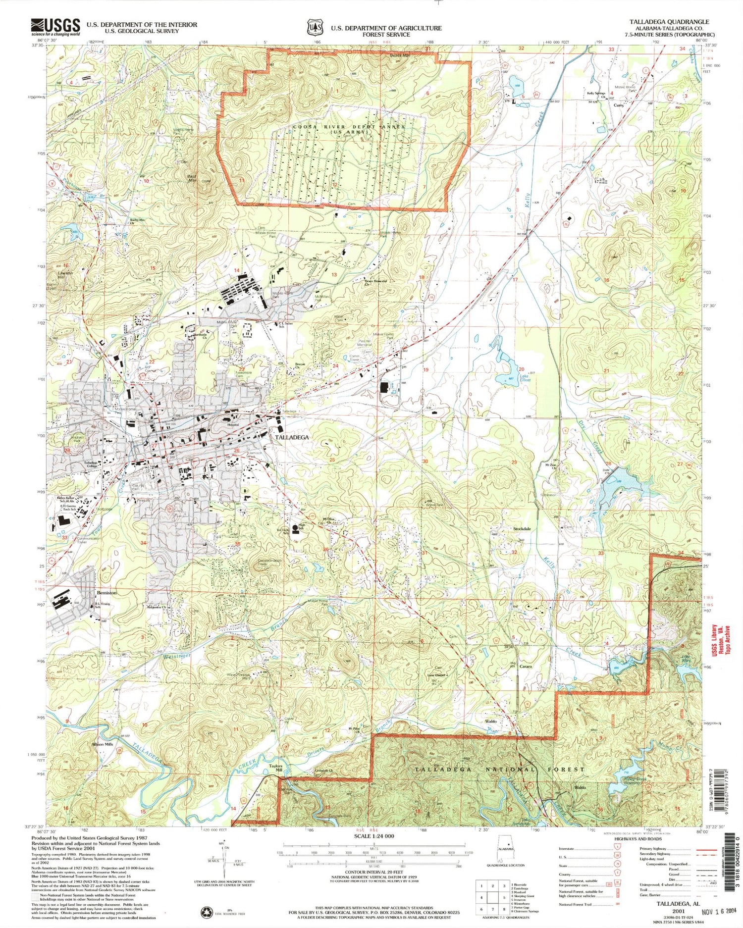
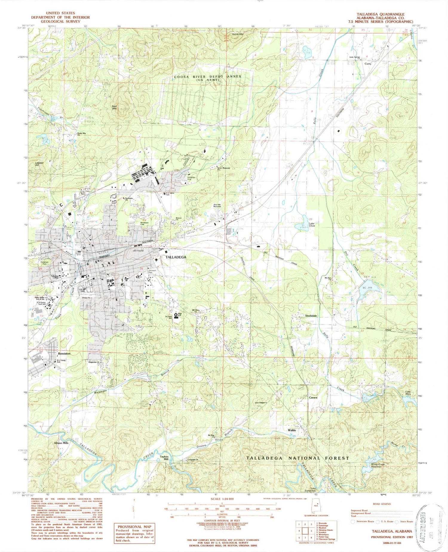
Classic USGS Talladega Alabama 7.5'x7.5' Topo Map
Couldn't load pickup availability
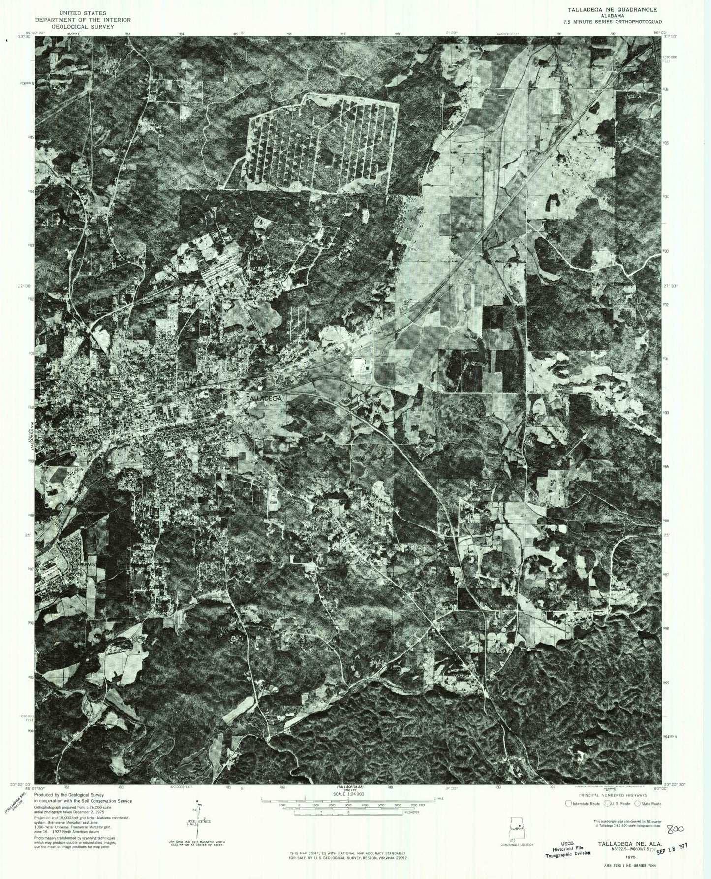
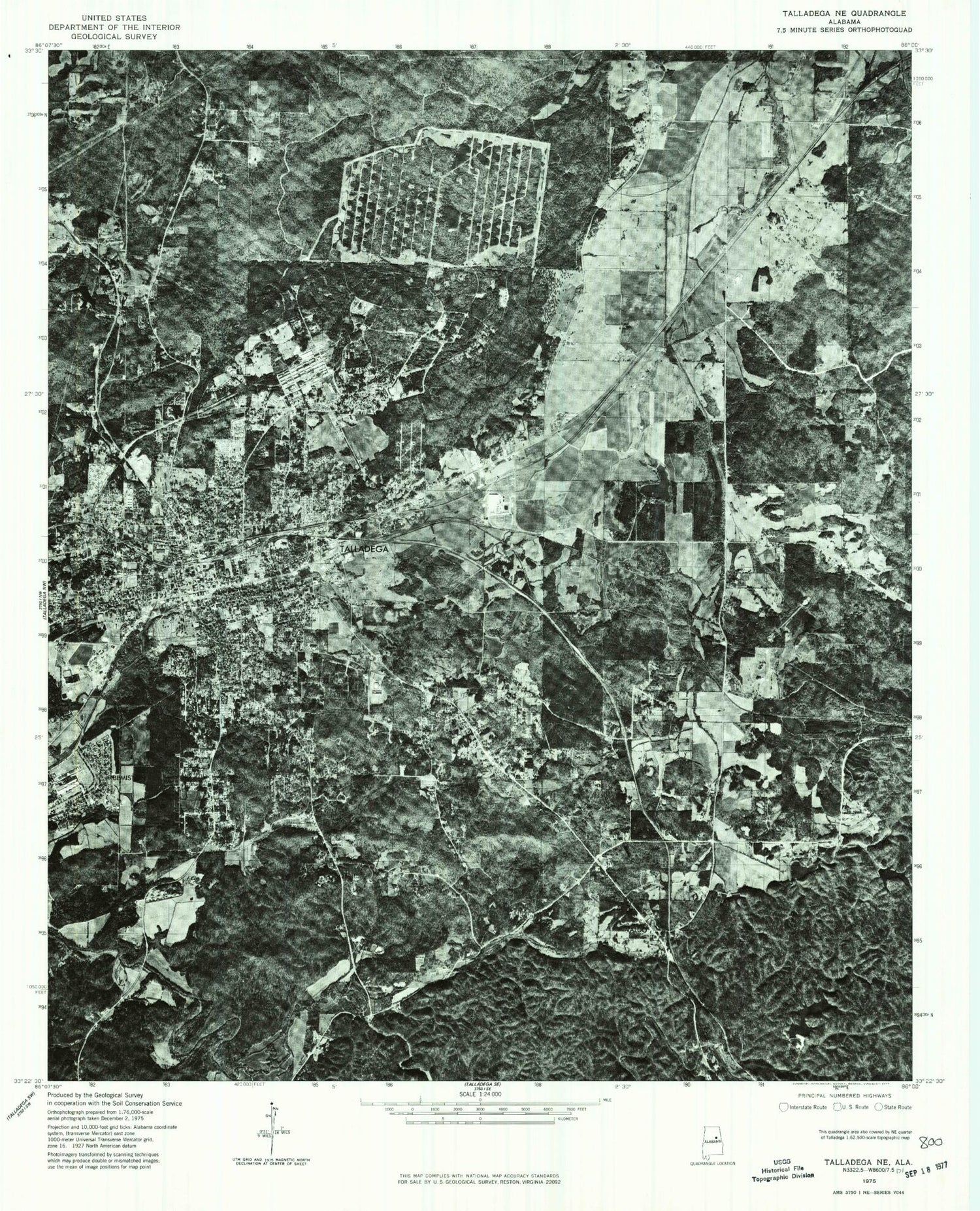
Historical USGS topographic quad map of Talladega in the state of Alabama. Map scale may vary for some years, but is generally around 1:24,000. Print size is approximately 24" x 27"
This quadrangle is in the following counties: Talladega.
The map contains contour lines, roads, rivers, towns, and lakes. Printed on high-quality waterproof paper with UV fade-resistant inks, and shipped rolled.
Contains the following named places: Alabama School for the Blind, Alabama School for the Deaf, Allison Mills, Bald Mountain, Barbers Mill, Belleview Plantation, Belview Baptist Church, Bemiston, Bemiston Baptist Church, Bemiston United Methodist Church, Big Spring, Bingham Park, Bledsoe, Bledsoe Post Office, Brecon, Brecon Church, Burts Chapel, C L Salter Elementary School, Carara, Central Baptist Church, Central Elementary School, Chatham Branch, Cheaha Creek Watershed Dam Number 2, Cheaha Creek Watershed Dam Number 3, Cherry Street Church of God, Chinnabee Post Office, Church of Christ, Citizens Baptist Medical Center, City of Talladega, College Hill, Cragdale Church, Cunninghams Mill, Curry, Drivers Branch, Dry Creek, E H Gentry Technical School, Elliott Lake, Elliott Lake Dam, First Presbyterian Church, First United Methodist Church, First United Pentecostal Church, Fort Leslie, Furnace Station, Gents Mountain, Gold Log Mine, Grace Memorial Baptist Church, Graham Elementary School, Greater Ebenezer Baptist Church, Hal Henderson Elementary School, Hanes Cheaha Lake, Helen Keller School of Alabama, Immanuel Baptist Church, Ironaton Fire Department, Isbell Spring, Jemison Park, Jonesville, Kelly Springs Missionary Baptist Church, Lake Joan, Lake Mary, Lake Socapatoy, Lake Socapatoy Dam, Lane Chapel, Lawson Hill, Lillie Hill Baptist Church, Londons Hill, Maria Forge, Maria Forge Post Office, Mary Dumas Stadium, Mary Lake Dam, McCannsville, McMillan Park, Moberley Bottom, Moorefield, Mount Canaan Baptist Church, Mount Olive Baptist Church, Mount Olive Circle, Mount Pilgrim Church, Mount Zion Church, Mump Creek, Mump Creek Reservoir, Mump Creek Reservoir Dam, Nances Hill, Needmore Cemetery, Northgate Shopping Center, Northside Baptist Church, Northstar Paramedic Services Talladega, Oak Hill Cemetery, Peace Baptist Church, Pine Hill Memorial Park, Pines Park, Pond Springs, Pond Springs Branch, Pulliamville, Raymond L Young Elementary School, Refuge Church of Our Lord Jesus Christ, Riddles Mill, Ridgeview Baptist Church, Rock Run, Rocky Mount Baptist Church, Saint Peters Episcopal Church, Sand Mountain, Silk Stocking Historic District, Smyrna Methodist Church, Southside Baptist Church, Southwood Presbyterian Church, Spring Lake, Star of Zion African Methodist Episcopal Church, Stockdale, Stockdale Baptist Church, Stockdale Baptist Church Cemetery, Sugar Pond, Swayne Hall, Talladega, Talladega Battleground, Talladega City Police Department, Talladega College, Talladega College Historic District, Talladega Country Club, Talladega County Courthouse, Talladega County Sheriff's Office, Talladega Courthouse Square Historic District, Talladega District Ranger Office, Talladega Division, Talladega Fire and Rescue Station 1, Talladega Fire and Rescue Station 2, Talladega High School, Talladega Lake, Talladega Lake Dam, Talladega Middle School, Talladega Post Office, Talladega Public Library, Talladega Shopping Center, Town of Waldo, Trinity United Methodist Church, Waldo, Waldo Covered Bridge, Waldo Volunteer Fire Department, Wash Branch, Weisingel Branch, WEYY-AM (Talladega), Whites Cheaha Lake, WNUZ-AM (Talladega), Yufaula