
MyTopo
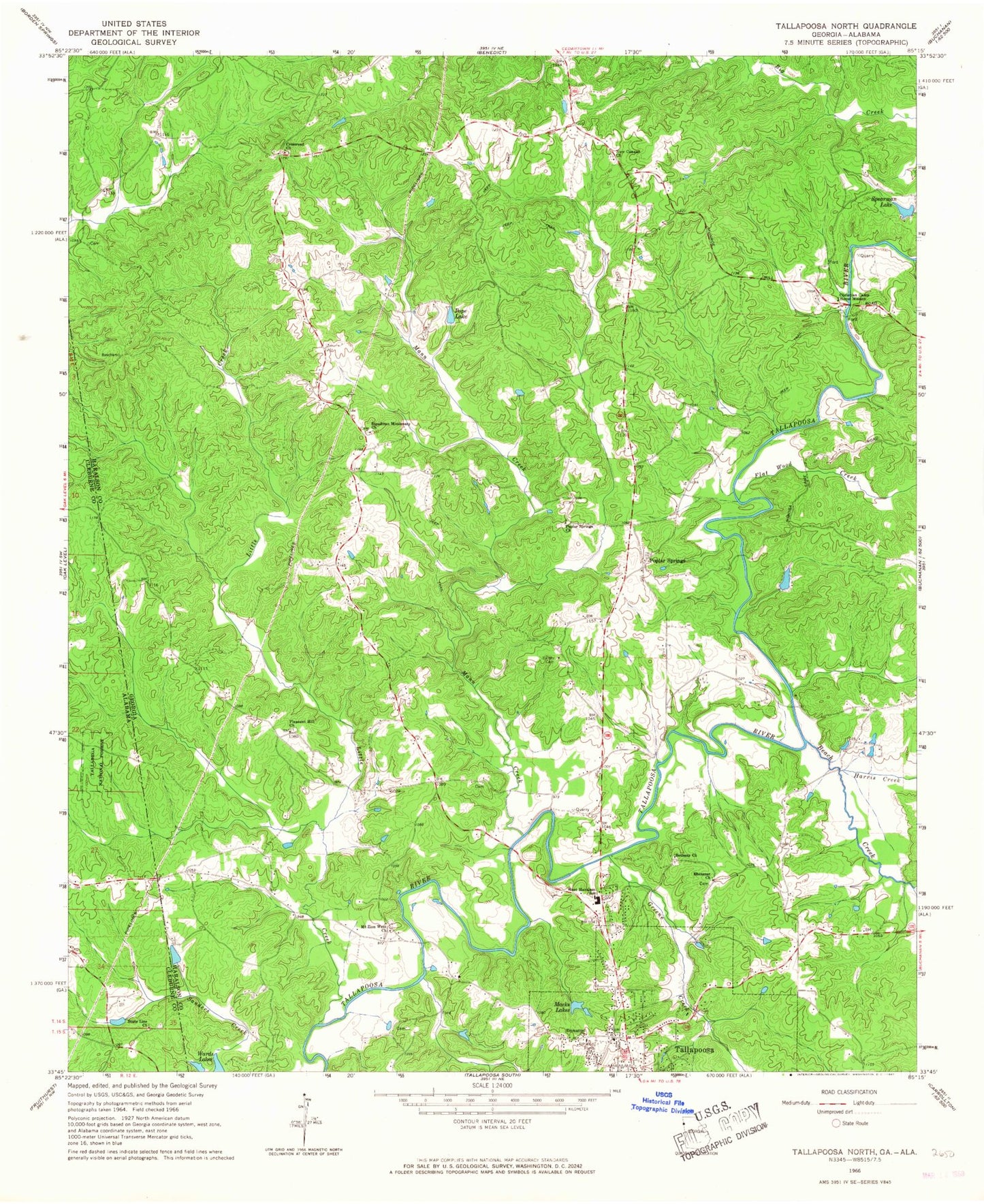
Classic USGS Tallapoosa North Georgia 7.5'x7.5' Topo Map
Couldn't load pickup availability
Historical USGS topographic quad map of Tallapoosa North in the states of Georgia, Alabama. Map scale may vary for some years, but is generally around 1:24,000. Print size is approximately 24" x 27"
This quadrangle is in the following counties: Cleburne, Haralson.
The map contains contour lines, roads, rivers, towns, and lakes. Printed on high-quality waterproof paper with UV fade-resistant inks, and shipped rolled.
Contains the following named places: Adderholds Bridge, Beach Creek, Bethany Cemetery, Bethany Church, Christian Camp Home Mission, Crossroad Church, Ebenezer Cemetery, Ebenezer Church, Emmanuel Church, Flat Wood Creek, Greene Creek, Haralson County Fire Department Station 4, Harris Creek, Little Creek, Macks Lakes, Mann Cemetery, Mann Creek, McBride Bridge, Mount Sinai Baptist Church, Mount Zion West Cemetery, Mount Zion West Church, Munroe Mill, New Canaan Cemetery, New Canaan Church, Old Tallapoosa, Pleasant Hill Church, Pope Lake, Poplar Springs, Poplar Springs Cemetery, Poplar Springs Church, Rainwater Ford, Rowels Bridge, Salem Cemetery, Spearman Lake, Spearman Lake Dam, State Line Church, Steadman, Steadman Missionary Church, Tallapoosa Division, Tallapoosa Primary School, Verner Lake, Verner Lake Dam, West Haralson Elementary School, ZIP Code: 30176