MyTopo
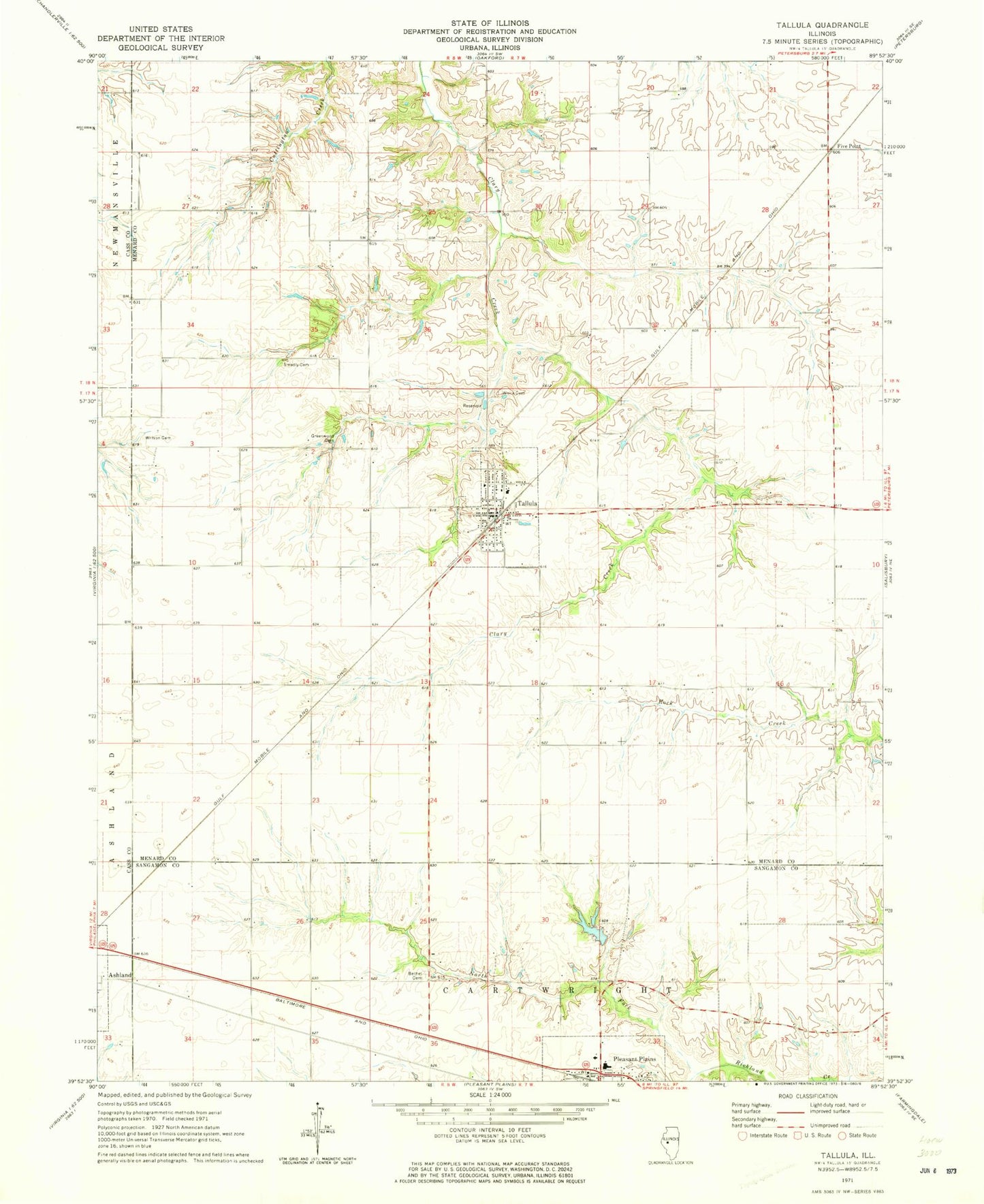
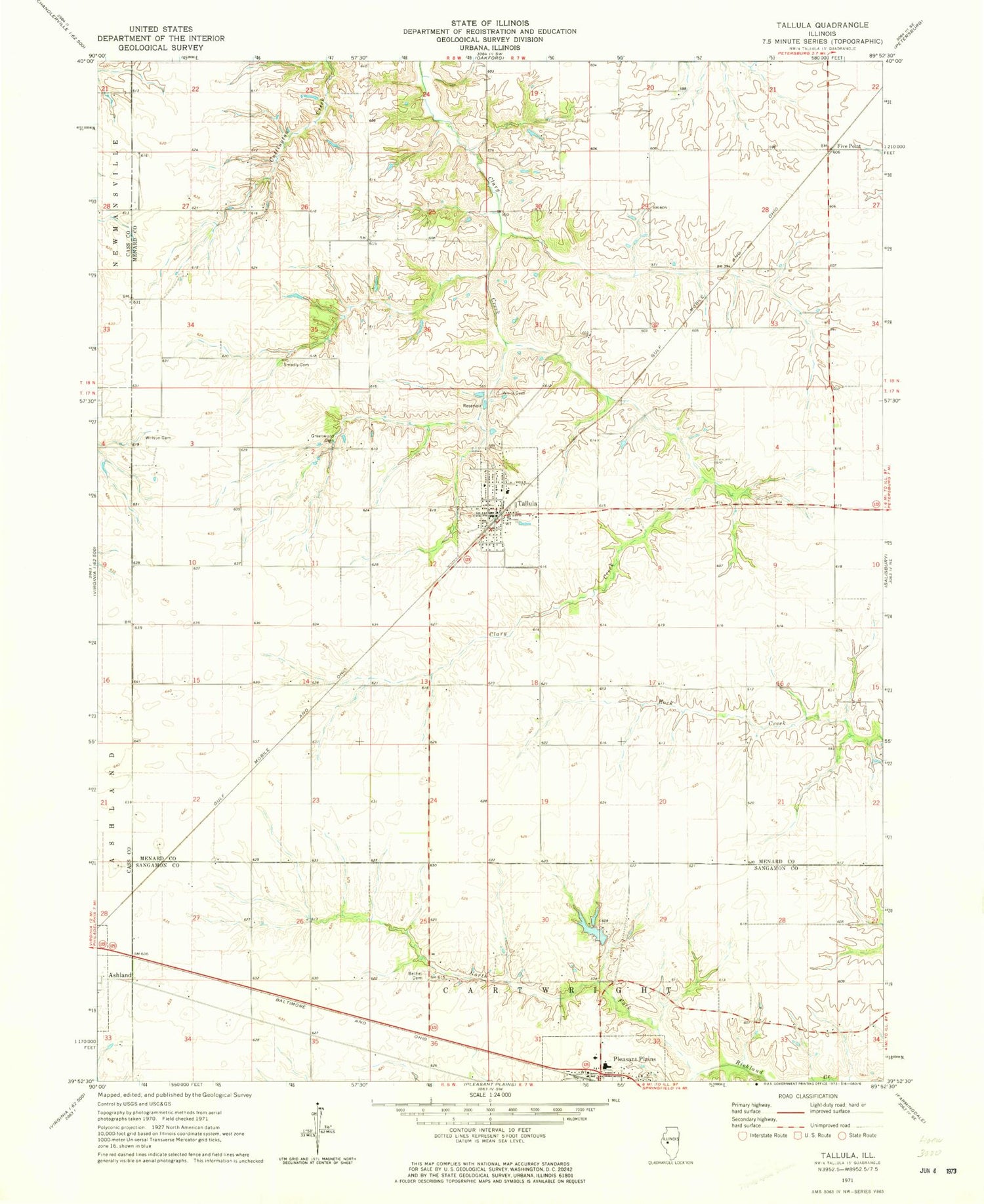
Classic USGS Tallula Illinois 7.5'x7.5' Topo Map
Couldn't load pickup availability
Historical USGS topographic quad map of Tallula in the state of Illinois. Map scale may vary for some years, but is generally around 1:24,000. Print size is approximately 24" x 27"
This quadrangle is in the following counties: Cass, Menard, Sangamon.
The map contains contour lines, roads, rivers, towns, and lakes. Printed on high-quality waterproof paper with UV fade-resistant inks, and shipped rolled.
Contains the following named places: Bethel Cemetery, Brandt Heliport, Braun Pond, Braun Pond Dam, Calvary Baptist Church, Five Point, Greenwood Cemetery, Hill Top, North Fork Richland Creek, Petersburg South Number 15 Election Precinct, Pleasant Plains Fire Protection District, Pleasant Plains High School, Pleasant Plains Police Department, Smedly Cemetery, Tallula, Tallula Christian Church, Tallula Elementary School, Tallula Fire Department, Tallula Freewill Baptist Church, Tallula Number 11 Election Precinct, Tallula Post Office, Village of Tallula, White Cemetery, Willson Cemetery, ZIP Code: 62688