MyTopo
Classic USGS Talofofo Guam 7.5'x7.5' Topo Map
Couldn't load pickup availability
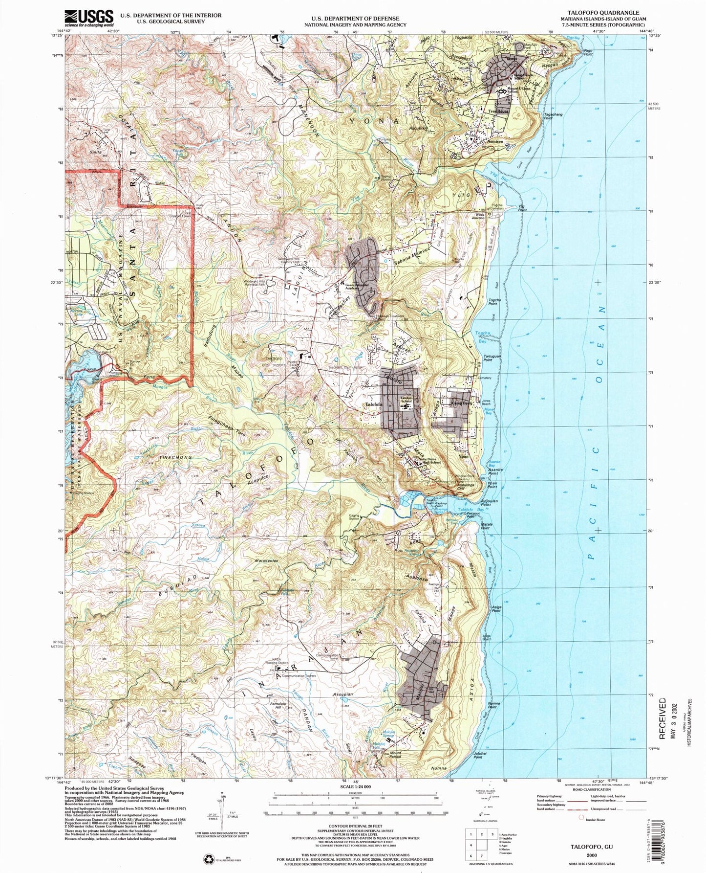
Historical USGS topographic quad map of Talofofo in the state of Guam. Map scale may vary for some years, but is generally around 1:24,000. Print size is approximately 24" x 27"
This quadrangle is in the following counties: Guam.
The map contains contour lines, roads, rivers, towns, and lakes. Printed on high-quality waterproof paper with UV fade-resistant inks, and shipped rolled.
Contains the following named places: Abac, Acapulco, Adae, Adjoulan Point, Anaga, Asaguero, Asalonso, Asalonso River, Asalonso Spring, Asanario, Asanite Bay, Asanite Point, Asculano, Ascutino, Asiga, Asiga Beach, Asiga Point, Aslucas, Asmisen, Asmulato Hill, Asquidachay, Asquiroga Cliff, Assupian, Atate River, Baza Gardens, Baza Gardens Ball Park, Bonya River, Bubulao, Bubulao River, Calvo Beach, Camp Dealy, Camp Witek, Canuon, Cotal, Cotal Conservation Reserve, Country Club of the Pacific, Dagua, Dandan, Devils Cove, East Lookout Tower, Fafalog, Fena, Fena Pumping Station, Fena Valley Reservoir, Finogchaan Toro, First Beach, Gayloup Cove, Gayloup Point, Guam Adventist Academy, Guam Tracking Station, Ibaba, Inarajan Election District, Ipachol, Ipan Beach Park, Ipan Census Designated Place, Itadudong, Jajlao, Jalaihai Point, Jones Beach, KGUM-AM (Hagatna), Laguina, Layon, Leo Palace Golf Resort, Maagas River, Maemong River, Mahlac River, Majaga, Malaja River, Malojloj, Malojloj Census Designated Place, Malojloj Falls, Malojloj Spring, Man Apu Hill, Man Apu Park, Mana Bay, Manengon, Manengon River, Manuel U Lujan Elementary School, Mapao, Mapo, Mata, Mataitaotao, Matala, Matala Point, Morrow Lake, Mount Patsud, Nasgan, Nomna Point, Notre Dame High School, Notre Dame School, Pago, Pago Point, Pagunon, Paicpouc Cove, Paicpouc Point, Pulantat, Quiroga Hill, Rest Haven Cemetery, Sabana Maleyuc, Sagge River, Saint Francis School, San Francisco De Asis Church, San Miguel Church, Sarasa River, Sinifa, Siput, Taga`chang Beach Park, Tagachan Beach, Tagachang, Tagachang Point, Talisay, Talisay River, Talofofo, Talofofo Ballpark, Talofofo Bay, Talofofo Beach, Talofofo Bridge, Talofofo Census Designated Place, Talofofo Election District, Talofofo Elementary School, Talofofo Falls, Talofofo Golf Resort, Talofofo River, Tartuguan Point, Tarzan Falls, Tarzan River, Tinechong, Tinechong River, Togcha, Togcha Bay, Togcha Cemetery, Togcha Point, Togcha River, Togpaola, Tolaeyuus River, Tres Reyes, Ugum River, Window Rock, Windward Hills Census Designated Place, Windward Hills Country Club, Windward Hills Memorial Park, Witek Junction, Ylig, Ylig Bay, Ylig Bridge, Ylig Point, Ylig Pumping Station, Ylig River, Yona, Yona Ballpark, Yona Census Designated Place, Yona Election District, Ypan, Ypan Point, ZIP Codes: 96915, 96917


