MyTopo
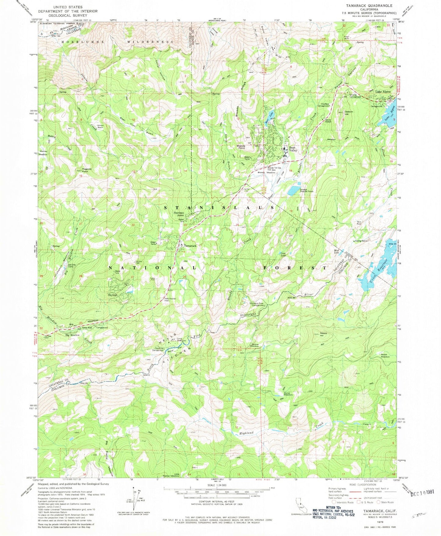
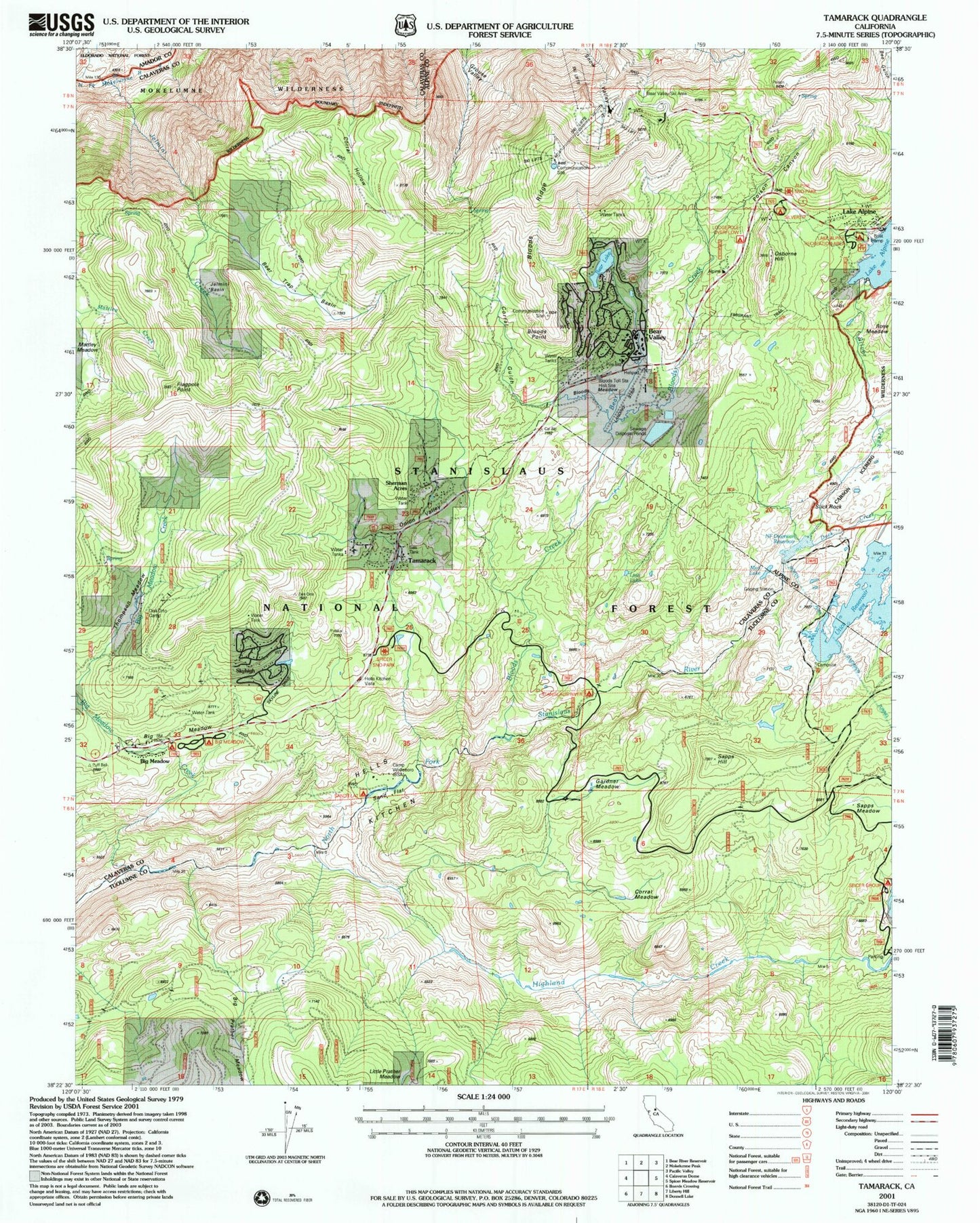
USGS Classic Tamarack California 7.5'x7.5' Topo Map
Couldn't load pickup availability
Historical USGS topographic quad map of Tamarack in the state of California. Scale: 1:24000. Print size: 24" x 27"
This quadrangle is in the following counties: Alpine, Amador, Calaveras, Tuolumne.
The map contains contour lines, roads, rivers, towns, lakes, and grids including latitude / longitude and UTM / MGRS. Printed on high-quality waterproof paper with UV fade-resistant inks.
Contains the following named places: Alpine Station, Bear Creek, Bear Lake, Bear Trap Basin, Big Meadow, Big Prather Meadow, Bloods Creek, Bloods Meadow, Bloods Point, Bloods Ridge, Bloods Toll Station Historical Site, Camp Wolfeboro, Corral Gulch, Corral Meadow, Corral Meadow, Del Orto Camp, Duck Creek, Emigrant Trail, Flagpole Point, Gardner Meadow, Grouse Valley, Hells Kitchen, Hells Kitchen Vista, Highland Creek, Jelmini Basin, Jelmini Creek, Little Prather Meadow, Mattley Meadow, Mud Lake, Osborn Hill, Overflow Campground, Poison Canyon, Sand Flat, Sand Flat Campground, Sapps Hill, Sapps Meadow, Silver Creek, Silvertip Campground, Slick Rock, Stanislaus River Campground, Thompson Meadow, Lion Lake, Utica Reservoir, Lake Alpine Campground, Big Meadow Campground, Lombardi, Onion Valley, Alpine Station, Bear Valley Airport, Mount Reba Ski Area, Bear Valley, Big Meadow, Lake Alpine, Sherman Acres, Skyhigh, Tamarack, Rose Meadow, Alpine 99-000 Dam, Utica 99-006 Dam, Reba 519 Dam, Bear Valley S H 1088 Dam, Sapps Camp (historical), Bear Valley Elementary School, Bear Valley Ski Area, Tamarack Lodge, Tamarack Springs, Lake Alpine Post Office (historical), Bear Valley Census Designated Place, Bear Valley Public Safety, Alpine County Sheriff's Office