
MyTopo
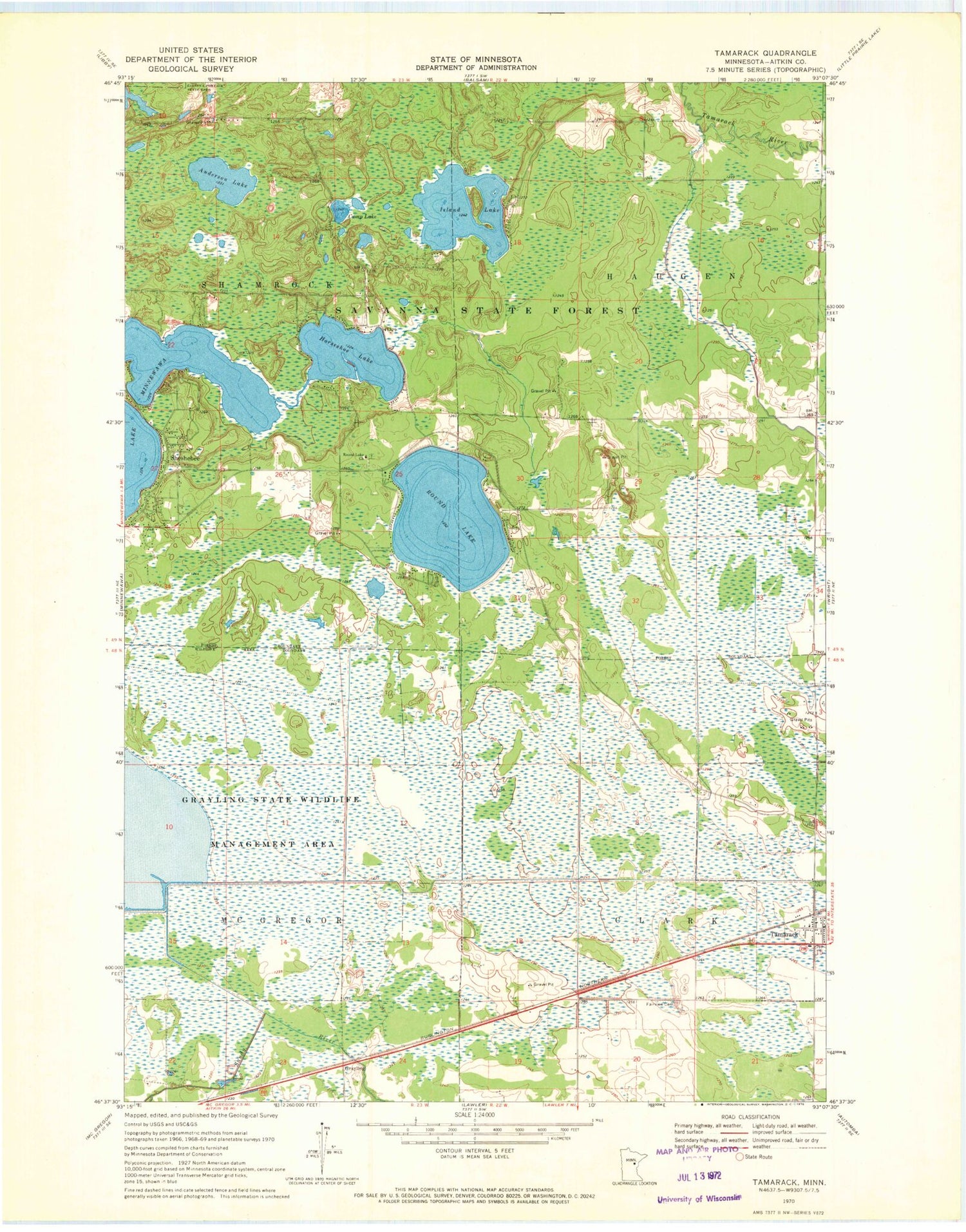
Classic USGS Tamarack Minnesota 7.5'x7.5' Topo Map
Couldn't load pickup availability
Historical USGS topographic quad map of Tamarack in the state of Minnesota. Map scale may vary for some years, but is generally around 1:24,000. Print size is approximately 24" x 27"
This quadrangle is in the following counties: Aitkin.
The map contains contour lines, roads, rivers, towns, and lakes. Printed on high-quality waterproof paper with UV fade-resistant inks, and shipped rolled.
Contains the following named places: Anderson Lake, Camp Lake, Church of Christ, Fairview Cemetery, First Presbyterian Church, Grayling, Grayling Post Office, Grayling State Wildlife Management Area, Horseshoe Lake, Island Lake, Island Lake Creek, Kivi-Mokki Seaplane Base, Musselshell Creek, Round Lake, Round Lake Cemetery, Round Lake Church, Sheshebee, Sheshebee Post Office, Tamarack, Tamarack Post Office, Township of Clark, Township of Haugen, Whispering Pines Campground


