MyTopo
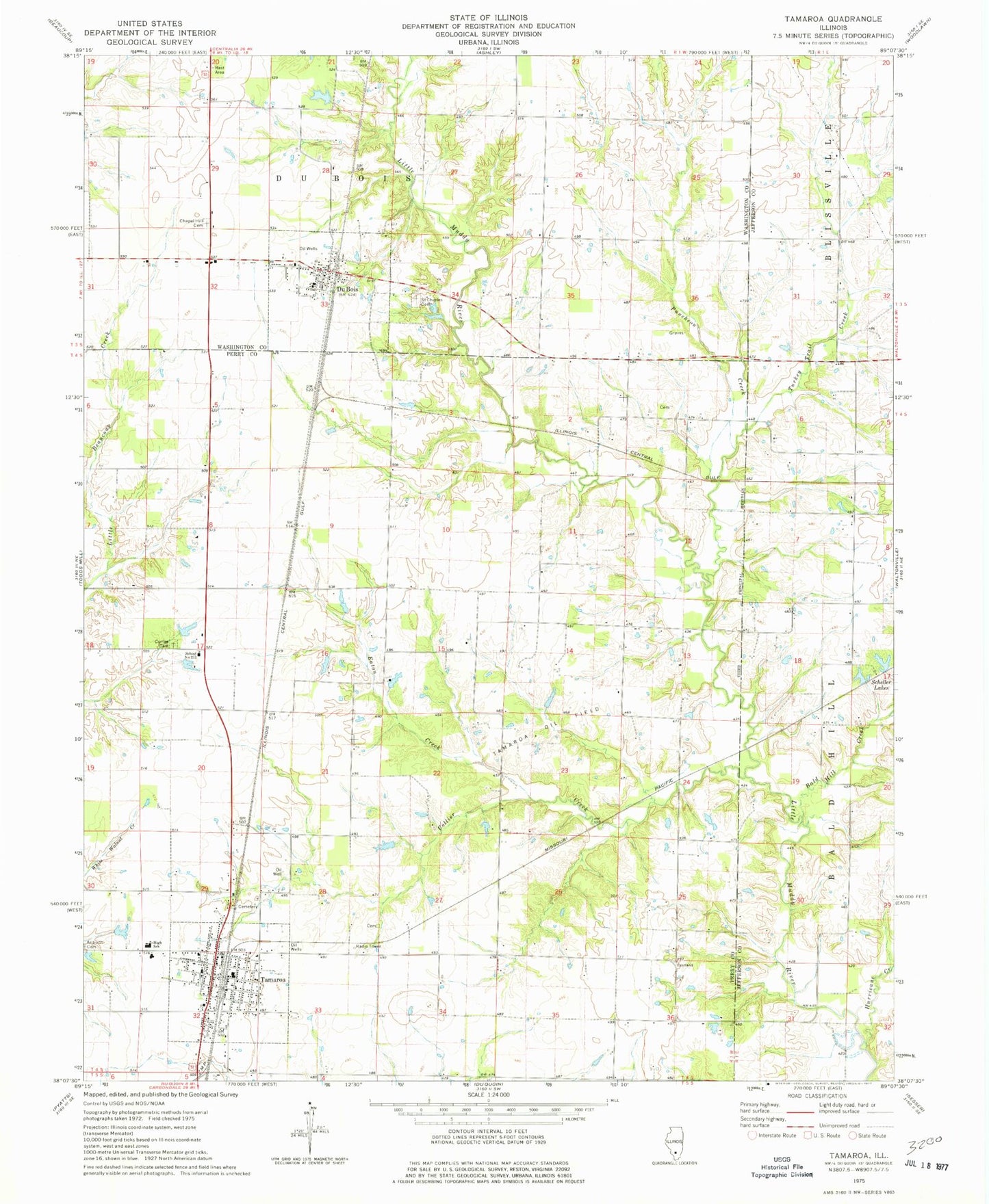
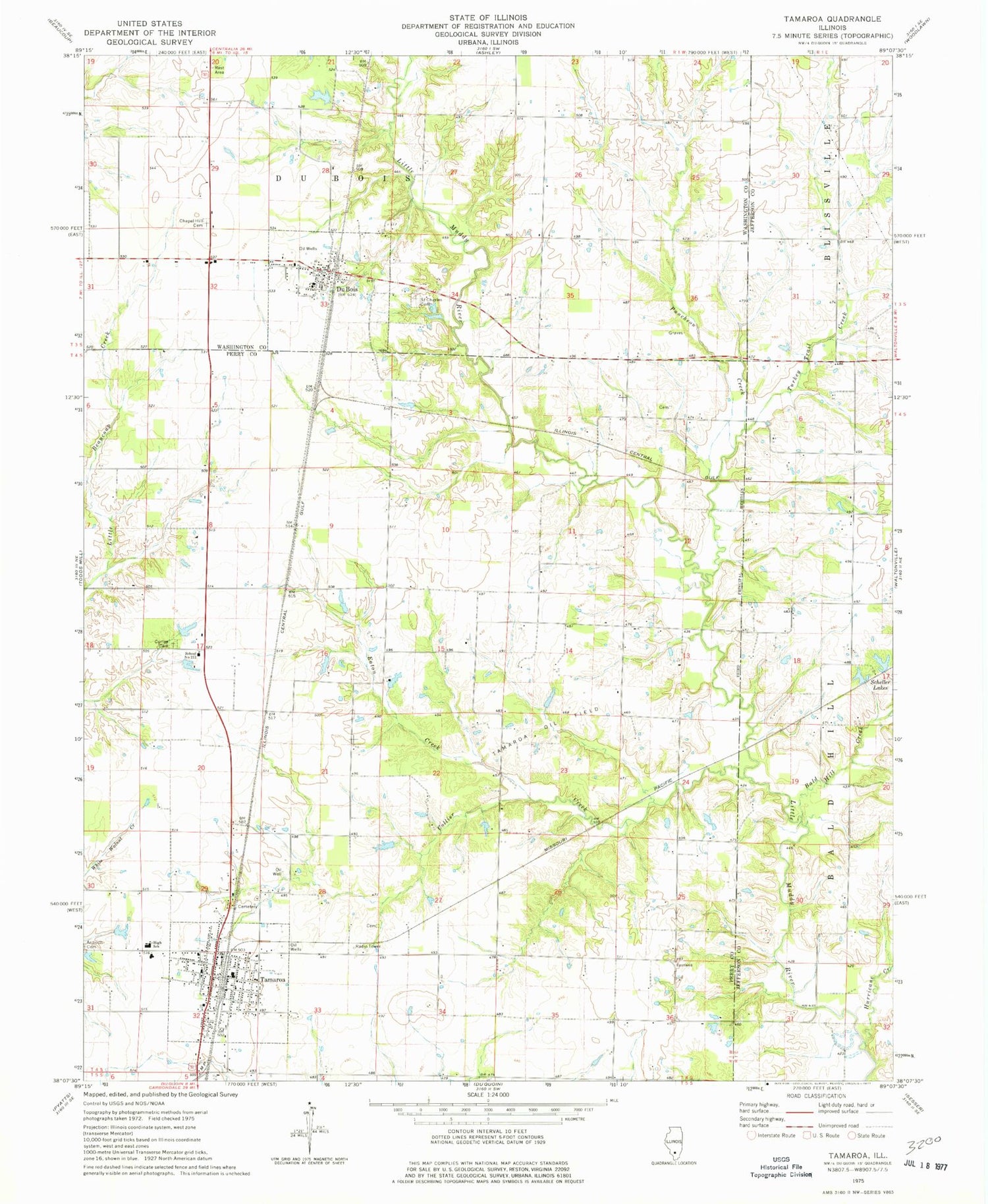
Classic USGS Tamaroa Illinois 7.5'x7.5' Topo Map
Couldn't load pickup availability
Historical USGS topographic quad map of Tamaroa in the state of Illinois. Map scale may vary for some years, but is generally around 1:24,000. Print size is approximately 24" x 27"
This quadrangle is in the following counties: Jefferson, Perry, Washington.
The map contains contour lines, roads, rivers, towns, and lakes. Printed on high-quality waterproof paper with UV fade-resistant inks, and shipped rolled.
Contains the following named places: Ashley Fire Protection District Substation, Bald Hill Creek, Bald Hill School, Bethany Church, Big Ben Mine, Chapel Hill Cemetery, Chapel Hill School, Collier Creek, Curlee Cemetery, Currie School, Du Bois, Du Bois Post Office, Eastland School, Eaton Creek, Hickory Knoll School, Hopewell School, Hurricane Creek, Lone Oak School, Puncheon Creek, Redbrush School, Rock Bridge, Saint Charles Cemetery, Scheller Lakes, School Number 211, Tamaroa, Tamaroa Cemetery, Tamaroa Community Fire Protection District, Tamaroa Elementary School, Tamaroa Number 1 Election Precinct, Tamaroa Oil Field, Tamaroa Post Office, Turkey Trail Creek, Village of Du Bois, Village of Tamaroa, West Lynn School, ZIP Codes: 62831, 62888