MyTopo
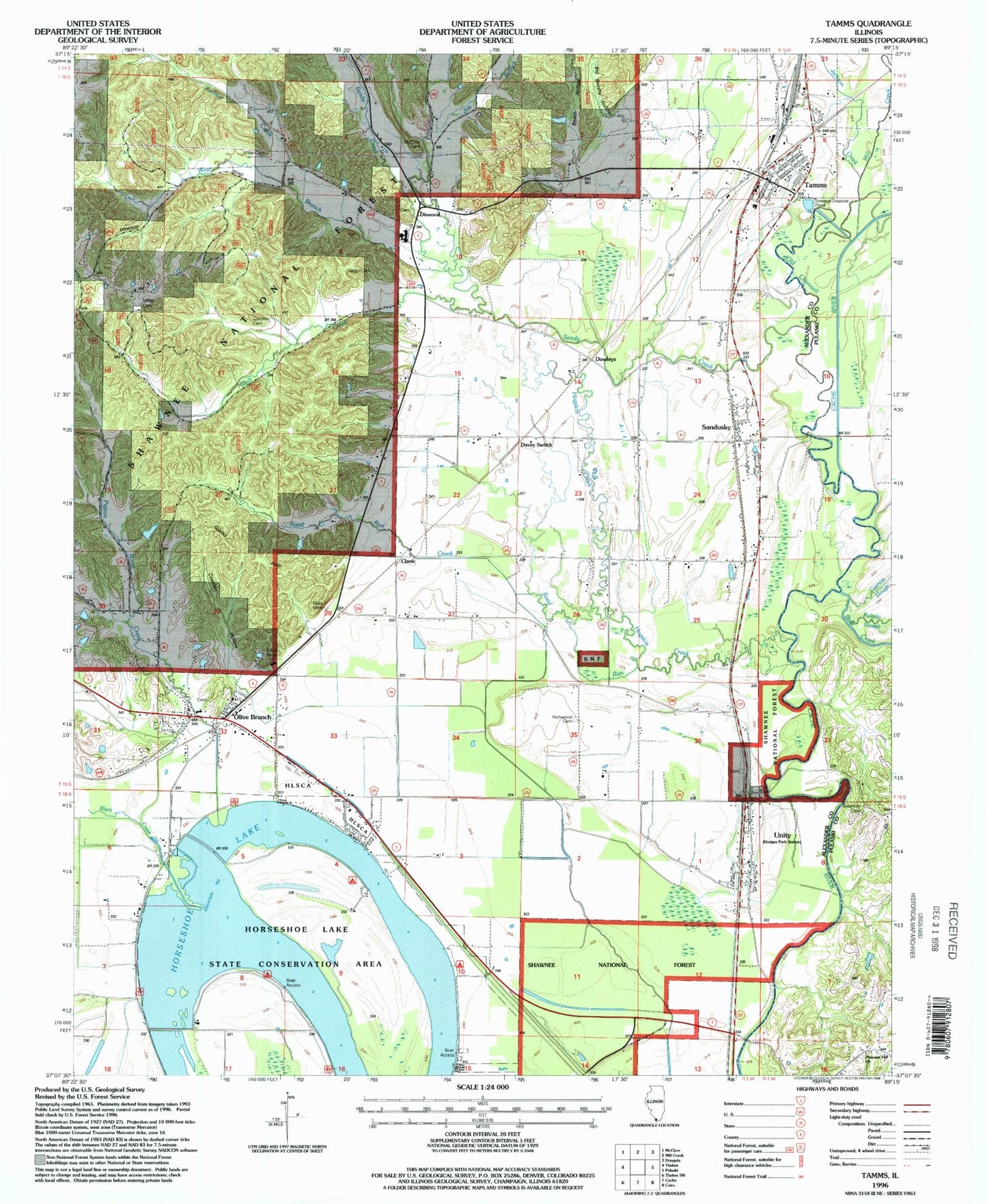
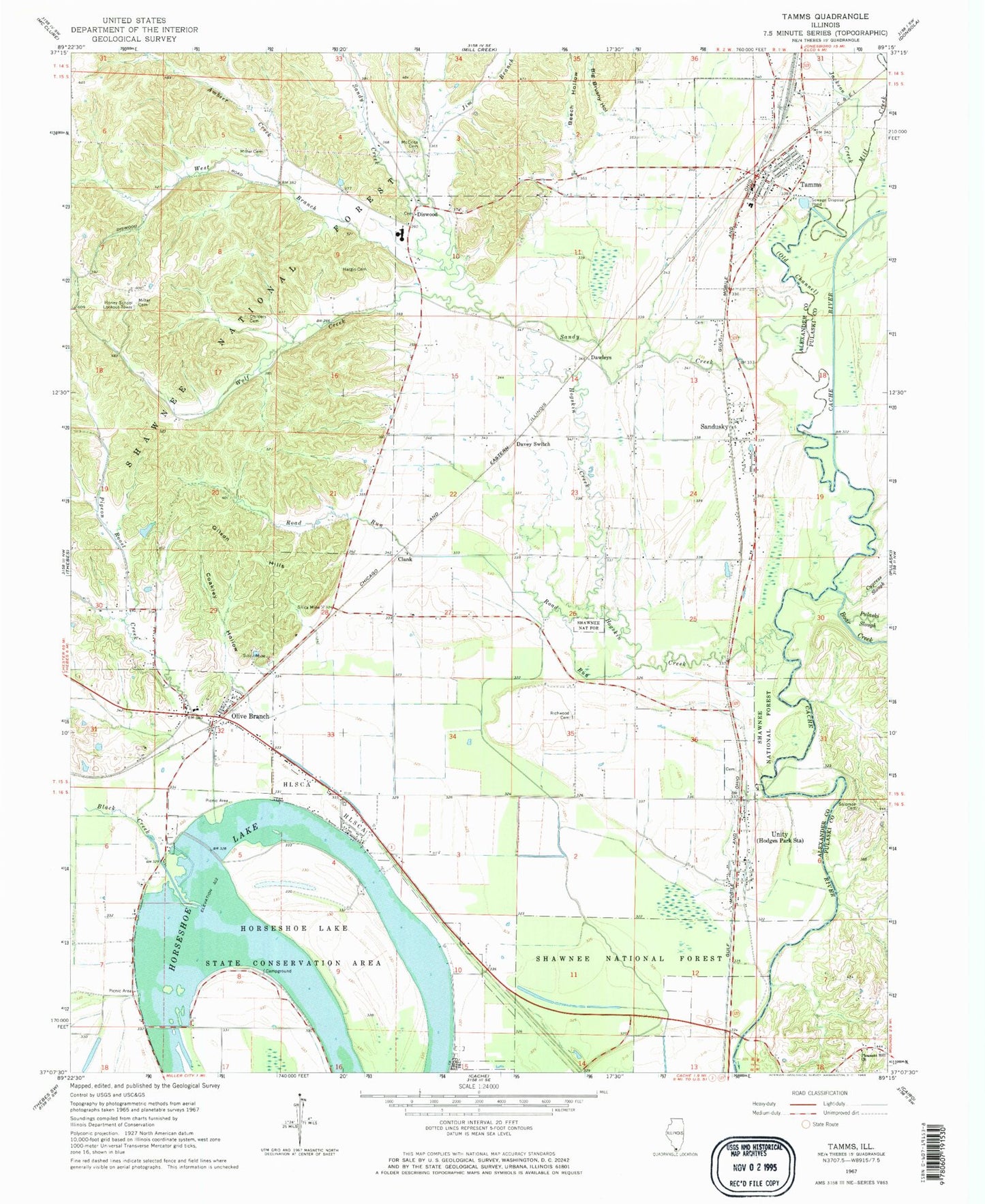
Classic USGS Tamms Illinois 7.5'x7.5' Topo Map
Couldn't load pickup availability
Historical USGS topographic quad map of Tamms in the state of Illinois. Typical map scale is 1:24,000, but may vary for certain years, if available. Print size: 24" x 27"
This quadrangle is in the following counties: Alexander, Pulaski.
The map contains contour lines, roads, rivers, towns, and lakes. Printed on high-quality waterproof paper with UV fade-resistant inks, and shipped rolled.
Contains the following named places: Alexander County, Ambeer Creek, Beech Hollow, Big Brushy Hollow, Black Creek, Boar Creek, Childers Cemetery, Clank, Coakley Hollow, Cypress Slough, Davey Switch, Dawleys, Diswood, Gilson Hills, Hargis Cemetery, Hogskin Creek, Honey School Lookout Tower, Horseshoe Lake, Jackson Creek, Jim Branch, McCrite Cemetery, Mill Creek, Miller Cemetery, Miller Cemetery, Old Channel, Olive Branch, Pigeon Roost Creek, Pleasant Hill Church, Pulaski Slough, Richwood Cemetery, Road Run, Sandusky, Sandy Creek, Silica Mine, Solomon Cemetery, Tamms, Unity, West Branch Sandy Creek, Wolf Creek, Horseshoe Lake State Conservation Area, Hodges Park, Hogskin Bottoms, Honey School (historical), Sandy Creek Church, Egyptian Senior High School, Olive Branch Post Office, Olive Branch Cemetery, Olive Branch Election Precinct, Sandusky Election Precinct, Horseshoe Lake Nature Preserve, Hodges Park Cemetery, Uninty Cemetery, Village of Tamms, Olive Branch Census Designated Place, Tamms Volunteer Fire Department, Horseshoe Lake Fire Department, Alexander County Emergency Medical Services, Tamms Police Department, Tamms Post Office, Unity Census Designated Place