MyTopo
Classic USGS Tamola Mississippi 7.5'x7.5' Topo Map
Couldn't load pickup availability
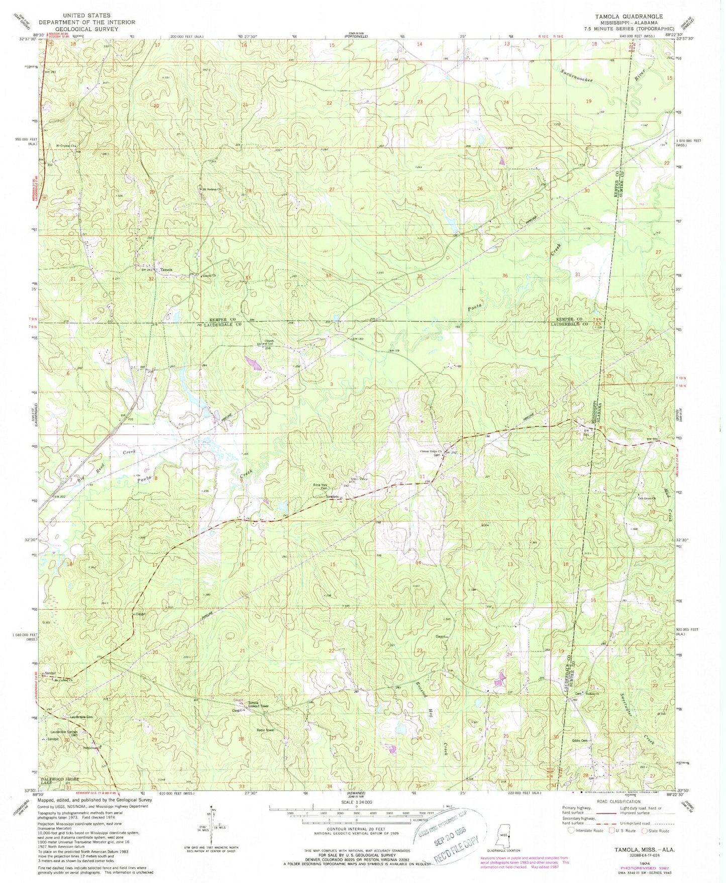
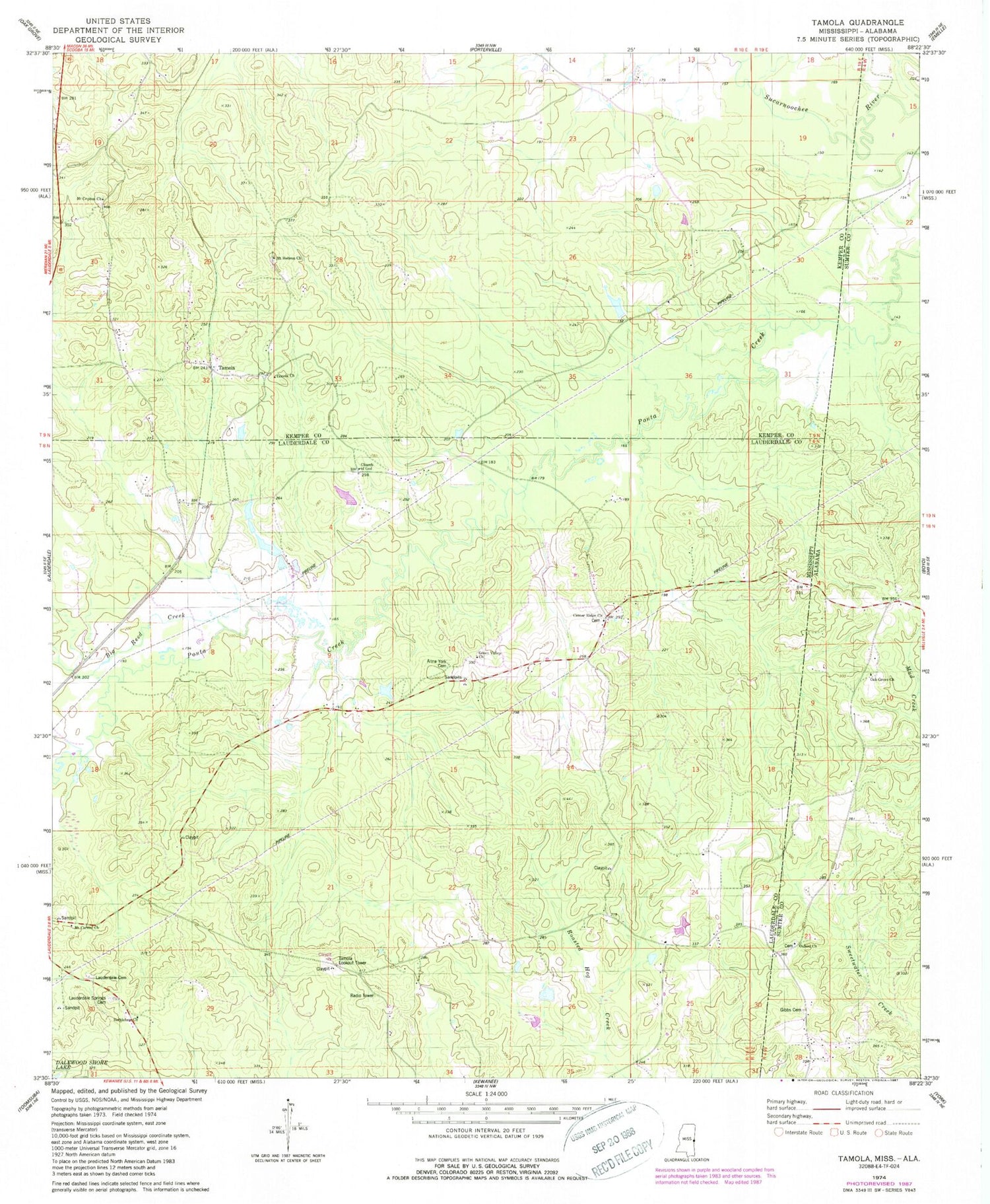
Historical USGS topographic quad map of Tamola in the states of Mississippi, Alabama. Map scale may vary for some years, but is generally around 1:24,000. Print size is approximately 24" x 27"
This quadrangle is in the following counties: Kemper, Lauderdale, Sumter.
The map contains contour lines, roads, rivers, towns, and lakes. Printed on high-quality waterproof paper with UV fade-resistant inks, and shipped rolled.
Contains the following named places: Anna York Cemetery, Atwood School, Bethlehem Church, Big Reed Creek, Center Ridge Cemetery, Center Ridge Church, Center Ridge School, Center Ridge Volunteer Fire and Rescue Department, Church of God, Coonville, Delk School, Gibbs Cemetery, Green Valley Church, Grigsbys Springs, H S Wedgeworth Catfish Ponds Dam, Lauderdale Cemetery, Lauderdale Springs Confederate-Union Cemetery, Mount Carmel Church, Mount Cephus Church, Mount Hebron Cemetery, Mount Hebron Church, Oak Grove Baptist Church, Oxford Church, Running Creek, Simmons Creek, Tamola, Tamola Church, Tamola Lookout Tower, Tamola School, W B Boutwell Pond Dam, ZIP Code: 39335