MyTopo
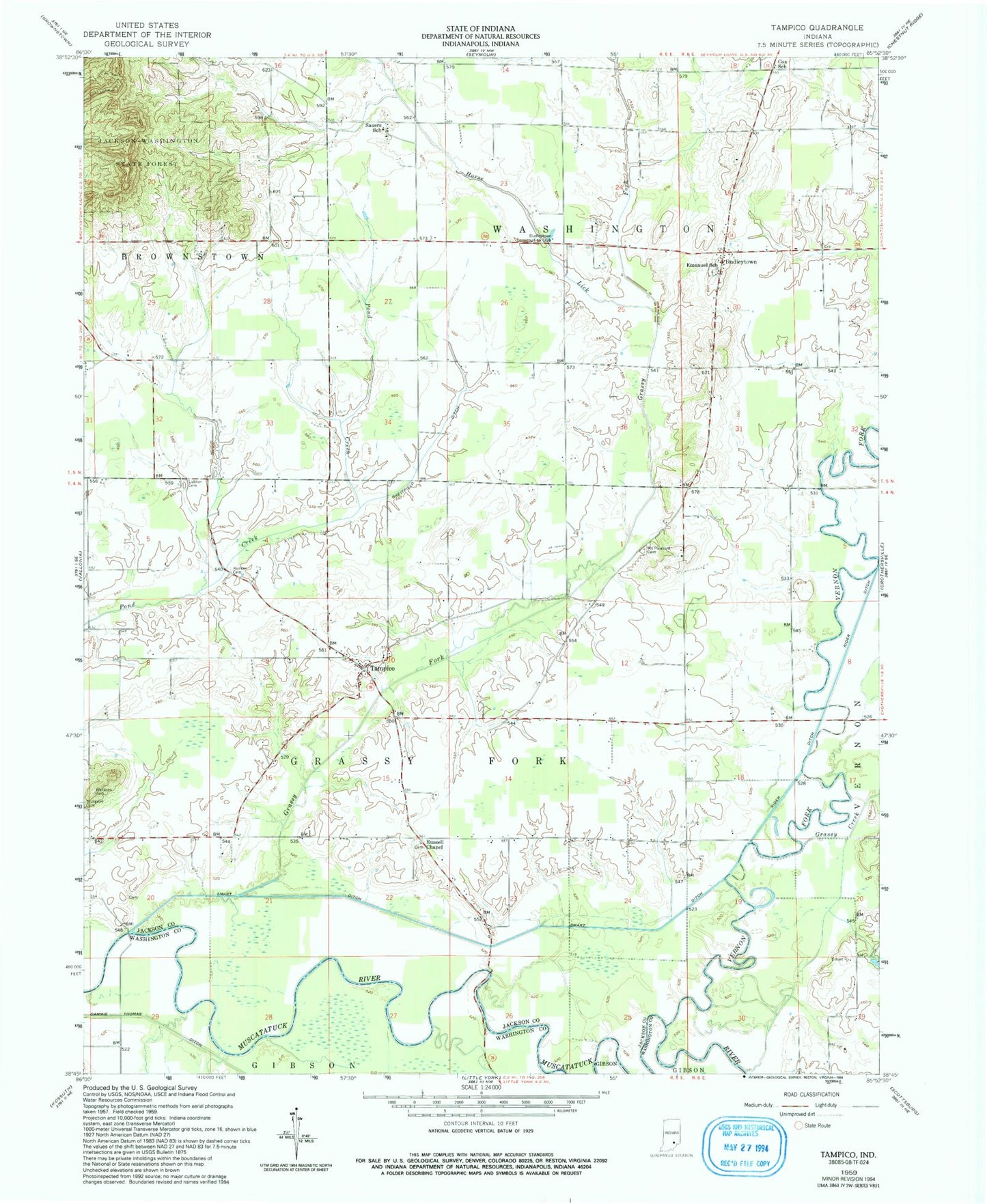
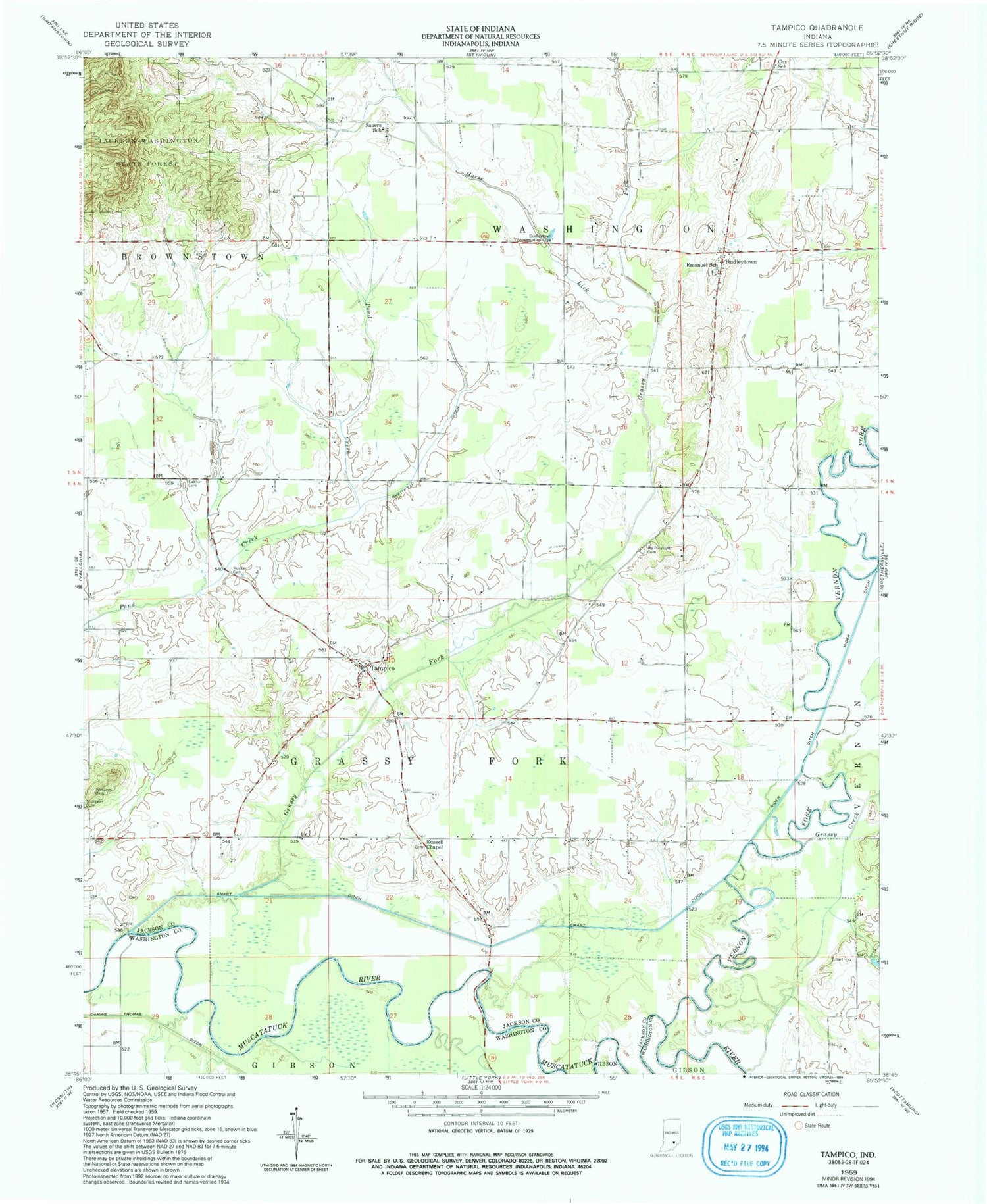
Classic USGS Tampico Indiana 7.5'x7.5' Topo Map
Couldn't load pickup availability
Historical USGS topographic quad map of Tampico in the state of Indiana. Map scale may vary for some years, but is generally around 1:24,000. Print size is approximately 24" x 27"
This quadrangle is in the following counties: Jackson, Washington.
The map contains contour lines, roads, rivers, towns, and lakes. Printed on high-quality waterproof paper with UV fade-resistant inks, and shipped rolled.
Contains the following named places: Breitfield Ditch, Cox School, Dudleytown, Dudleytown Conservation Club, Emanuel School, Grassy Creek, Grassy Fork, Grassy Fork Township Volunteer Fire Department, Hendersons Ferry, Horse Lick, Jackson - Washington Volunteer Fire Department - Dudleytown, Lubker Cemetery, Mount Pleasant Cemetery, Nobusiness Creek, Rucker Cemetery, Ruckers Ferry, Russell Chapel, Smart Ditch, Sturgeon Cemetery, Tampico, Township of Grassy Fork, Township of Washington, Vernon Fork Muscatatuck River, Waskom Cemetery